Calima days in the Canaries…

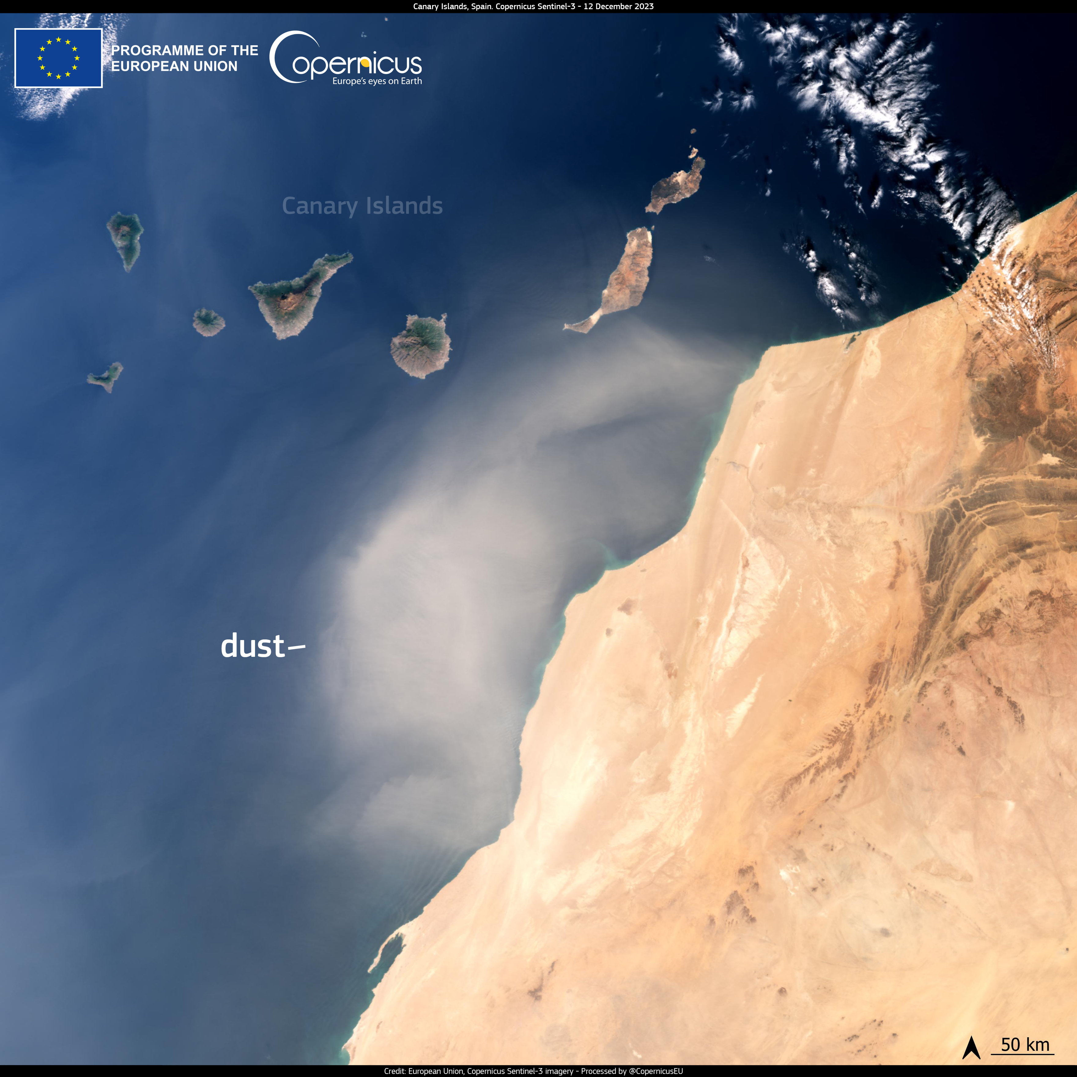
…and the calima is back… Winds blowing from Africa bringing hot, dry air with lot’s of sand covering the islands.

This can be perfectly seen on this satelite image by Copernicus EU (I’m not flying that high yet lol…)

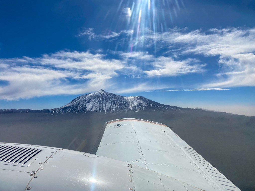
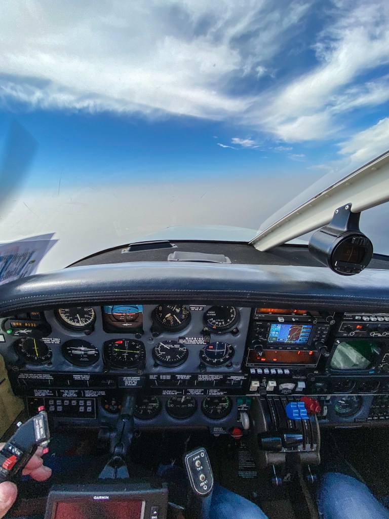
But I was “lucky” enough to be flying these days and to get above the calima layer to get get some “fresh air” and some better views. I have to admit the view from above was pretty impressive. Well, this layer reached almost 6.000-7.000 feet and mostly causes some breathing issues to the part of the population.

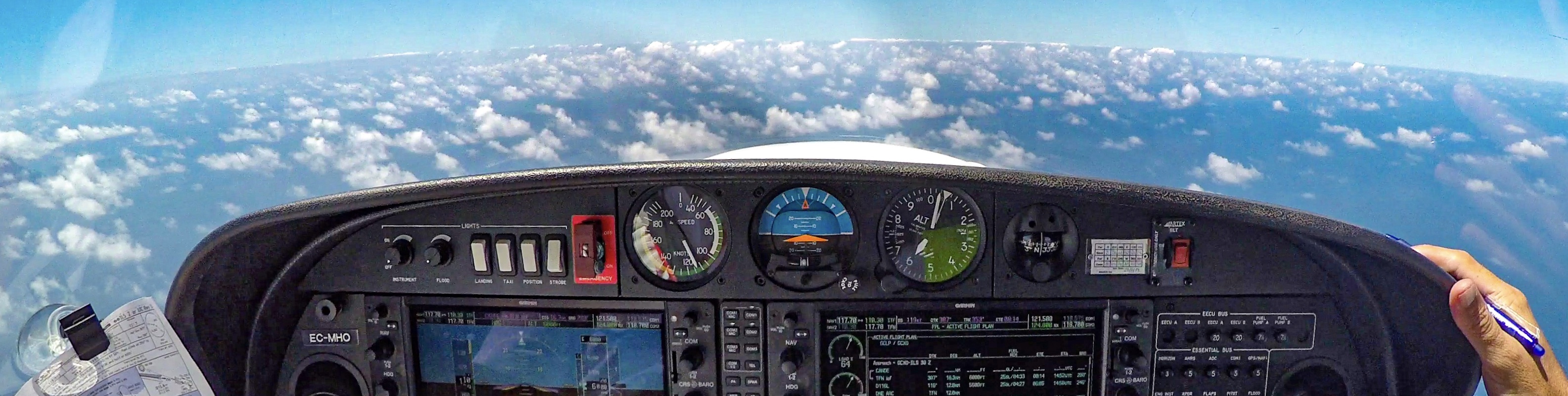
I’ll share it with you in the next image.

Stay safe, safe flying and Merry Christmas!

Calima in Tenerife
Calima in Tenerife

Flying above calima

First, what is actually calima. Calima is (mostly) hot, dust and sand laden wind blowing from Sahara from easterly direction. This wind causes a lot of respiratory problems, brings dust, the visibility drops and sometimes this causes problems in the aviation (like in the year 2020, when the airports around the islands had to be closed during several days).

I was flying today (again) around Tenerife and as we wanted to stay above this calima layer and get some better visibility, we have climbed up to 6.500 feet where we broke out of the sand and were flying above it in the nice, clean air…

You can see it in the next photographs.

All the best, and stay safe!