Right place, right time.
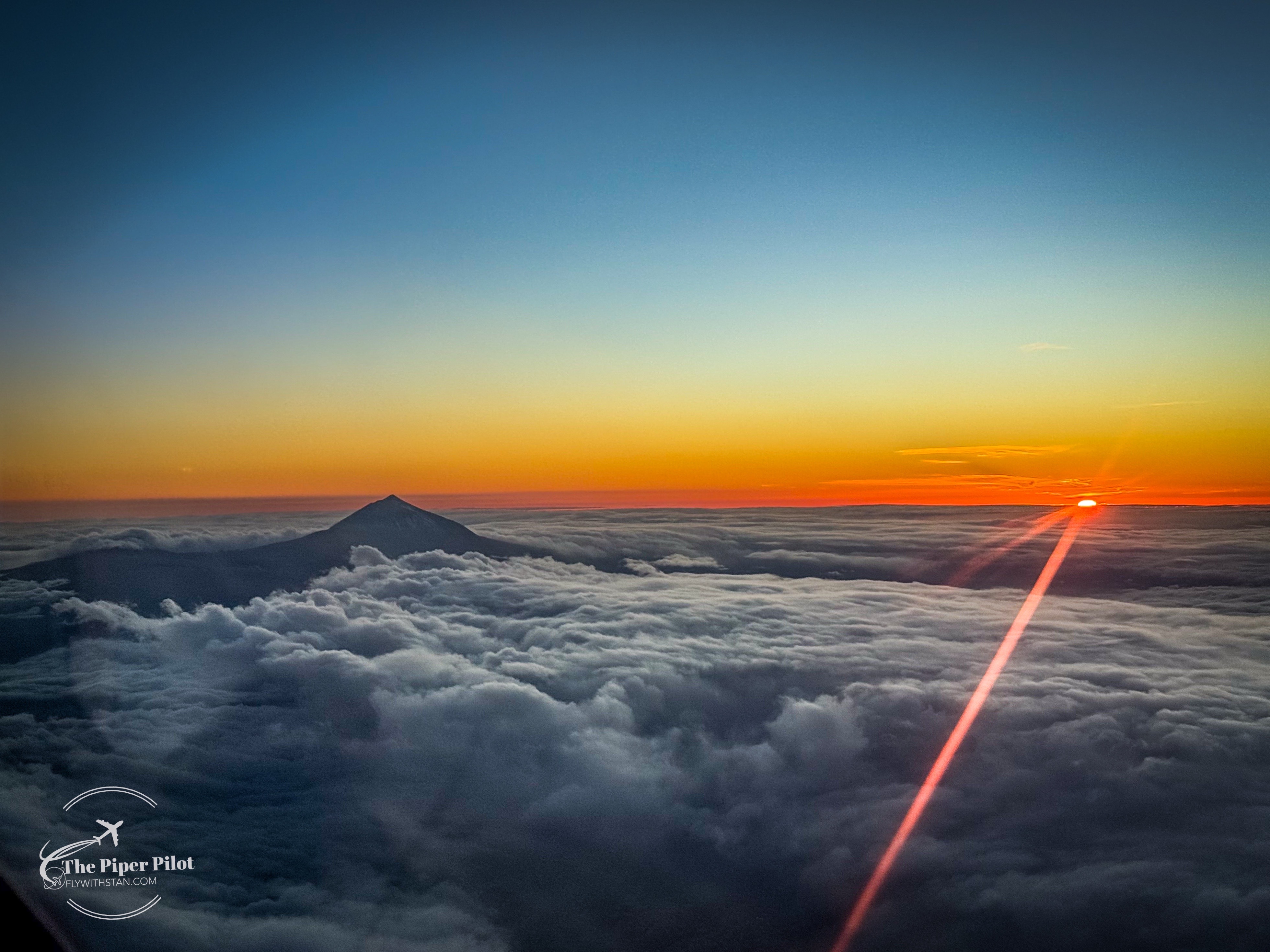
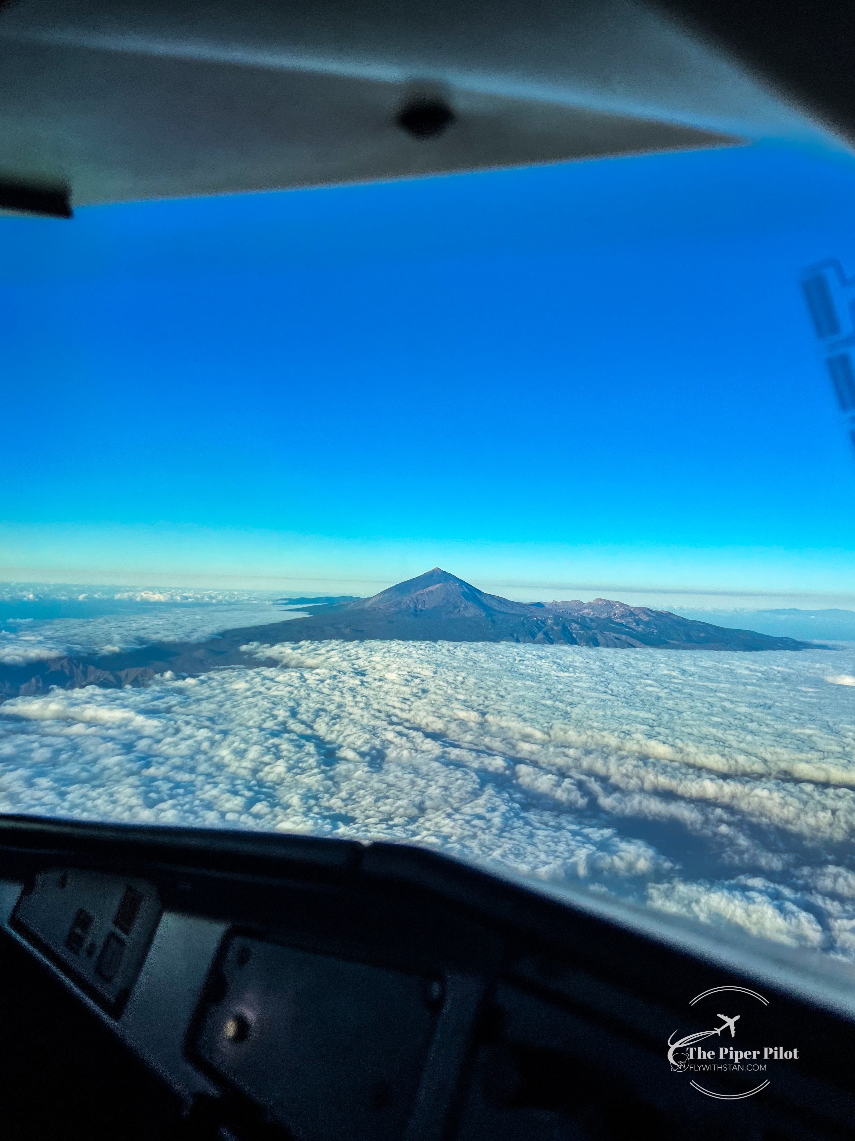
Flying at 14.000 feet above the sea level, the perfect route and at the height of Pico del Teide when the sun was going down… I was able to catch the last glimmer of sun above Tenerife…
Safe flights!
Right place, right time.
Flying at 14.000 feet above the sea level, the perfect route and at the height of Pico del Teide when the sun was going down… I was able to catch the last glimmer of sun above Tenerife…
Safe flights!
It’s been exactly 1 year since my last visit/flight to Madeira.
So on this occasion I’ve Installed my GoPro on the dashboard to see if it’ll shoot for me some nice images on our arrival. And yes!!! Passed through a light rain and got a nice welcome with a rainbow.
I was glad to be able to immortalize this moment and see it back over and over again.
Safe flights and landings as always!


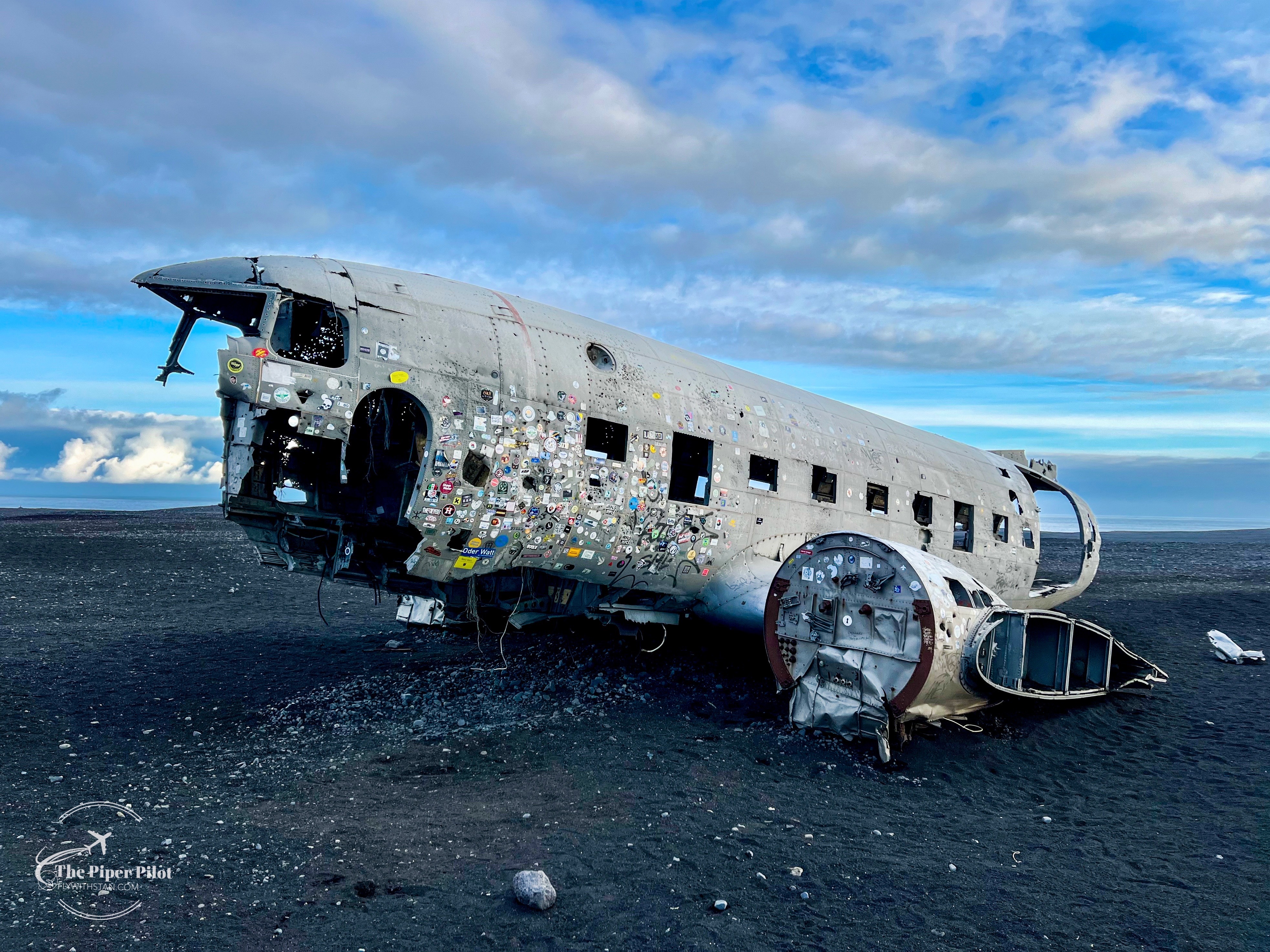
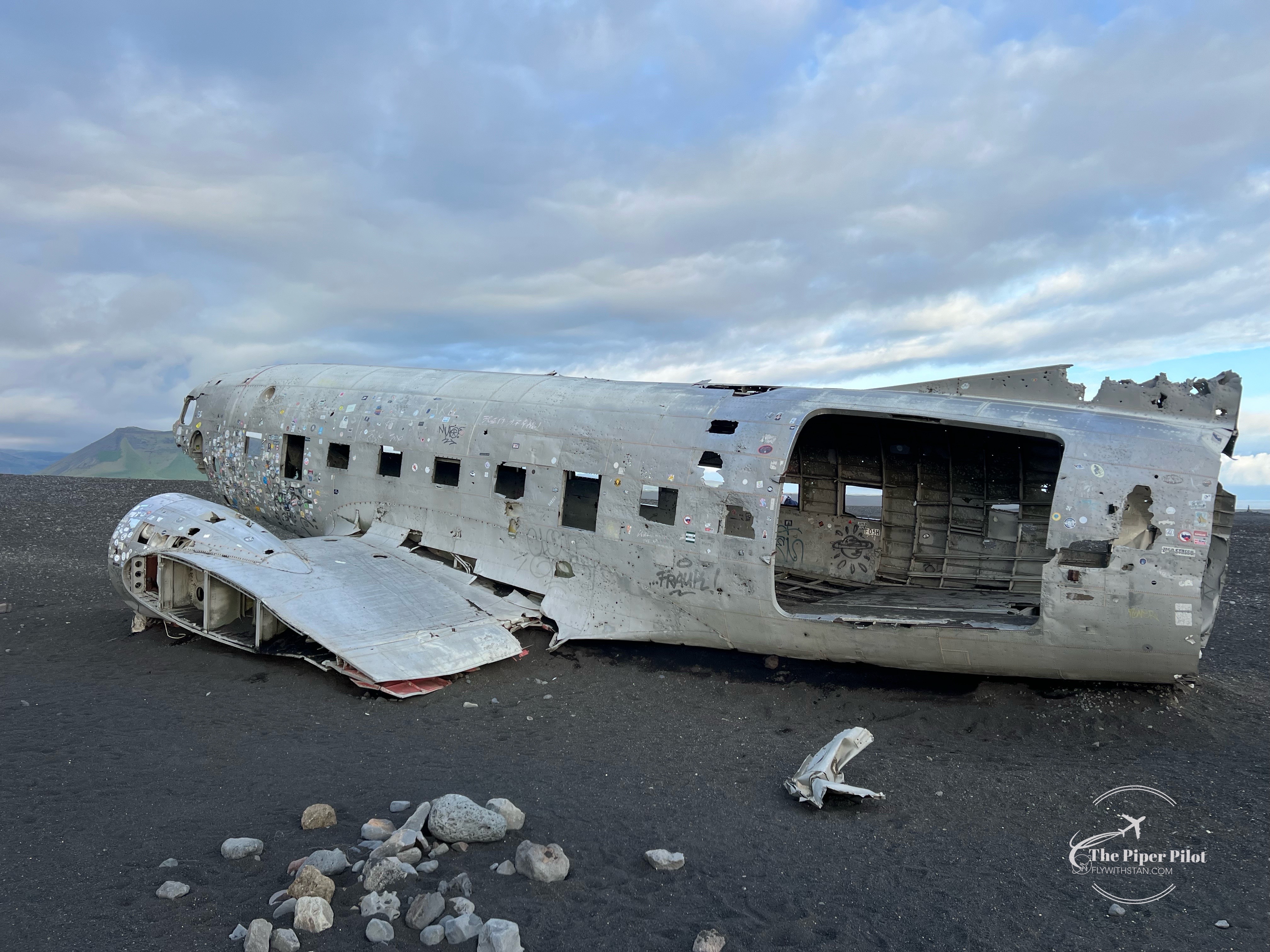
The visit of this place was something that has been on my bucket list for a long time; since I saw a photograph of the wreckage I got impressed by it so much that I’ve putted it on my bucket list.
Having waited patiently until the stars have aligned, the moment that I could make this journey happen has finally arrived.
So let’s tell the story…
Douglas R4D-8 (based on Super DC-3) was an US Navy transport plane delivering supplies.
Apparently en route the plane encountered severe icing and the crew were not able to maintain altitude. A forced landing was carried out on ice covered river on near coast of Iceland.
The ice broke but the plane did not sink. There were no fatalities. Source: Aviation Safety Network
Getting to the wreckage is easy.
There is a parking spot right next to the main road (online parking fee applies).
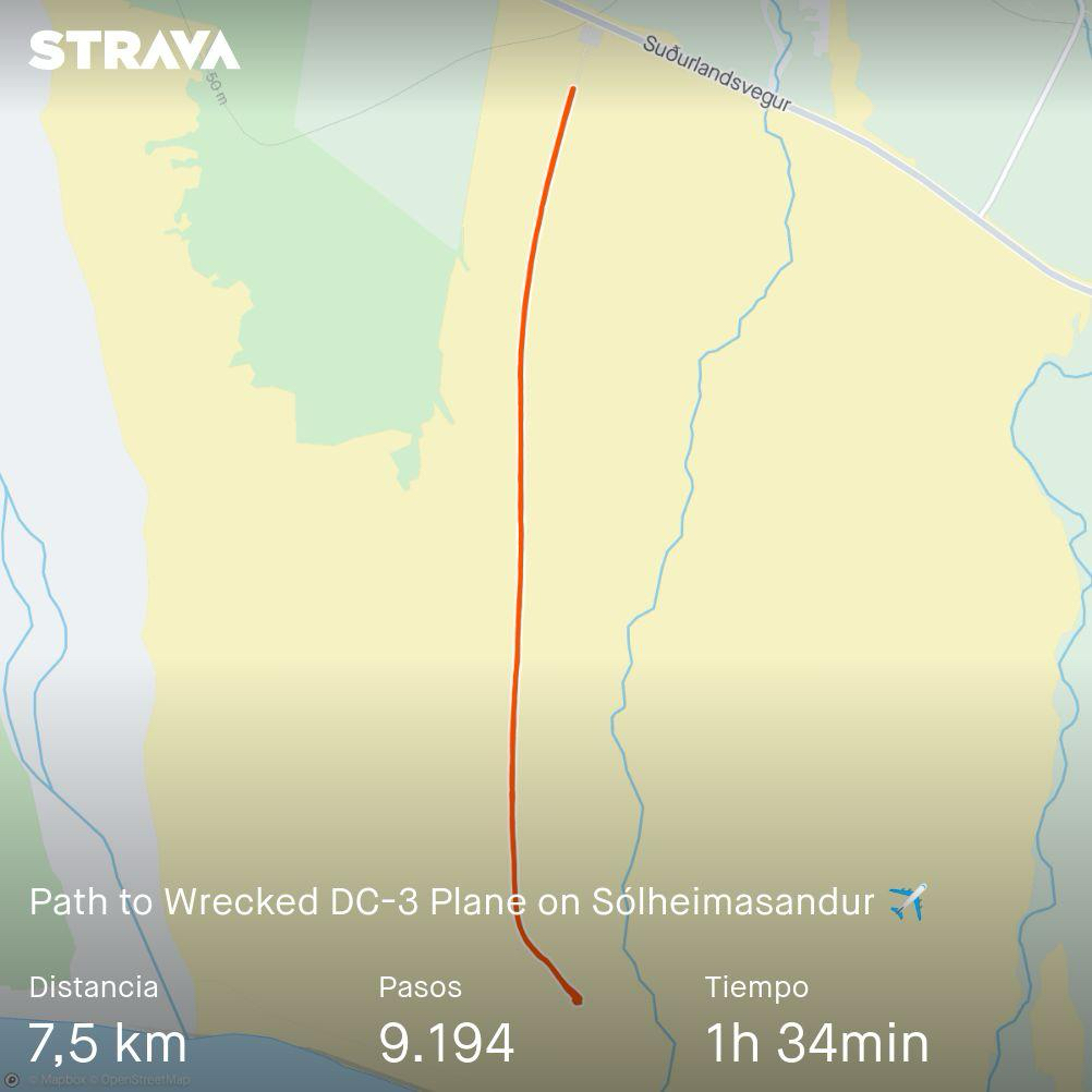
From there you can either walk approximately 4 kms to the site following the only path, or take a shuttle (please check the schedule). The walk to the plane takes approximately 1 hour depending on your rhythm (we made it in a bit less than 50 minutes) and needed the same time back.

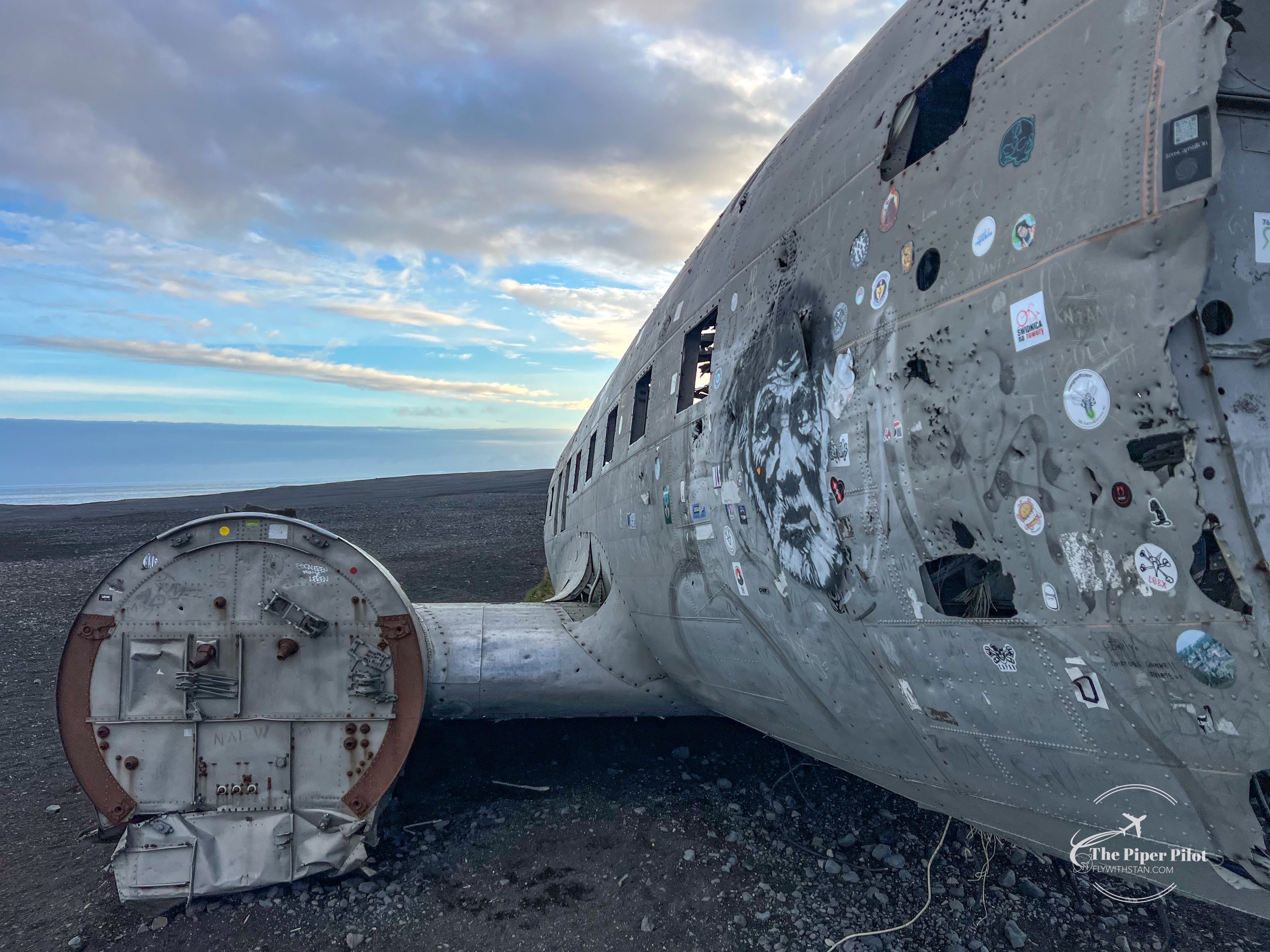
Obviously there are far more impressive images of the plane available on the internet than mine: night shots, with the northern lights, in the snow…
But I’ll just stick to those I’ve made now on this occasion being happy to have fulfilled one of my things from my bucket list.
Enjoy the images and safe landings 😊


Pico del Teide, the highest peak in the Atlantic Ocean (above the sea level), with it’s 12.190 feet or 3.715m, surrounded by the sea of clouds, greets us on our arrival into Tenerife south airport 😁⛰️🛬
In the background to the right, Gran Canaria can be seen as well.
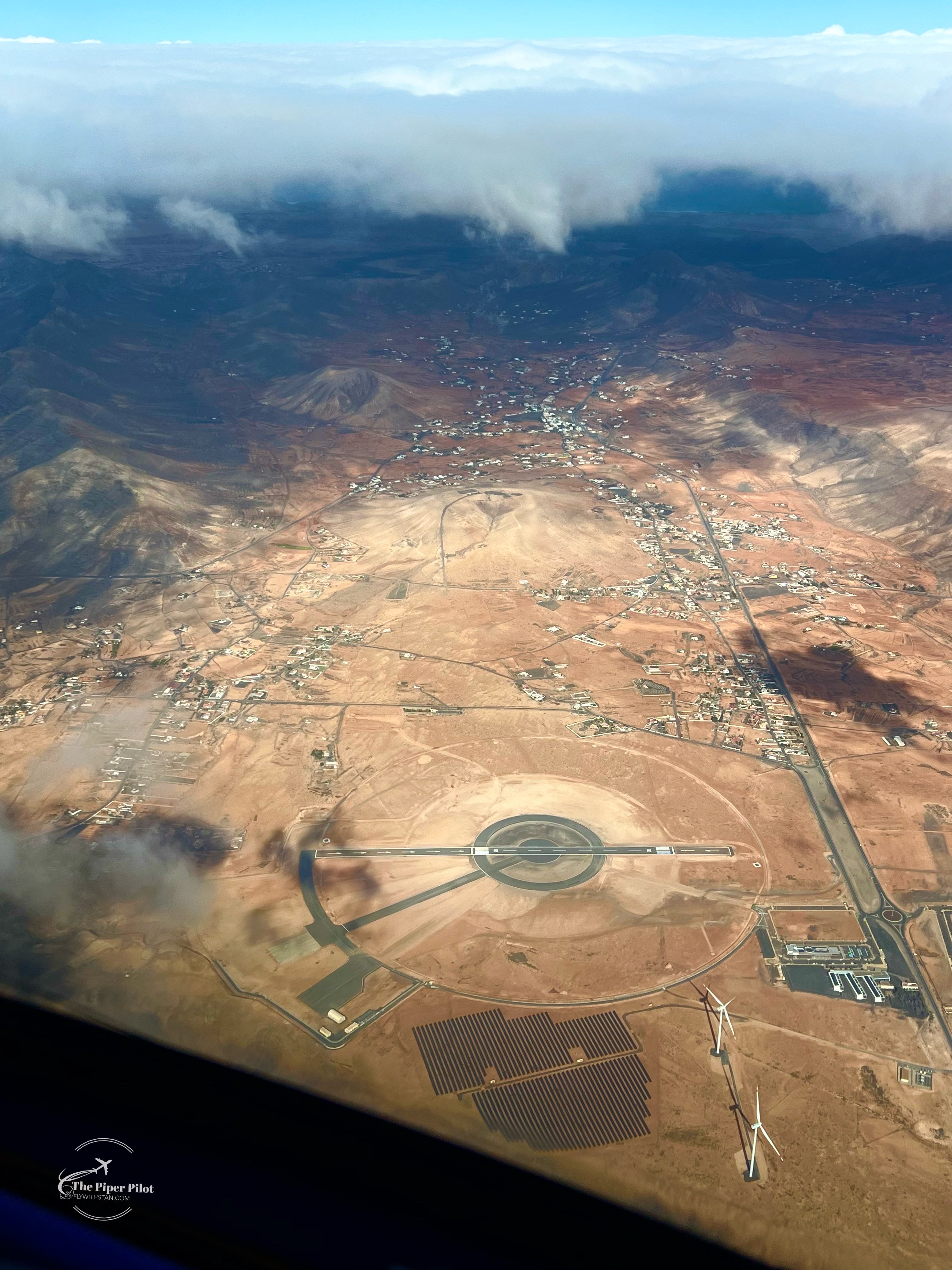
Someone could say there is an “Area 51” situated in Fuerteventura, but in fact there is (apparently the Europe’s first) stratoport built.
It should serve for take off and landing of pseudo satelites and high altitude drones. The runway 02/20 is a bit more than 900m long (don’t know if including or excluding the displaced threshold.)
It is situated at the old Fuerteventura airport (Antiguo Aeropuerto de los Estancos, which I’ve visited back in 2020). At that time there was no mention of building this stratoport yet…
You can find the exact location of stratoport here: https://maps.app.goo.gl/ZaZqYLhBv6dvCmUs8
…and the calima is back… Winds blowing from Africa bringing hot, dry air with lot’s of sand covering the islands.
This can be perfectly seen on this satelite image by Copernicus EU (I’m not flying that high yet lol…)
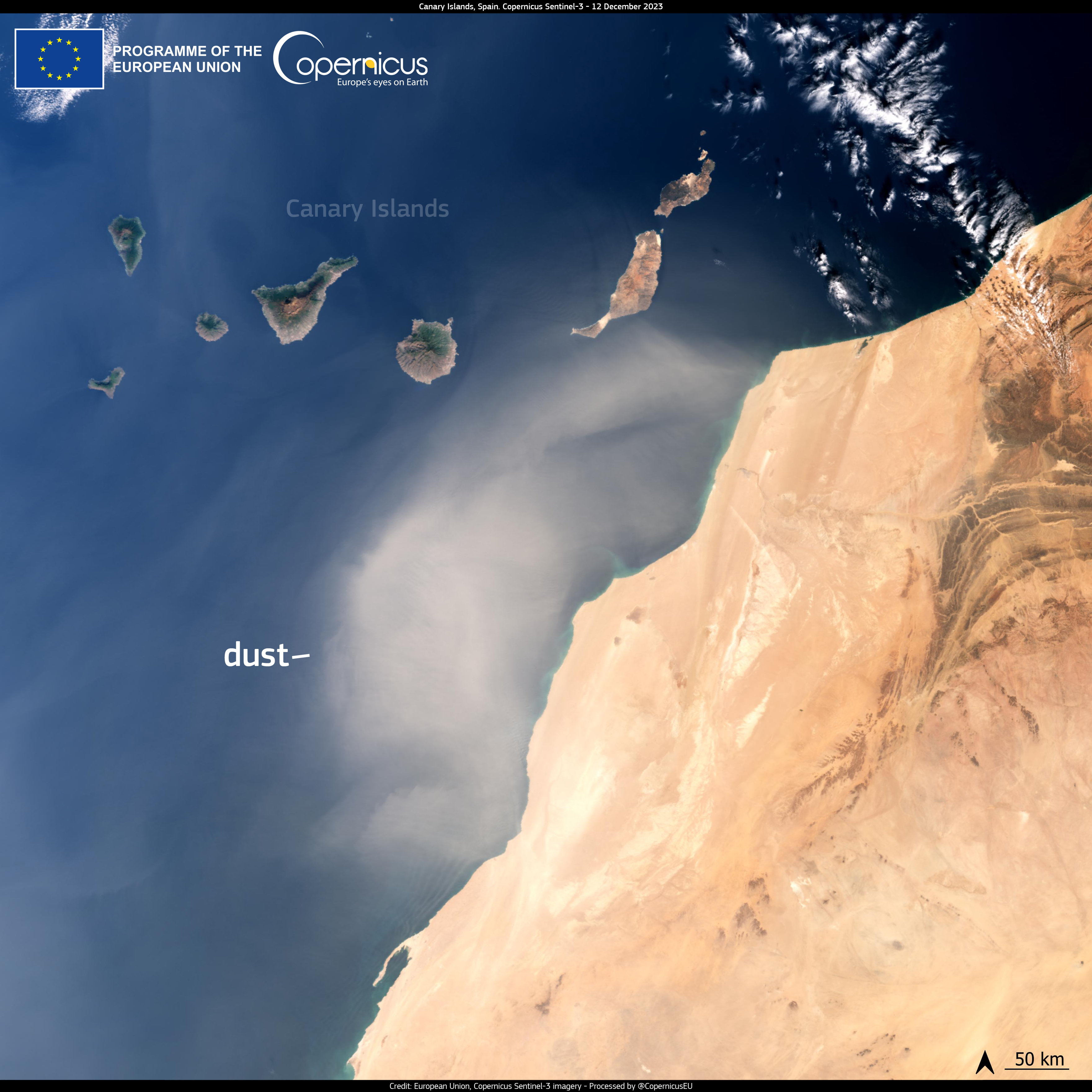
But I was “lucky” enough to be flying these days and to get above the calima layer to get get some “fresh air” and some better views. I have to admit the view from above was pretty impressive. Well, this layer reached almost 6.000-7.000 feet and mostly causes some breathing issues to the part of the population.
I’ll share it with you in the next image.
Stay safe, safe flying and Merry Christmas!

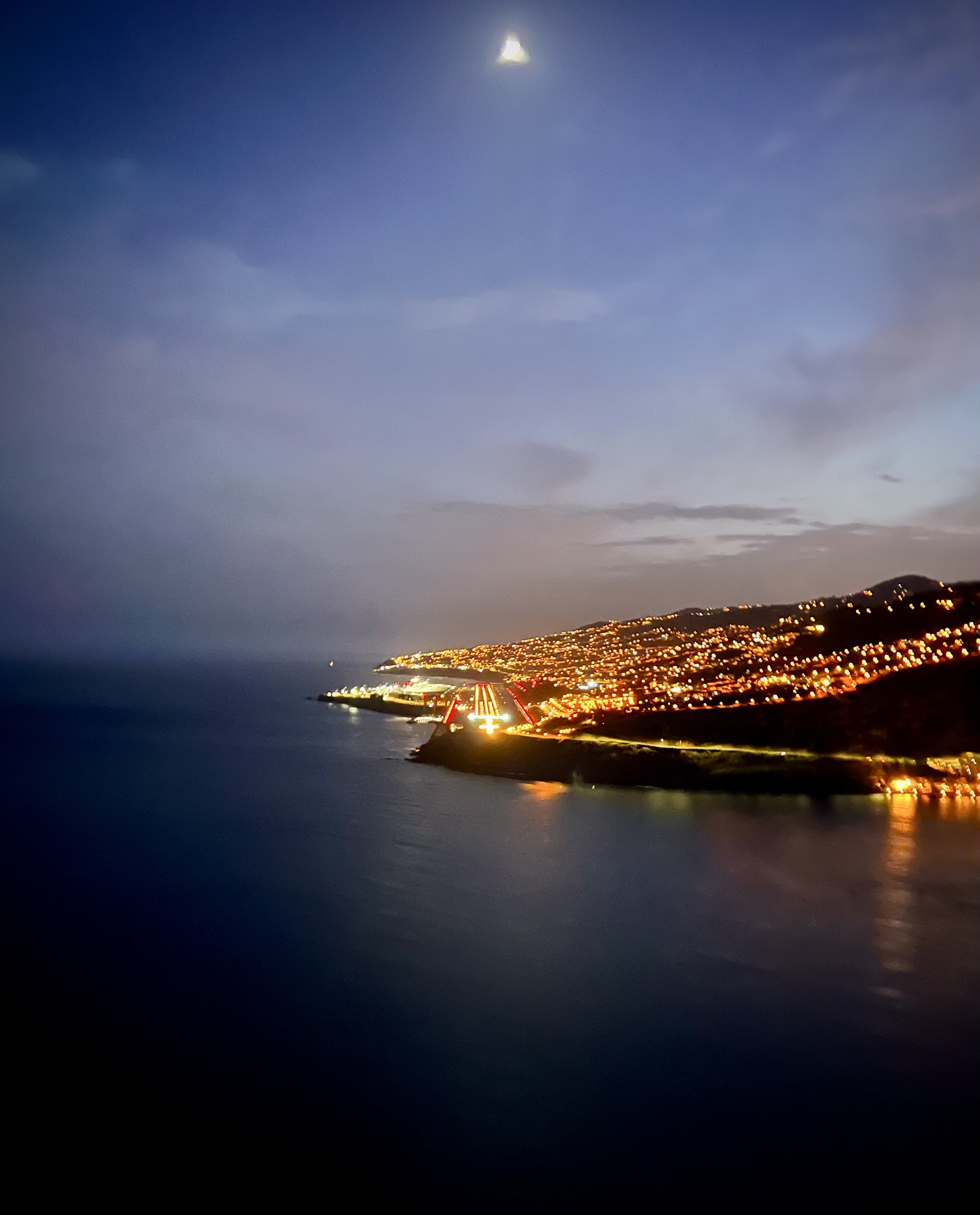
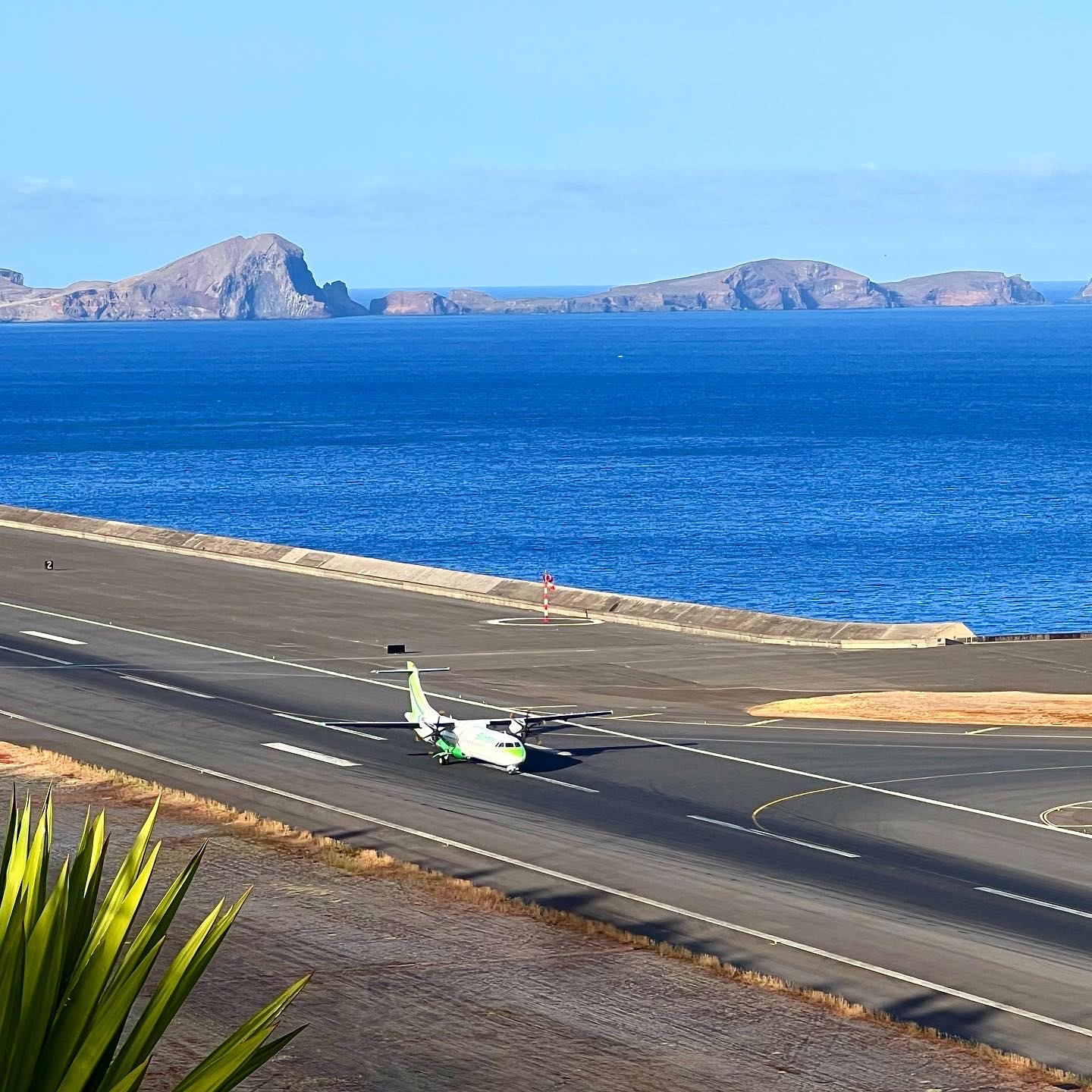
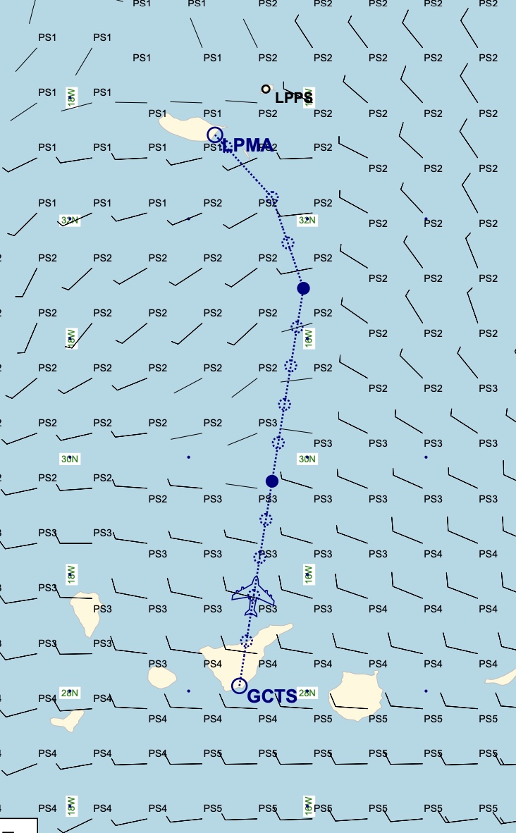
Finally got the chance to do a flight from Tenerife south to Madeira airport. The distance is approximately 280NM and the flight time on the ATR72 is around 1:30-1:45 minutes depending on the winds and traffic at Madeira (and also Tenerife south airport).
Madeira airport is very famous for its complicated approach; specially on a windy a stormy days. Captain landing only, and several other requirements by the local aviation authorities.
On this flight the winds were calm, which helped to make the flight more enjoyable and comfortable specially fot the passengers.
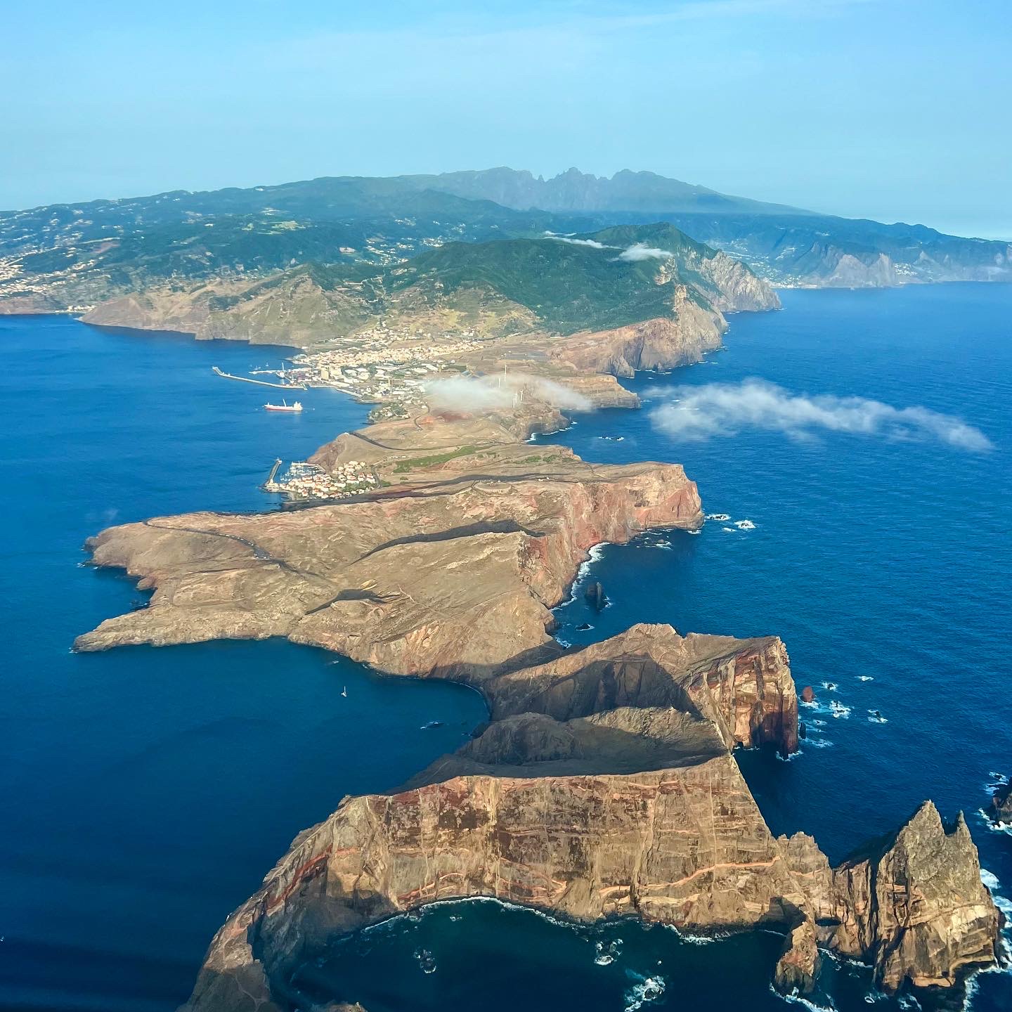
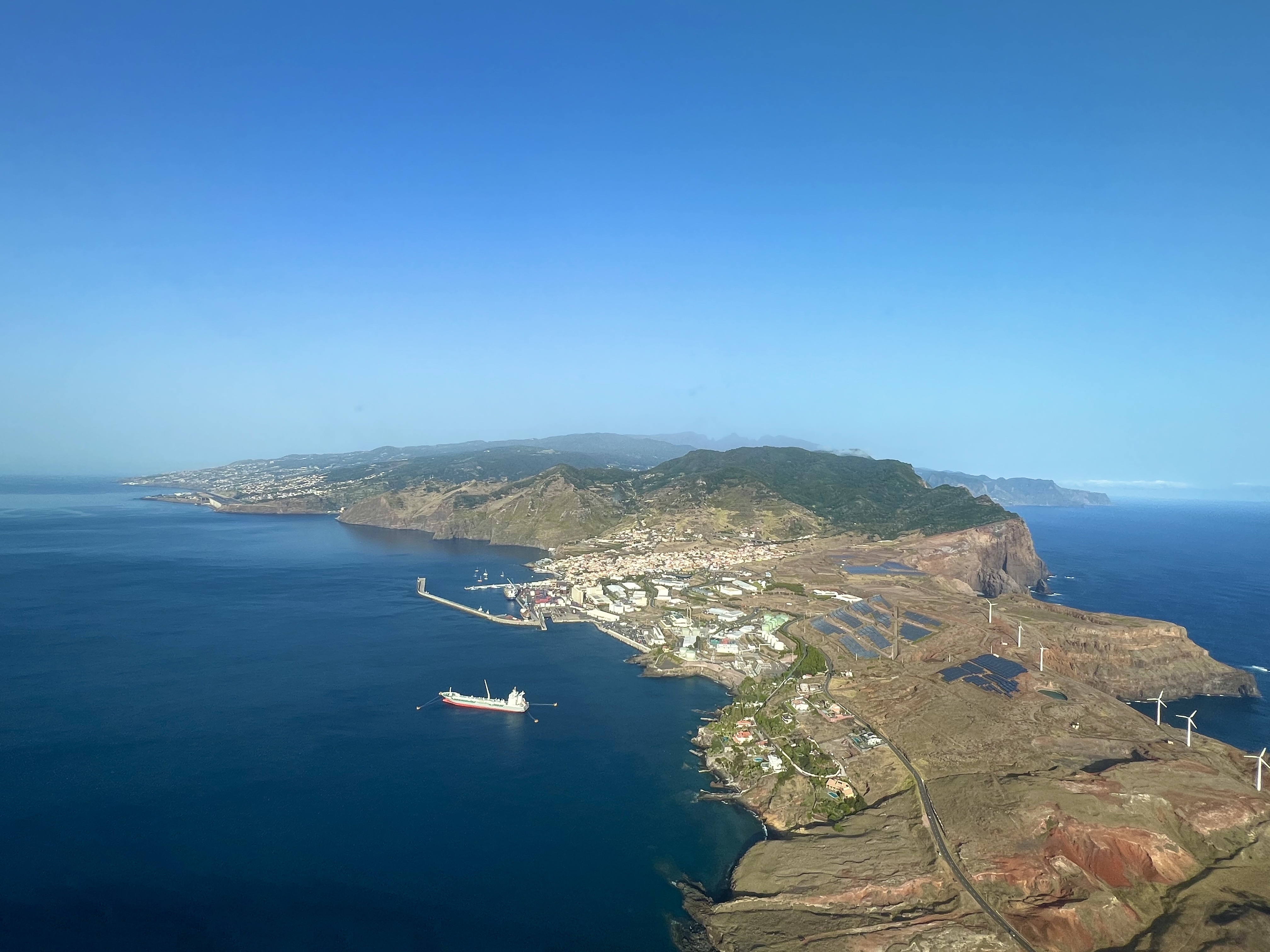
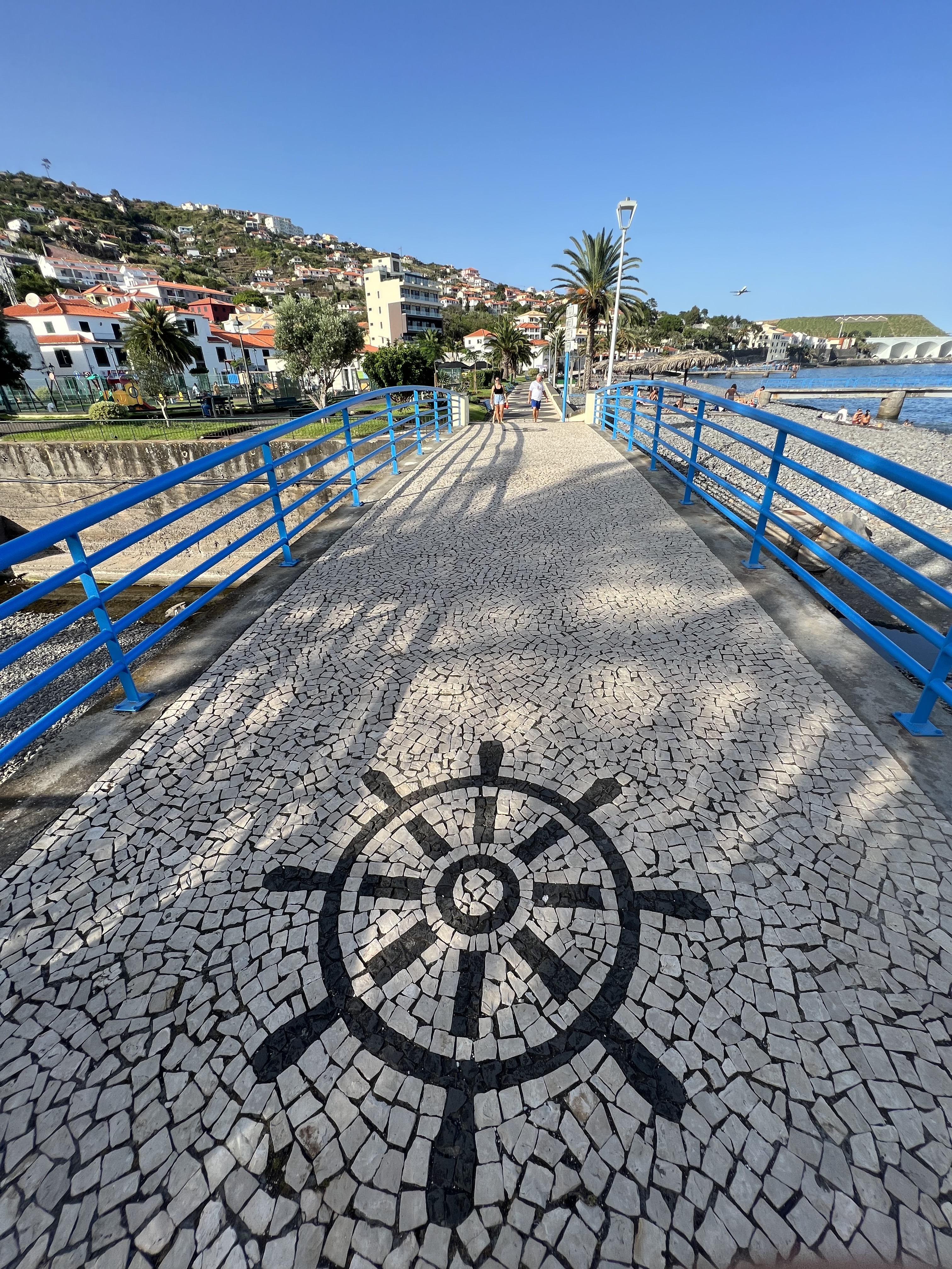
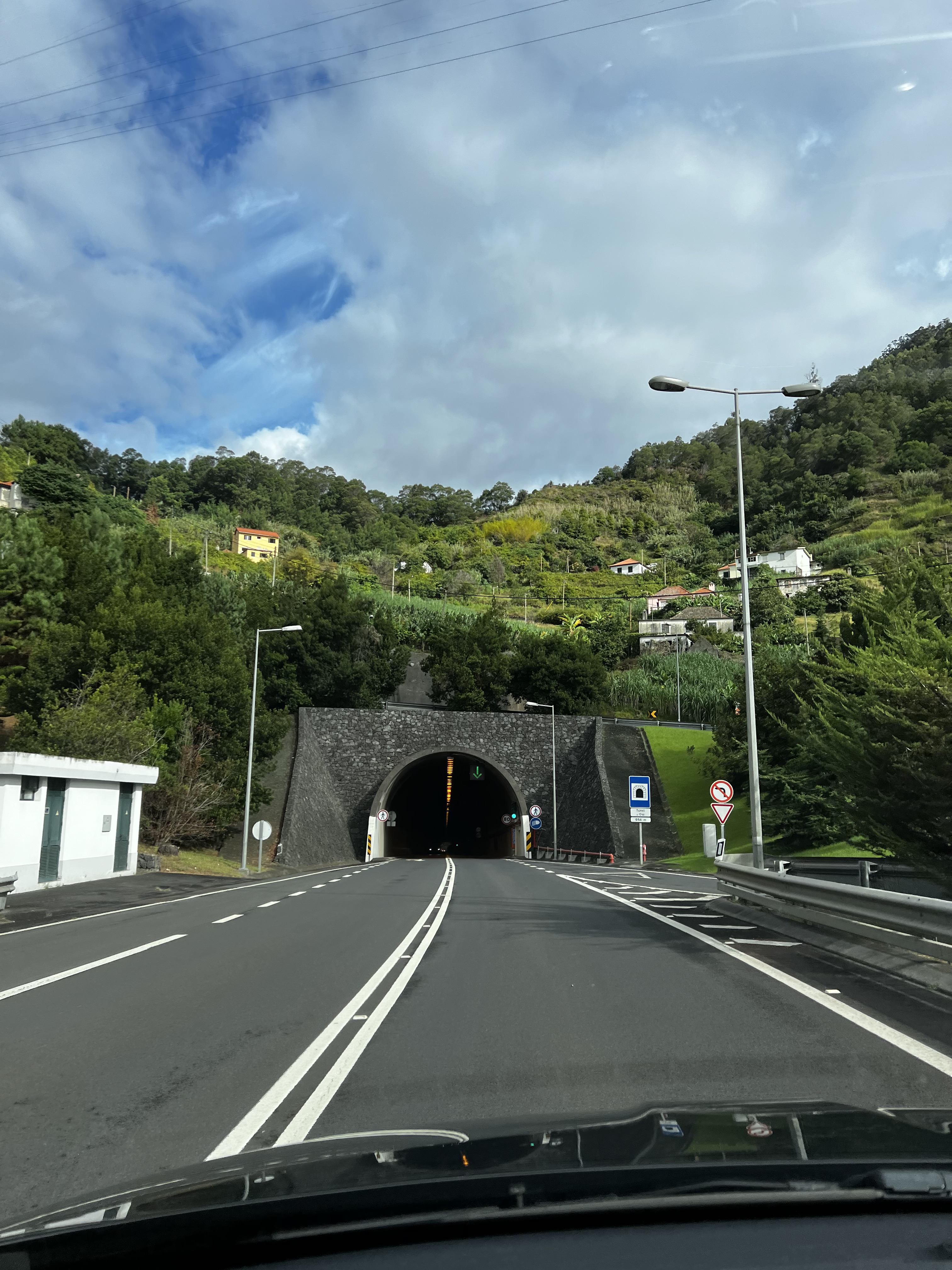
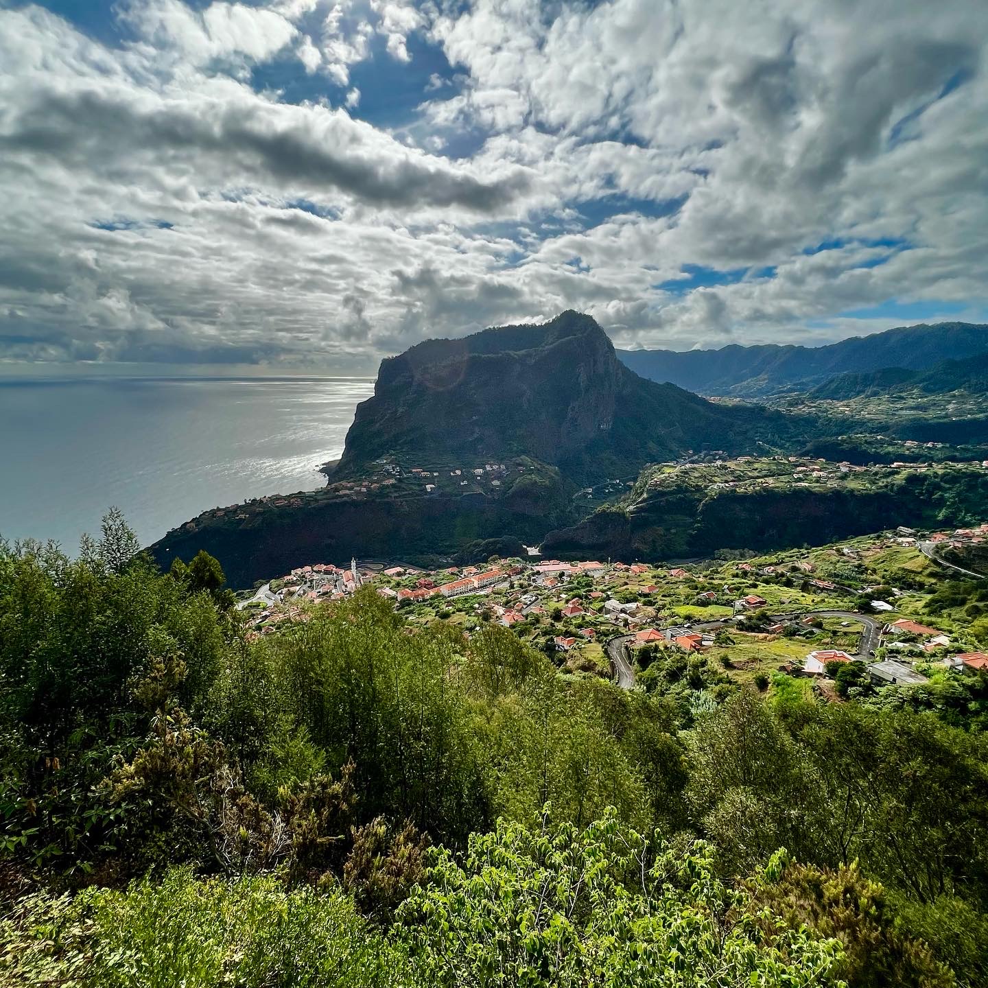
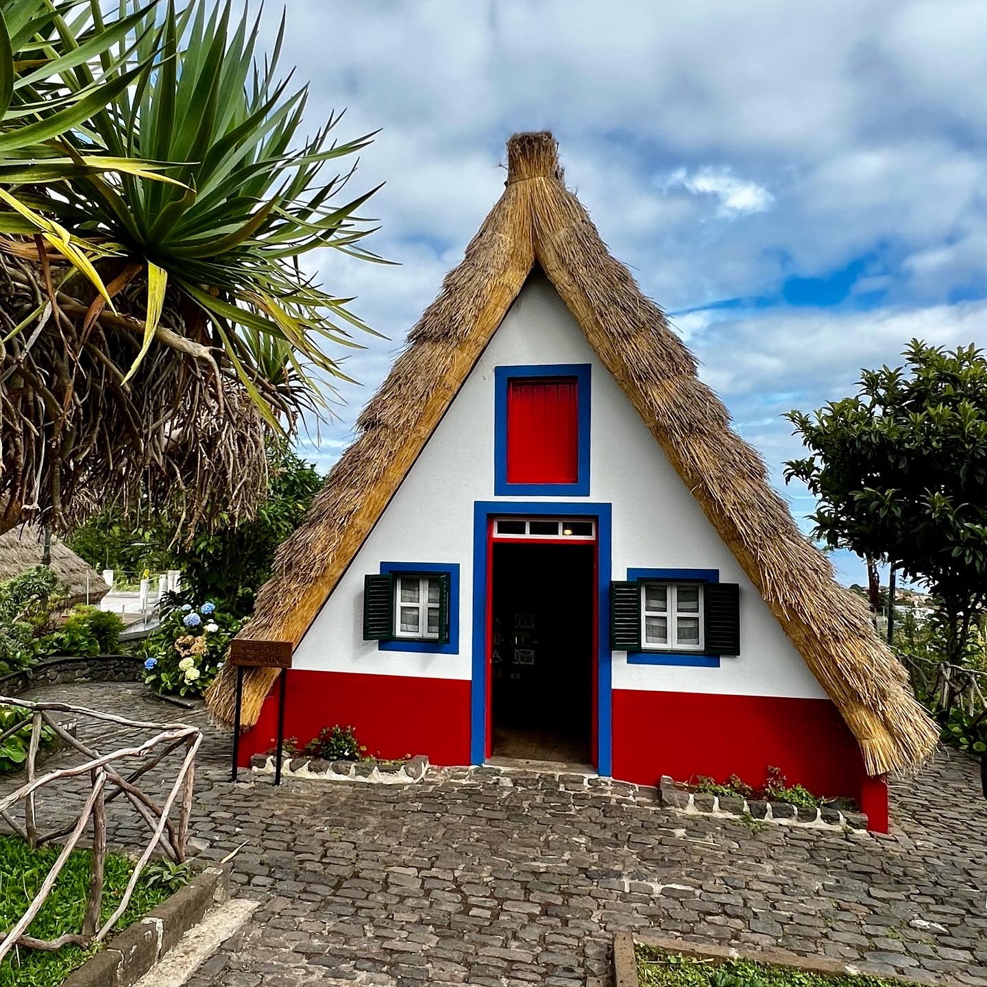
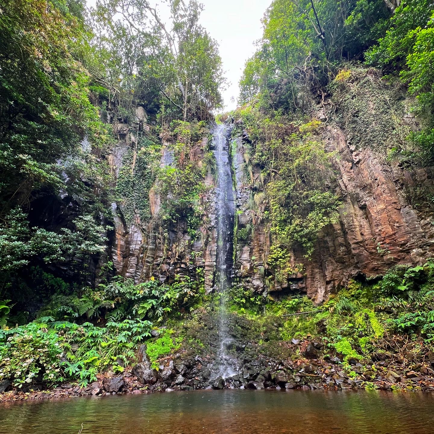
As I have spent some days on the island, I had the chance to rent a car a to drive a little bit around.
The nature is beautiful, green, lots of waterfalls, water running everywhere. Friendly people, good food. I’ll be definitely back (soon)!
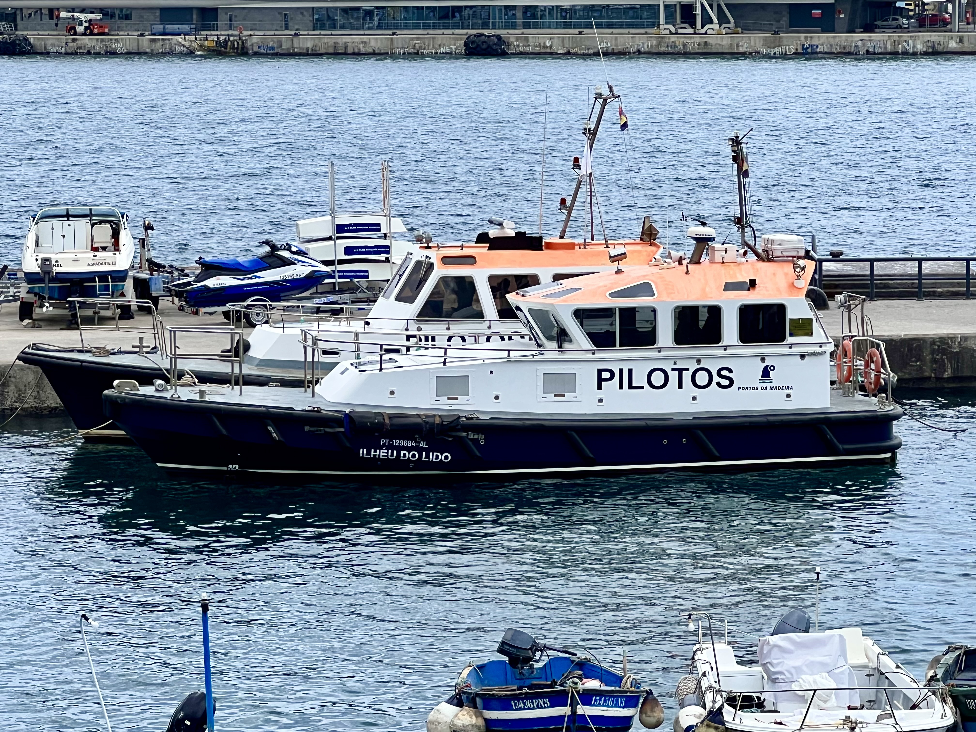
Here are some (not only aerial) mages from Madeira.
Safe flights!


Where to start and how to get to the point…
To spend some time in a full motion simulator is a dream of every private pilot or an aviation enthusiast. To enjoy the almost “real” feeling of flying a passenger plane, get pushed into the seat when increasing the power for take off, or experience the “vibrations” when passing through the turbulence.
Well, I’ve been a couple of times to a simulator and I mostly enjoyed it very much. Practicing IFR, enjoying the flight, just enhancing my knowledge.
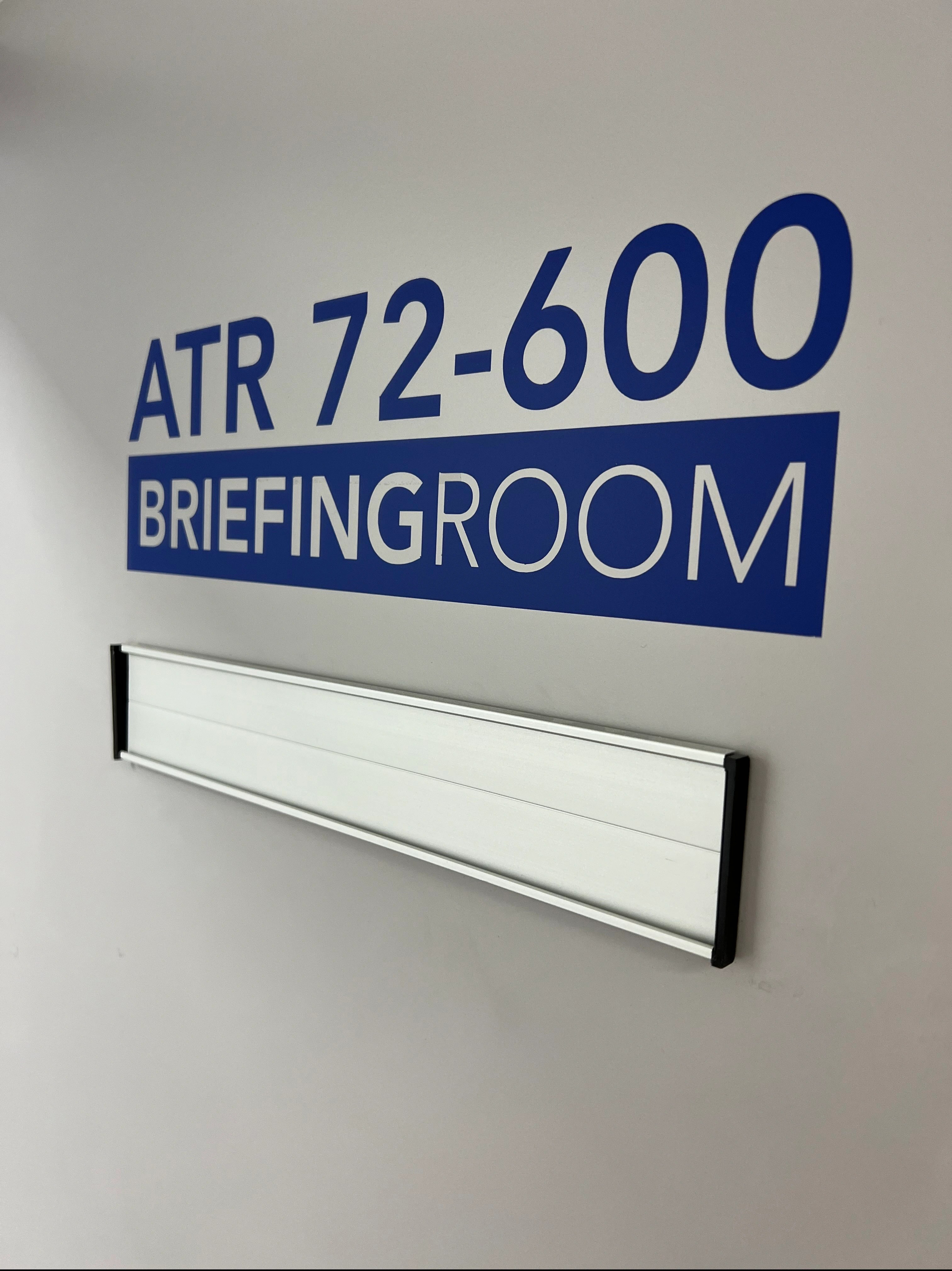
Well, now I had the chance to experience the “other side” of flying in the simulator during my Type Rating earlier this year.
Weeks of theory, learning all the plane systems, studying, exams… I think there is no other profession in the universe like aviation; where you have to keep studying and passing exams over and over again.
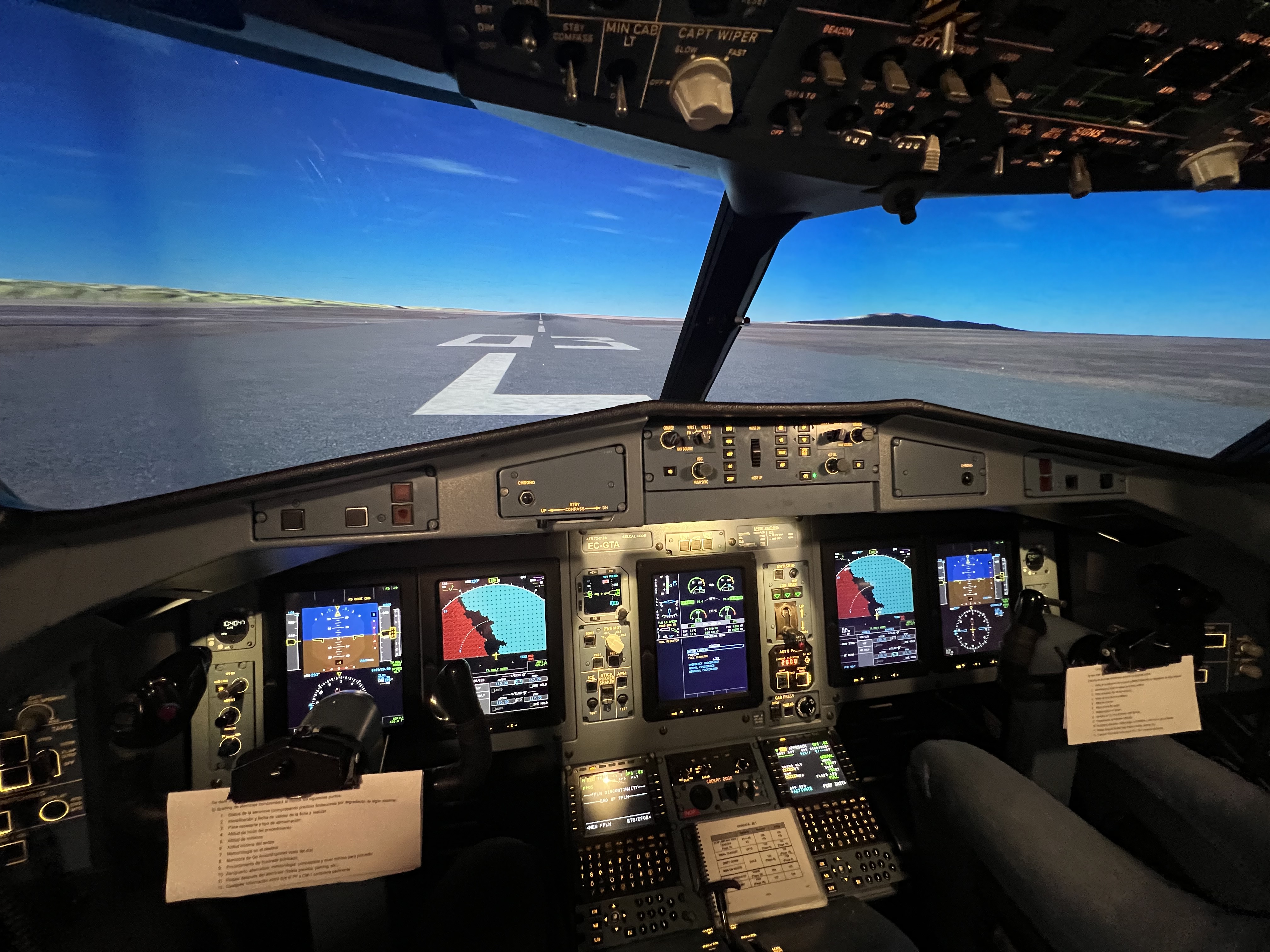
After we passed the theoretical part, it was finally so far: it was so far; we were allowed to go to the simulator.
We had in total 14 4-hour sessions ahead of us. Should be fun, they said…
Well, it kind was fun at the very beginning. Let’s say at the start. Let’s say the very first session, lol. Then everything started to get more complicated…
When the cockpit was prepared and set for the session, we just looked at each other with my colleague and asked: “ready”? Knowing, once we advance the power levers, the 4 hour rollercoaster will start.

Engine failure on take off roll, at take off, multiple failure during the flight, loss of systems, screens, pilot incapacitation, traffic resolution in the worse weather conditions, engine fire and far more was offered on the “daily menu”…
Obviously, it did make sense. You learn the “push” all the buttons, learn what happens and why and how to react in. the case of a real emergency. Planes are pretty safe, and the most important thing is to fly them until the “very last end”. Aviate, navigate, communicate.
Now I understand what the pilots go through when they speak about the “dancing box”. It’s not to have fun, it’s refresh all the emergency and abnormal procedures that are likely not going to happen during the normal operations, but we need to be prepared for.
Hard work, lot’s of studying and practicing brought us to the final sim check and we passed it!
Next step was touch and goes. It was a big experience, to be sitted at the controls of a passenger plane.
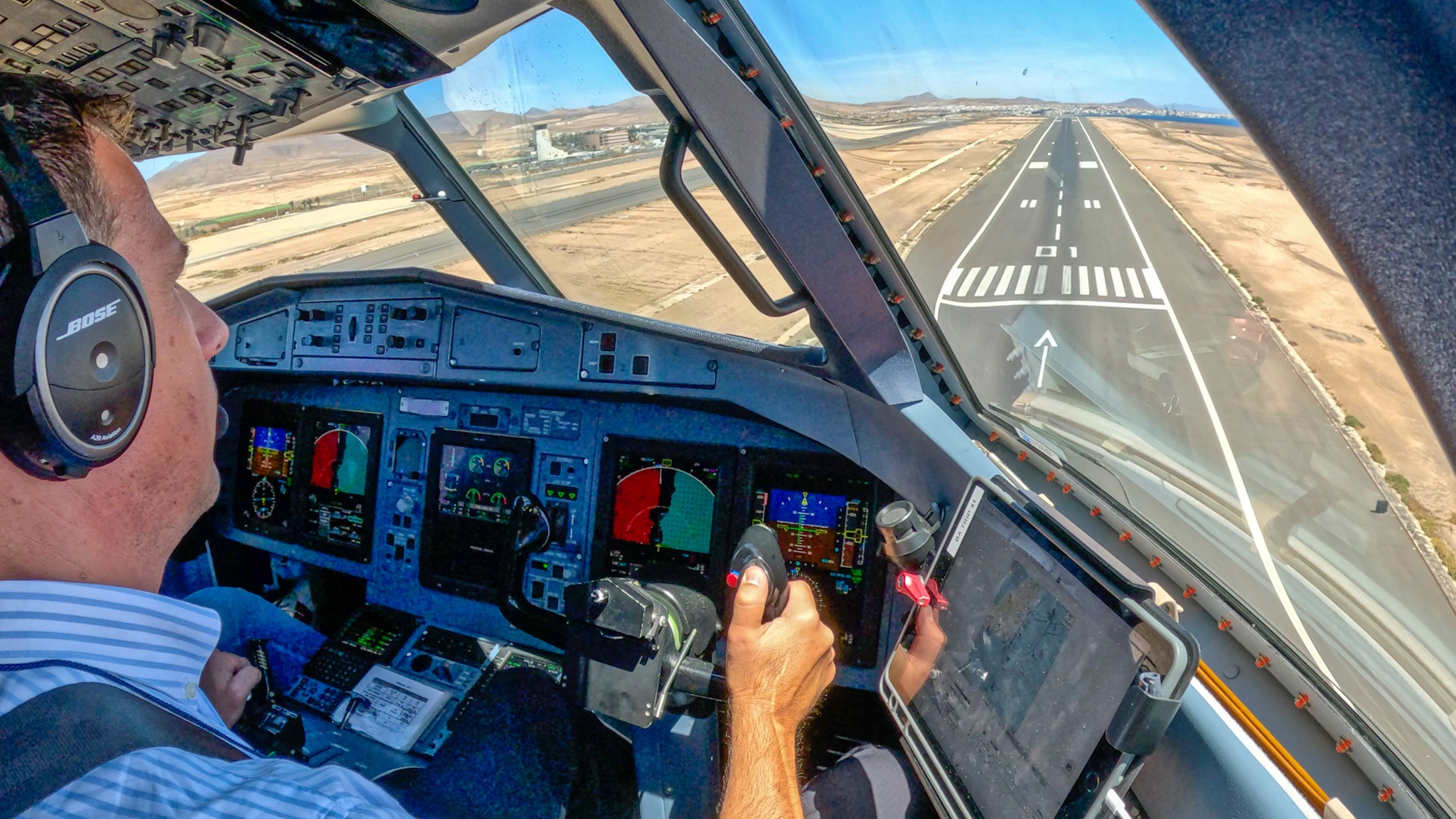
It was so far, this was the very first time. Achieving the dreams.

Honestly, even after we landed and returned home I couldn’t believe it that I achieved it. This was the icing on the cake.
Everything gets even more real when you wear the uniform and take the right seat. This is when the things get real.
Hard work pays off, I’m happy and very proud to have achieved this. It was not easy, but things will happen at the right time and for the right reason. It’s not that the learning has finished, this is where it’s just started!

Safe flights and hope to see you on board!
Yes. Good things take time…
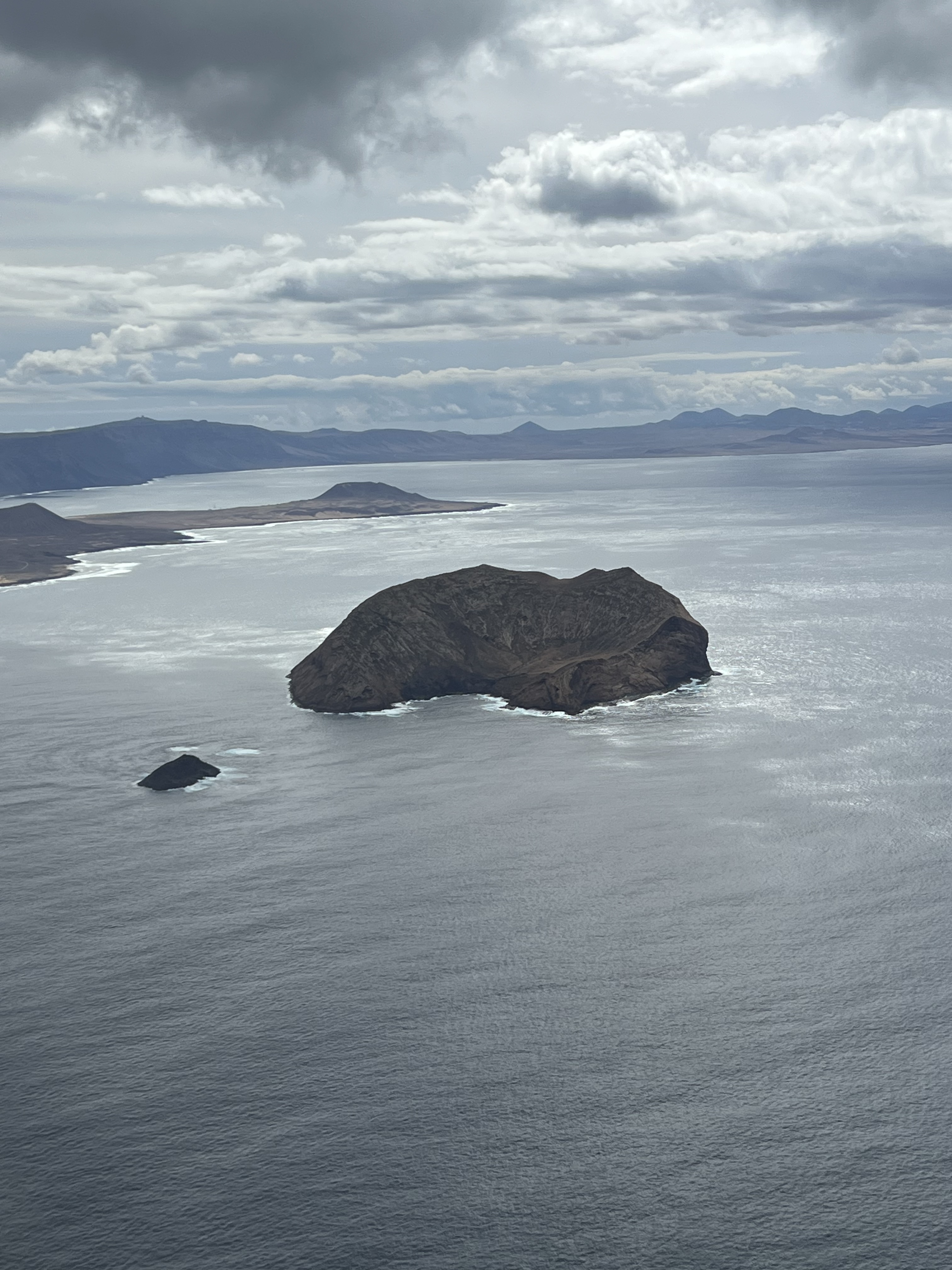
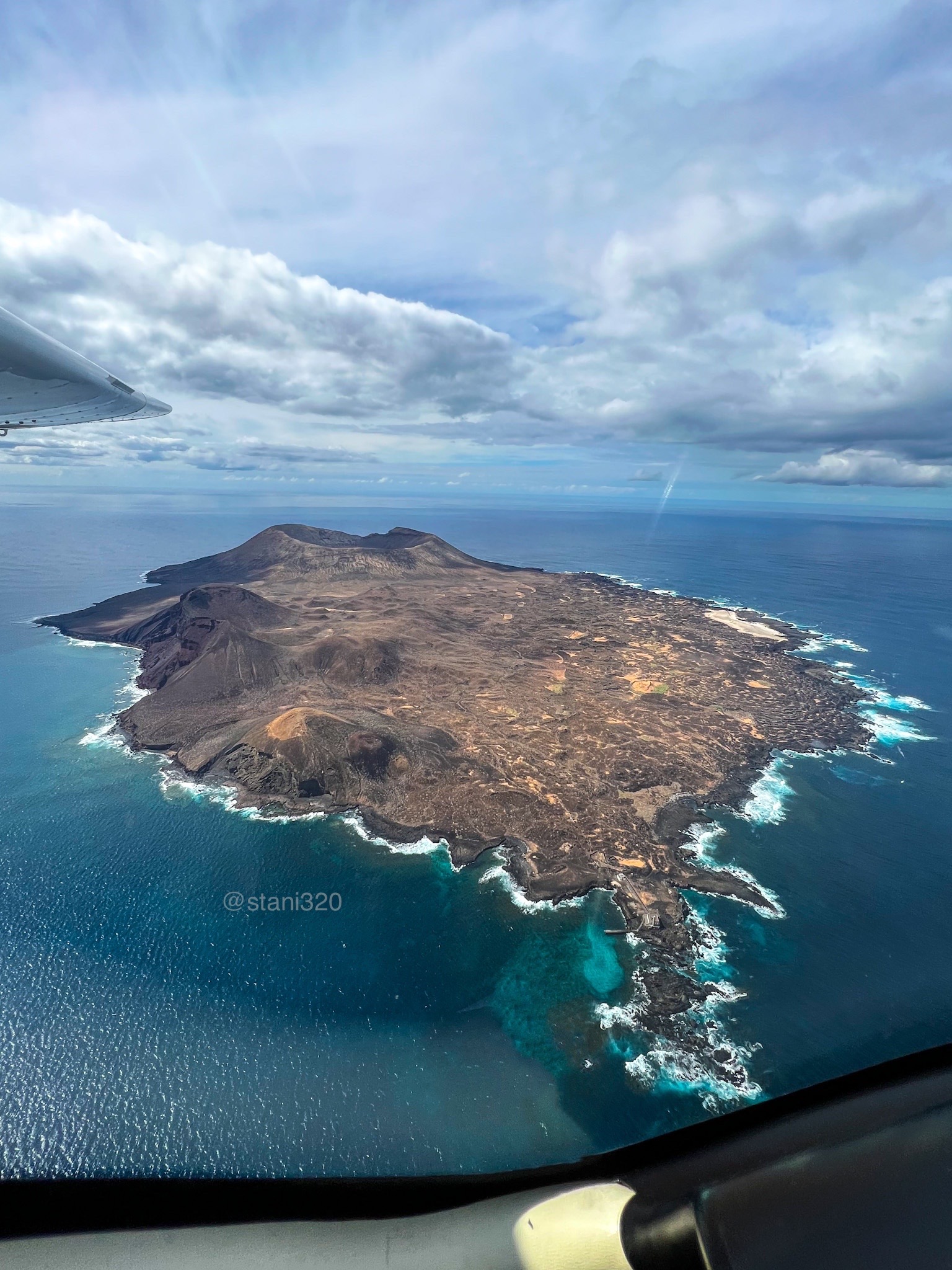
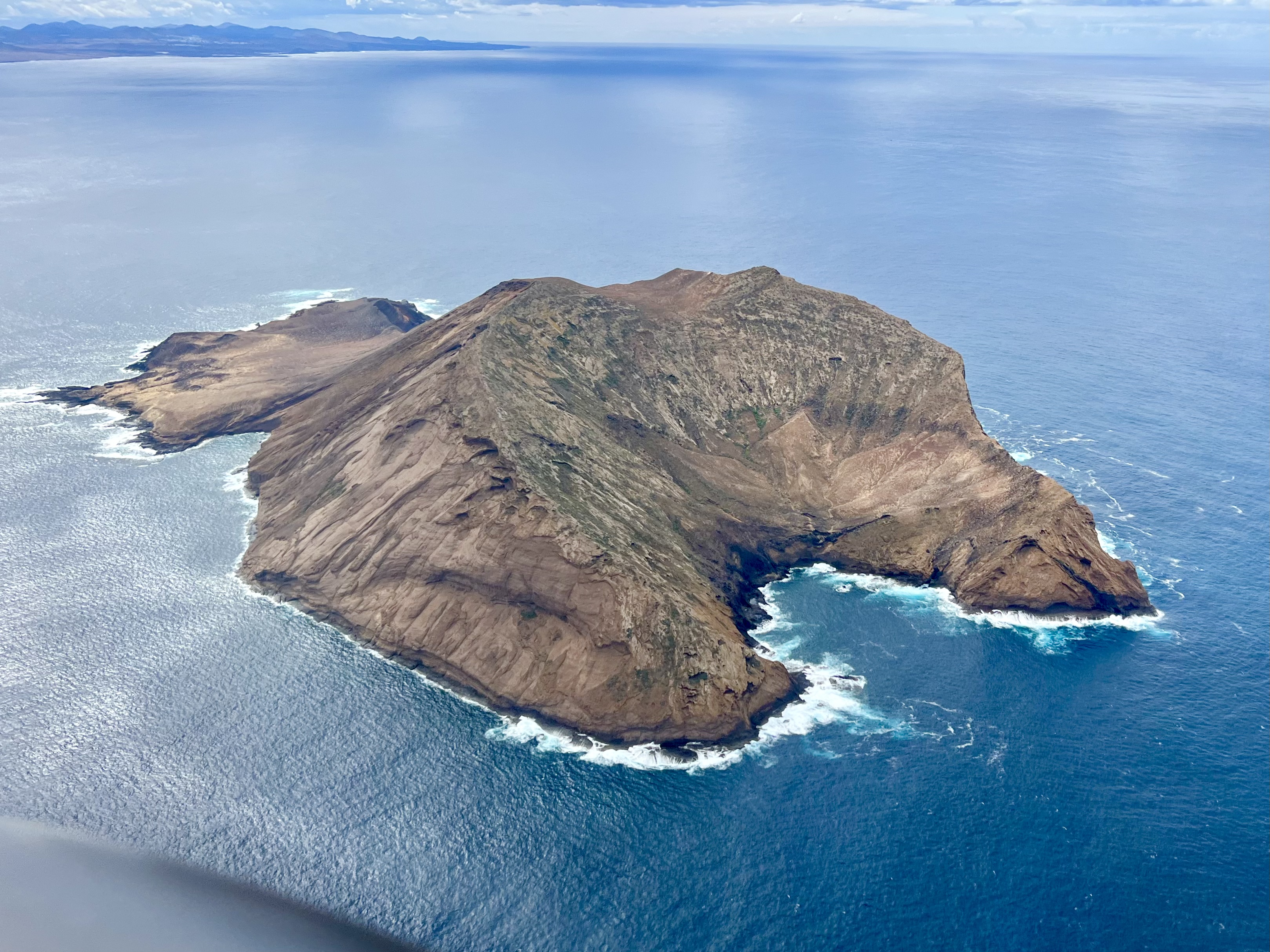
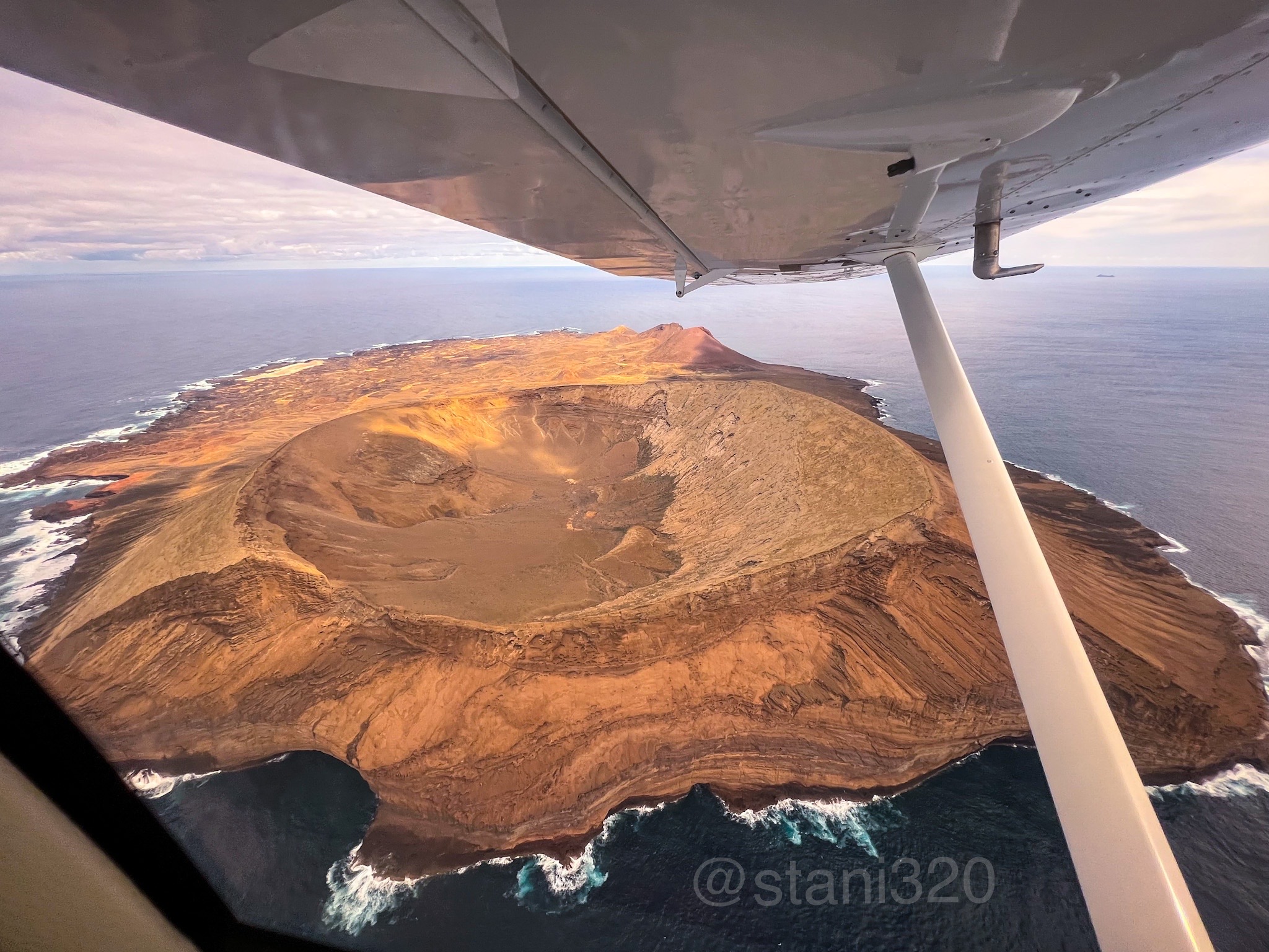
Since 2007 I was flying around the Canary Islands, but it took me almost 16 years to manage to visit the smallest islands situated northwest of Lanzarote: Isla de Alegranza and Isla de Montaña Clara. Yes, it took a lot of time…

These are some perks of this job. The diameter of the crater at Alegranza is 1.1kms. And is the biggest (=widest) crater of the Archipiélago.
In the past these islands could have been visited by boat, unfortunately it’s not allowed anymore.
More information about these islands can be found on wikipedia:
https://en.wikipedia.org/wiki/Montaña_Clara
https://en.wikipedia.org/wiki/Alegranza
Now simply enjoy the beauty… Safe flights!


Updated 15.11.2023
After visiting the closed aerodrome “El Revolcadero” at La Gomera, I did mention that my next stop will be at Breña Alta, to explore the former La Palma’s aerodrome.
So here it comes. Unfortunately there is not much to see around. A road is passing on the former runway and the terminal building and the tower are not accesible.

The elevation of the aerodrome is 1.3700 feet and is surrounded by mountainous terrain, which I think was the cause why the aerodrome was closed. When clouds start to form, visual approach into this airport could become pretty complicated or maybe impossible.
The aerodrome was opened in 1955 and served until 1970. Initaly I didn´t have any relative information about the runway length, nor designation; but thanks to Claudio Sánchez added on Twitter some value information and now we know that the runway designators were 03-21.

The Tower building looks to be still in a pretty good shape, considering it was closed for more than 50 years. Unfortunately the access was blocked, so it’s not possible to climb up to enjoy the “old airport” views.
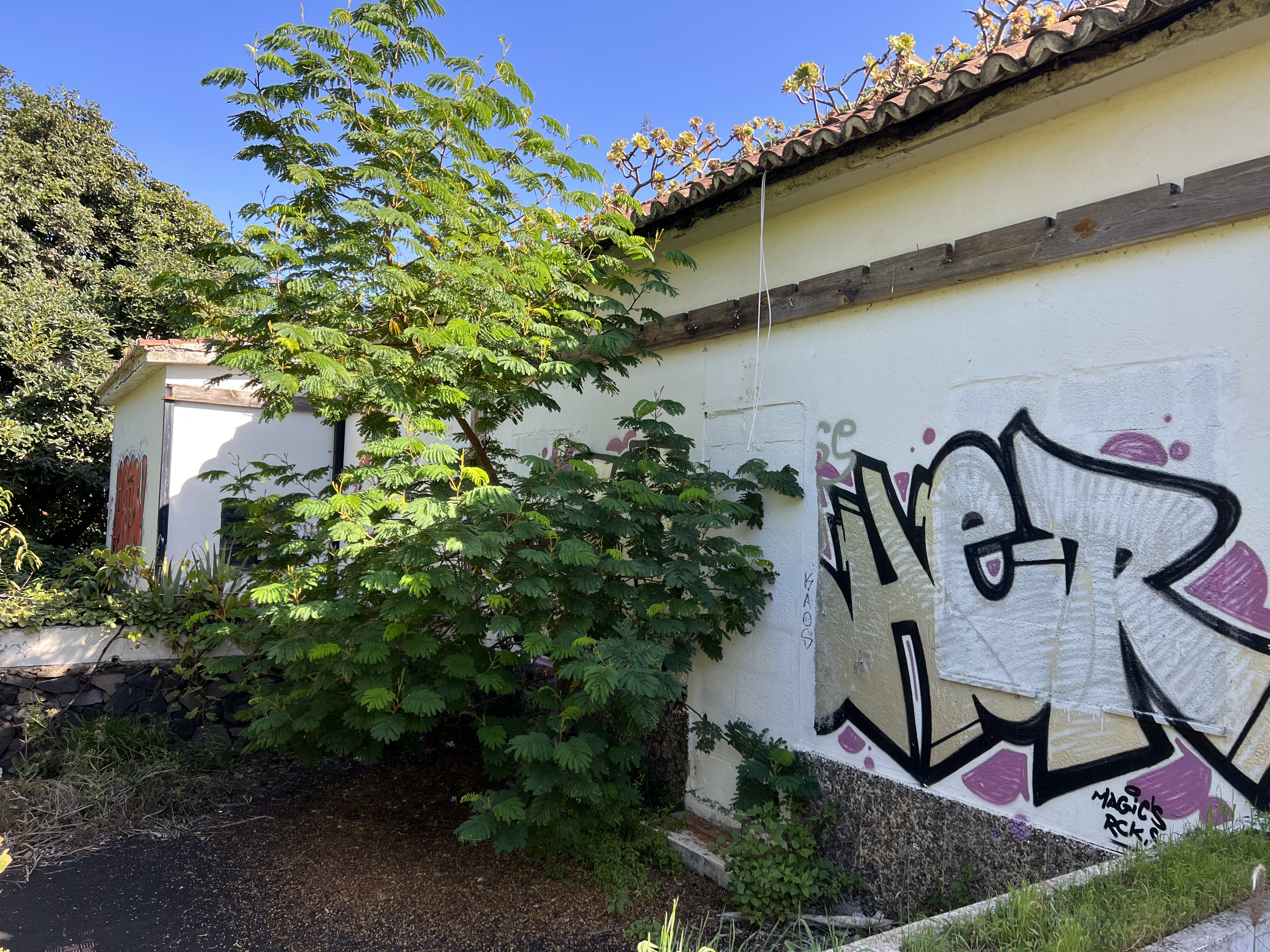
The terminal building doesn´t look that bad either. But again, it’s not accesible. All doors and windows have been blocked.

And how about the runway? Well, on Google Maps you can clearly see that once there was a runway, now a road is passing on it.
Tried to measure the length of the runway on my Foreflight App and i’m getting a bit less than 1km of runway. As I don’t know where it exactly started and finished, it’s difficult to say how long it exactly was.

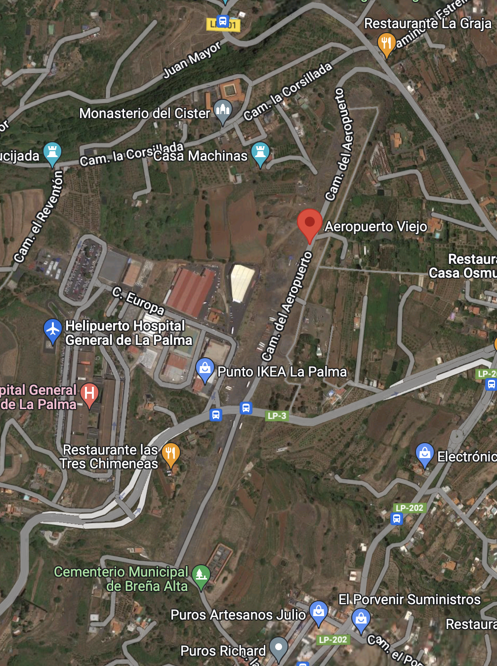


At least you can drive on the runway. Should have paid attention to the distance the car would have measured to know the exact length. And I think I did it, but forgot the note it somewhere…
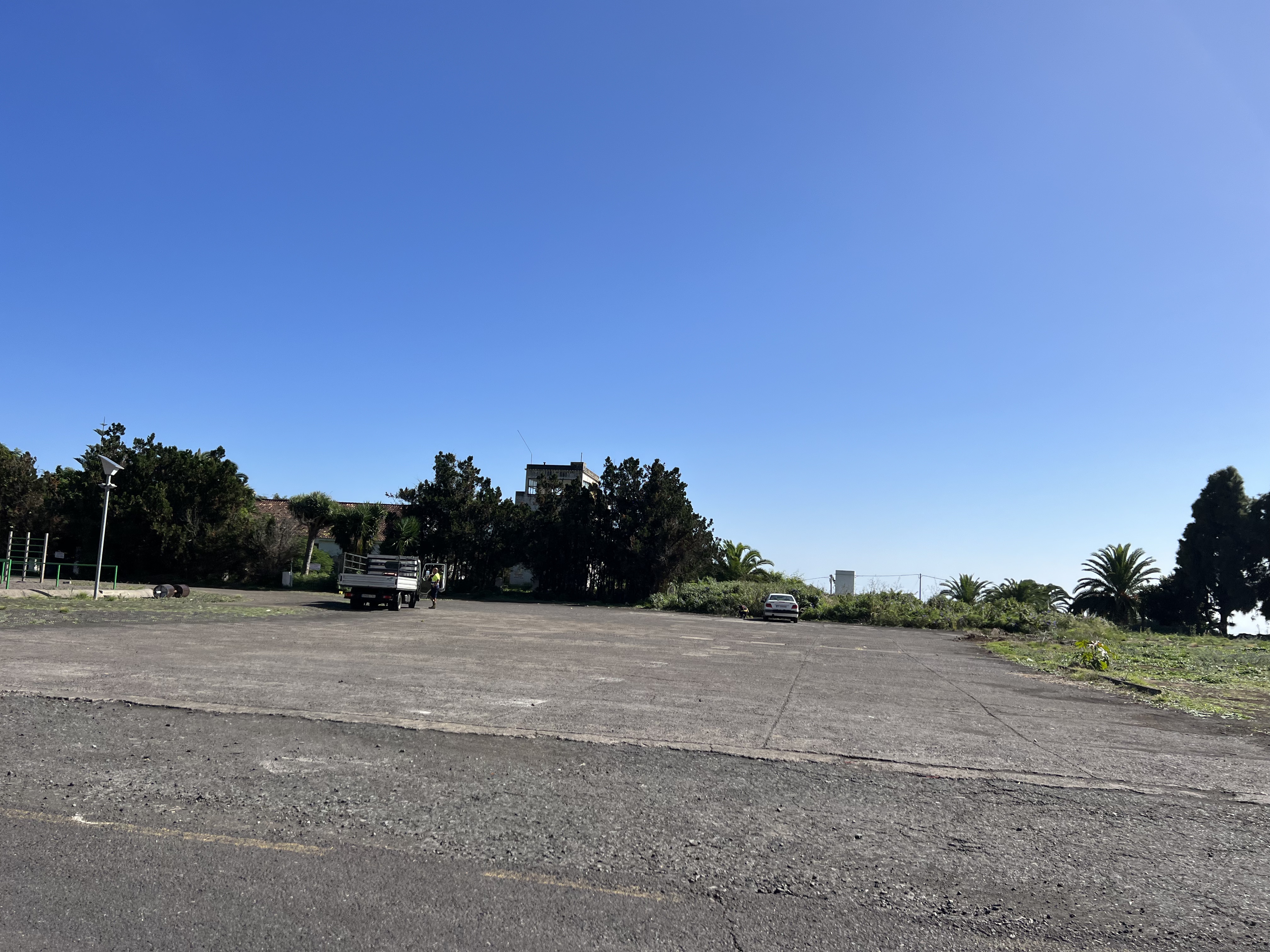
And this image looks like the apron just in front of the tower and terminal building.
Well, that’s it folks! A piece of history, pity they didn’t make anything special of it. But it seems there were a lot’s of problems with the ground and properties. But this would be something for a “non aeronautical post”, which is not the subject of my blog.
You can find more about the history in the following article: https://www.aena.es/es/la-palma/conocenos/historia.html (Many thanks to Claudio Sánchez for sharing this link).
Wish you safe flying!
