I´ll just share with you some images taken during my short flight around Tenerife last week… Tried to mount the gopro on a different place of the plane (horizontal stabilizer) and I simply love the images!!!
At the end you can find a short video of the flight with my friend Dirk as co-pilot as well! He did a great job and we had a great time up in the air!
Come and enjoy the views with me!
Preflight selfie
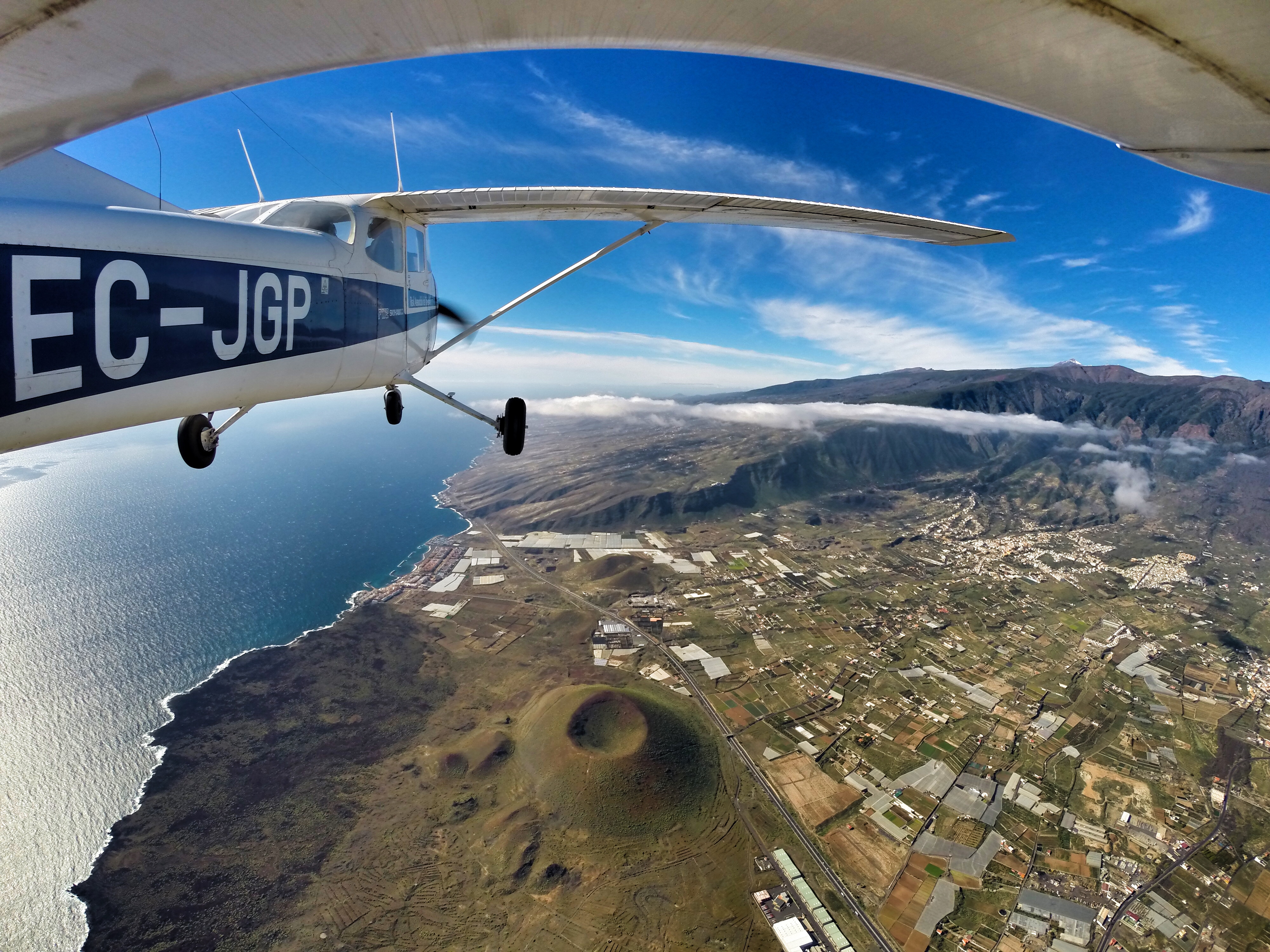
The Vulcano at Güimar valley
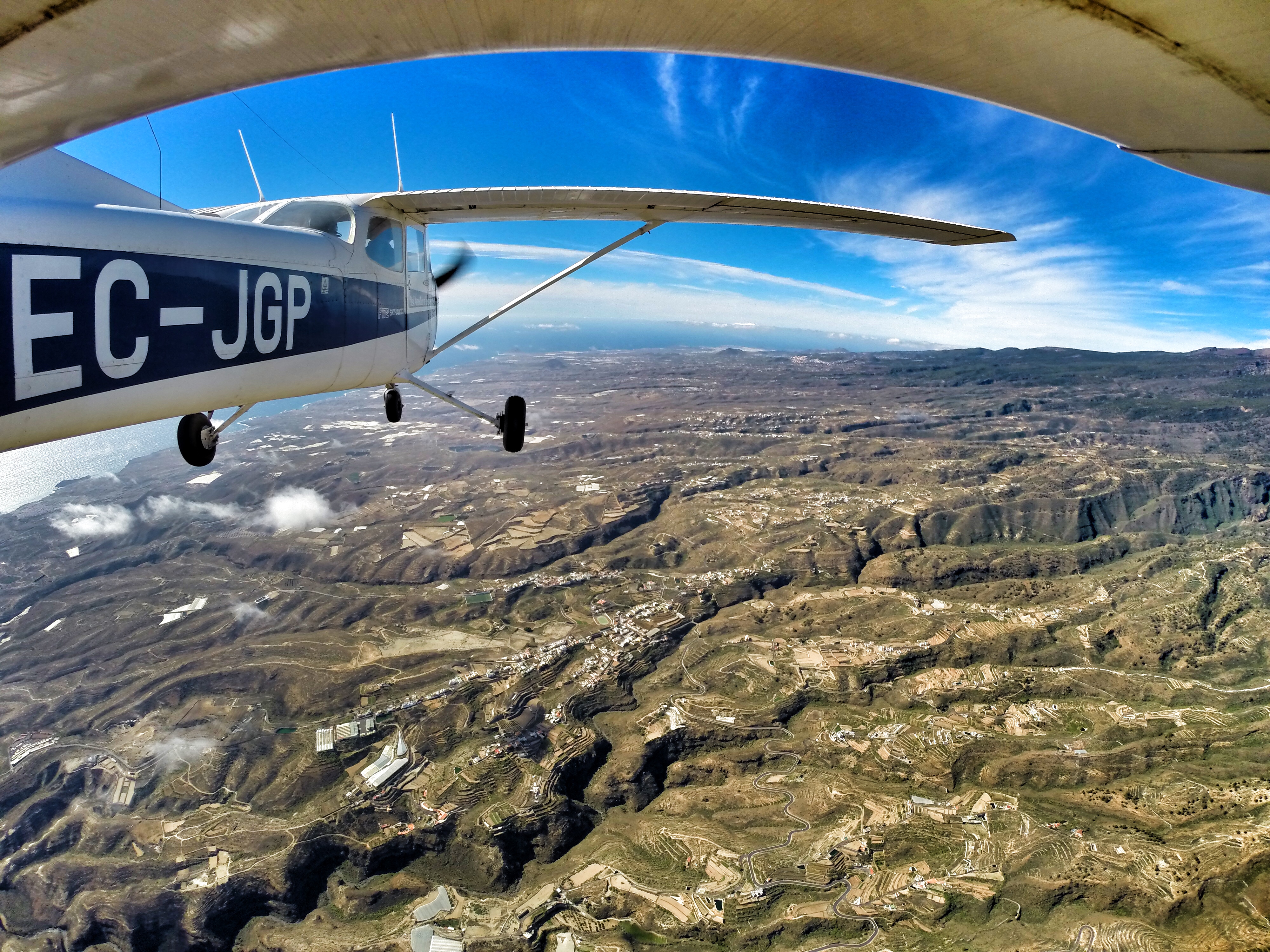
Somewhere over the mountains between Güimar and Arico
Flying along the coast
Chasing the shadow…
Playa de las Américas
Costa los Gigantes from the air
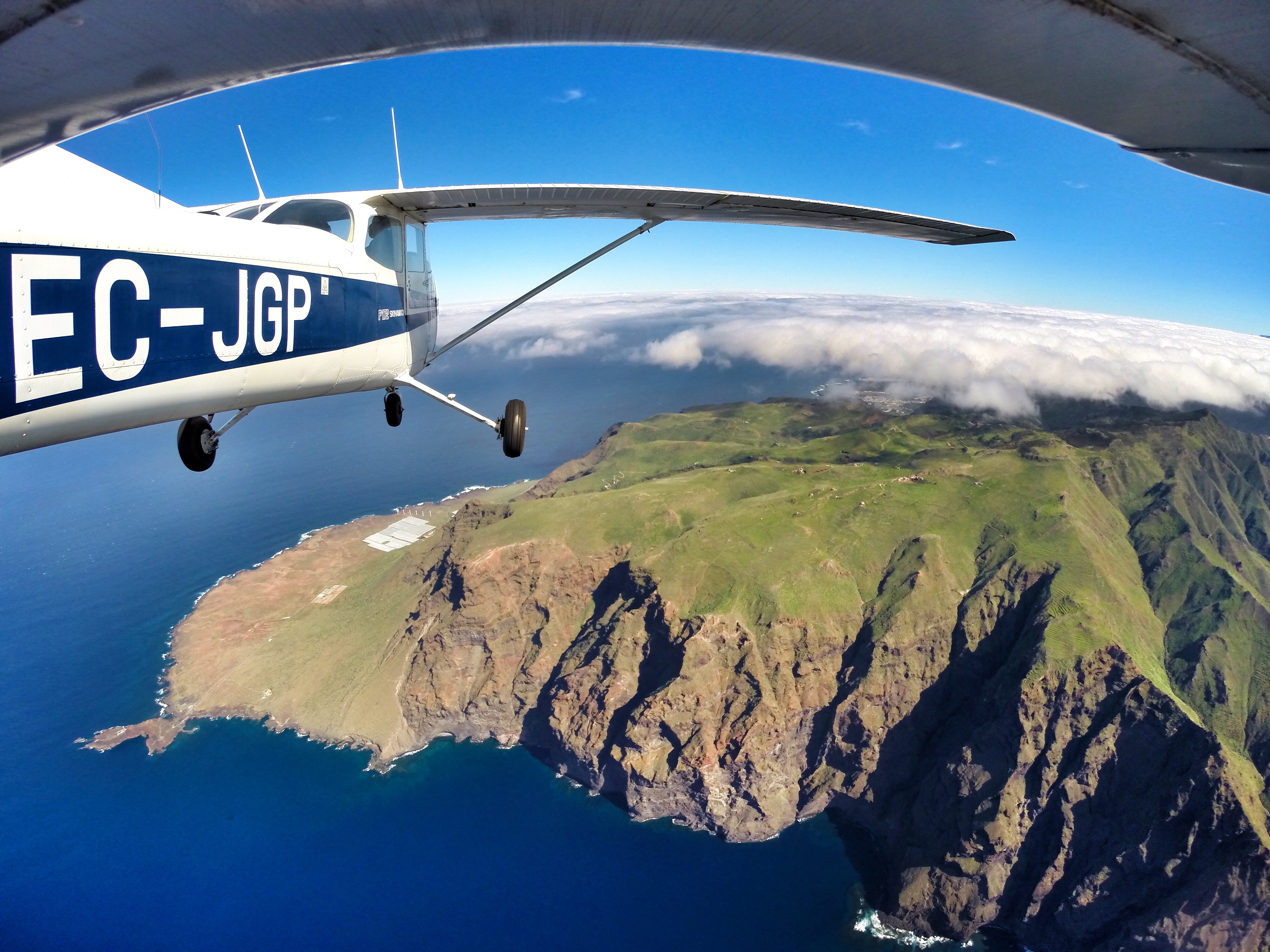
Punta Teno
Punta de Teno & Pico del Teide
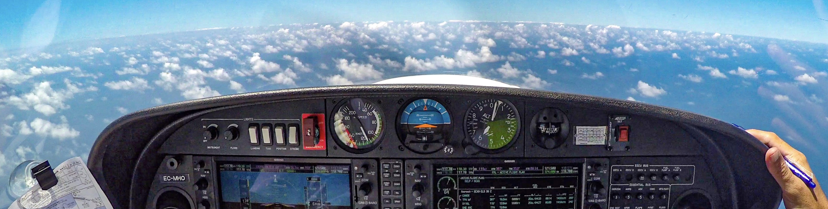
Sunshine above the clouds…
Enjoying the views.
Flying along the north coast of Tenerife
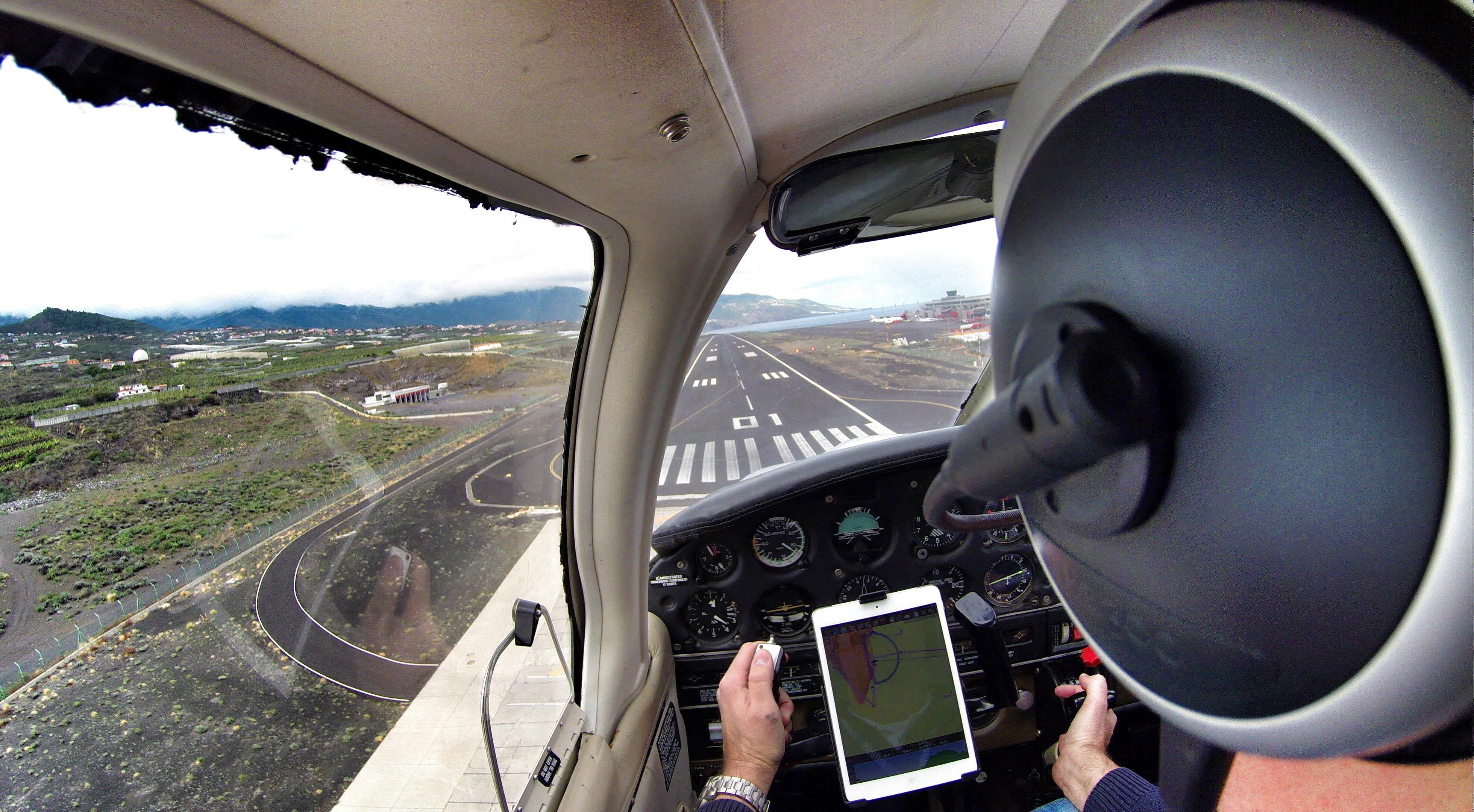
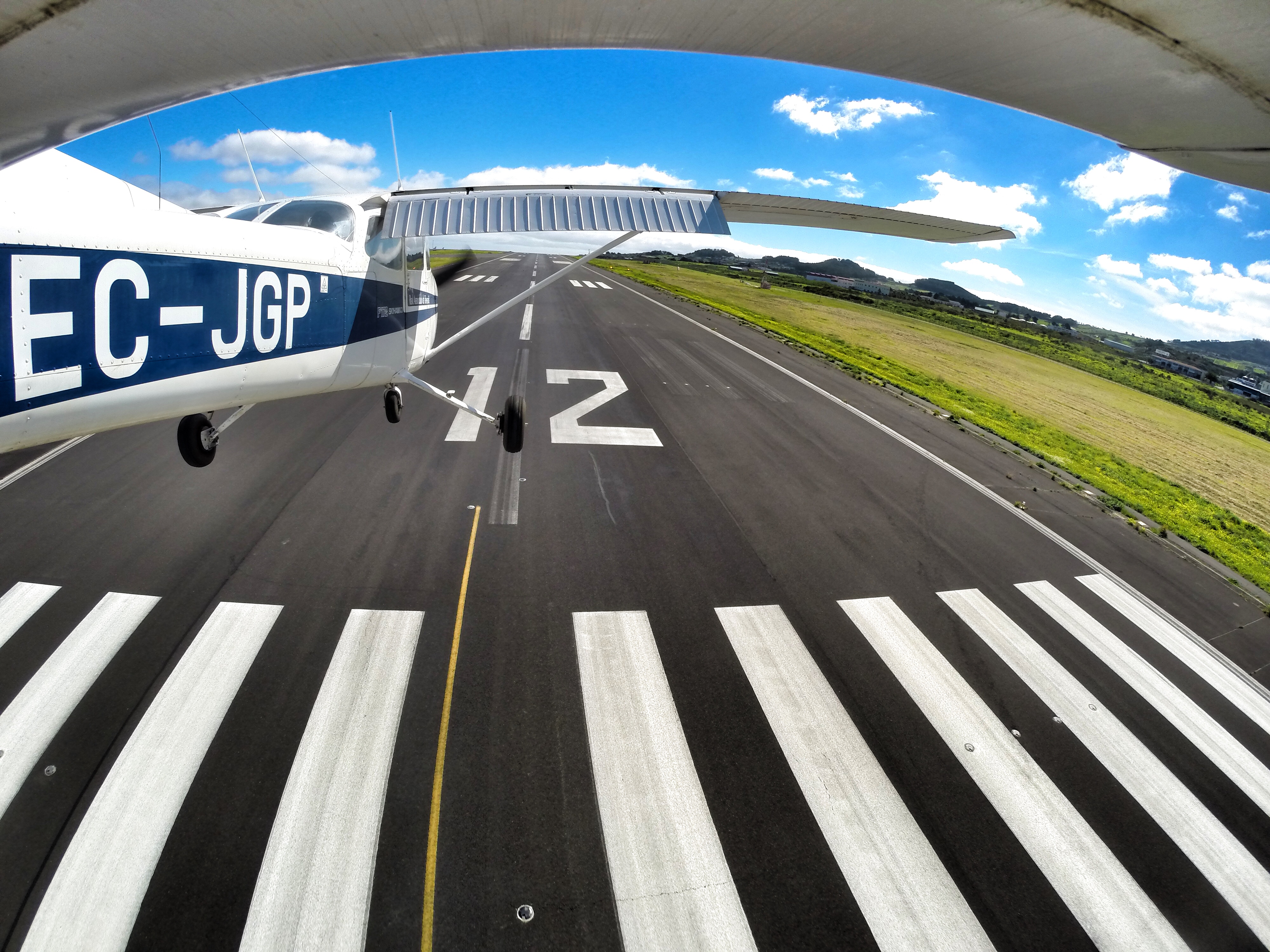
Moments before the landing at Tenerife North (TFN)
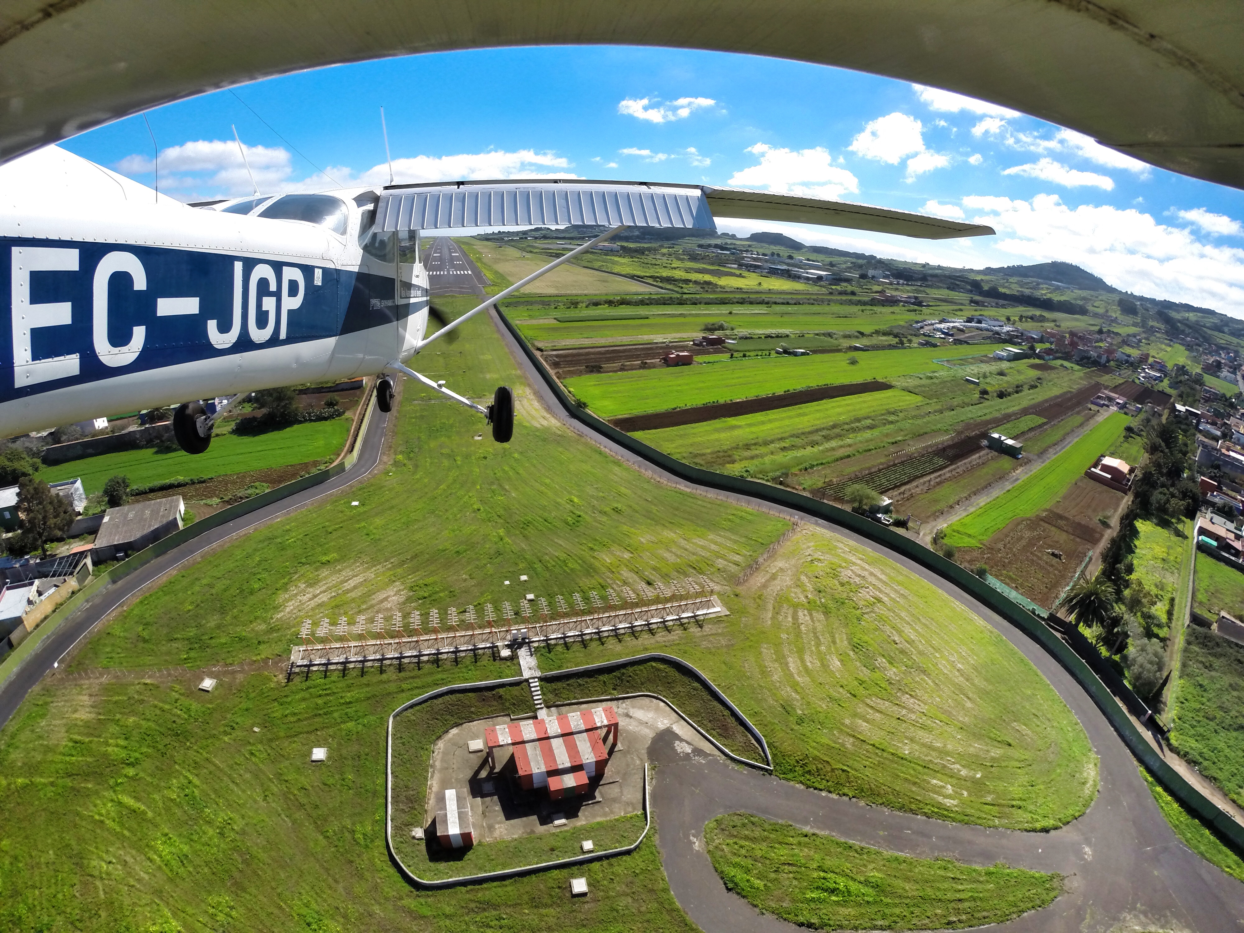
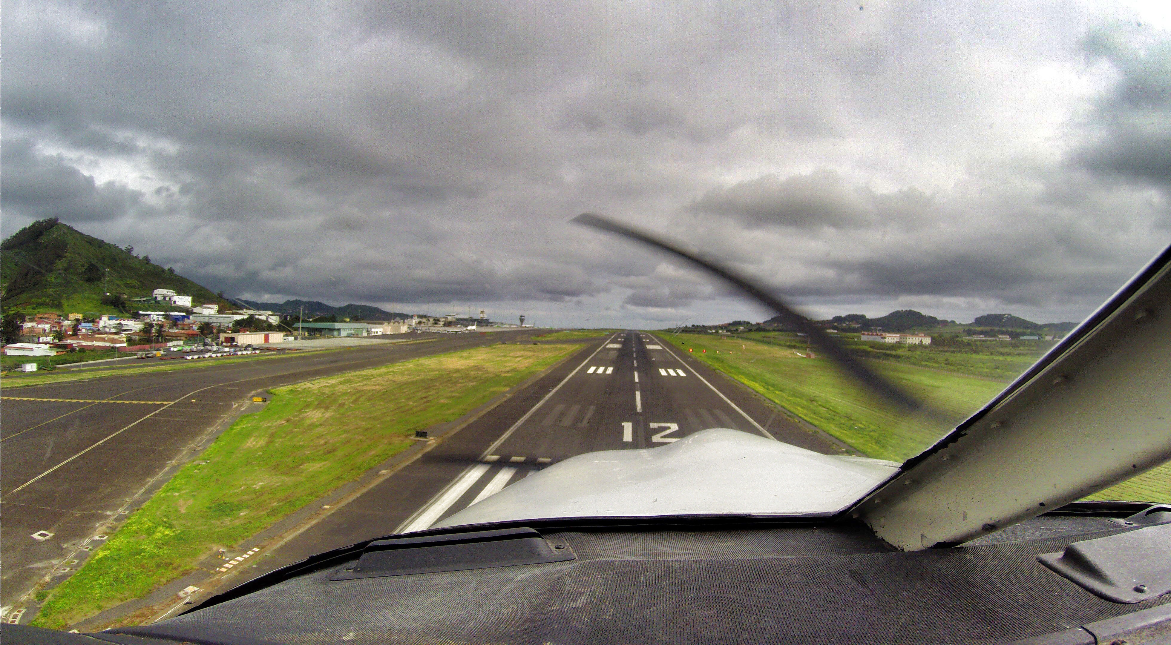
Recently I’ve made a flight with 2 friends spotters on the Piper from Tenerife North to La Palma and back.
As this was the first time for them on a small plane like this one, they were really enjoying the views from the cockpit and also from the co-pilot seat.
The weather was actually pretty good, almost no wind, no turbulence. Only some cloud layers between 3.000 – 8.000 feet. We were able to climb to get about them and wnjoy the views of the sea of clouds. It feels like to fly a big airliner…
The basic instrument training I´ve done was a great help to maintain the plane on the desired track when descending through the cloud layer. The basic thing is to look inside the cockpit on the instruments and trust your instruments and don’t look outside.
We did one touch and go at La Palma Mazo Airport (GCLA) and returned back to Tenerife North (GCXO). It was a great trip with great views in a great company!
Here I share with you some of the views and of course a short video as well.
Safe landings!
Above the sea of clouds cockpit view
Above the sea of clouds
North of La Palma
Los Llanos
About to touch and go at La Palma airport (GCLA)
Over the sea of clouds at 8.500 feet
About to land at my home airport GCXO (Tenerife North)
Yesterday I’ve made with some friends my first flight in 2015.
On the Canary islands, sometimes we have sand laden and dusty winds blowing from Sahara, also called “calima”. The visibility decreases, the temperature increases and the air is normaly very dry.
So we were flying in these “low visibility conditions”. I was hoping to climb a little bit to get over it, so we could see at least the highest peak with it’s almost 14.000 feet.
Our final cruise level was 9.000 feet and we started to see the blue sky a bit, but I have decided do decend, because it was not clear until which altitude the calima would persist.
So actually we were not able see almost nothing during our 50 minutes long flight. Even to spot the airport before landing was a bit challenge.
A very good help was my ipad with the Airnav Pro application, and also some skills learned during my basic instrument flight module course. It was the day to practice it, but today without the instructor.
I have to admit, that a further training will be good and have ordered a hood to keep practice. You will see in the video, that actually during this flight it was not necessary to wear it 😉