It’s been exactly 1 year since my last visit/flight to Madeira.
So on this occasion I’ve Installed my GoPro on the dashboard to see if it’ll shoot for me some nice images on our arrival. And yes!!! Passed through a light rain and got a nice welcome with a rainbow.
I was glad to be able to immortalize this moment and see it back over and over again.
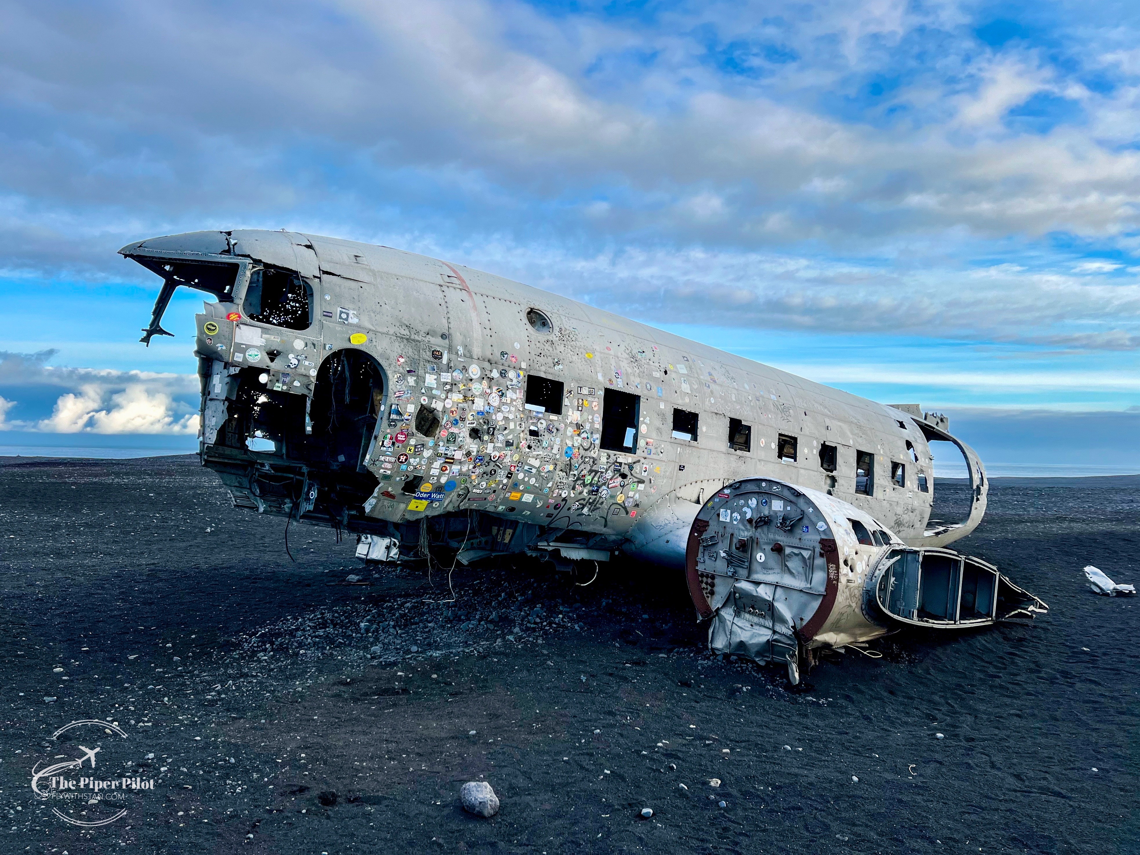
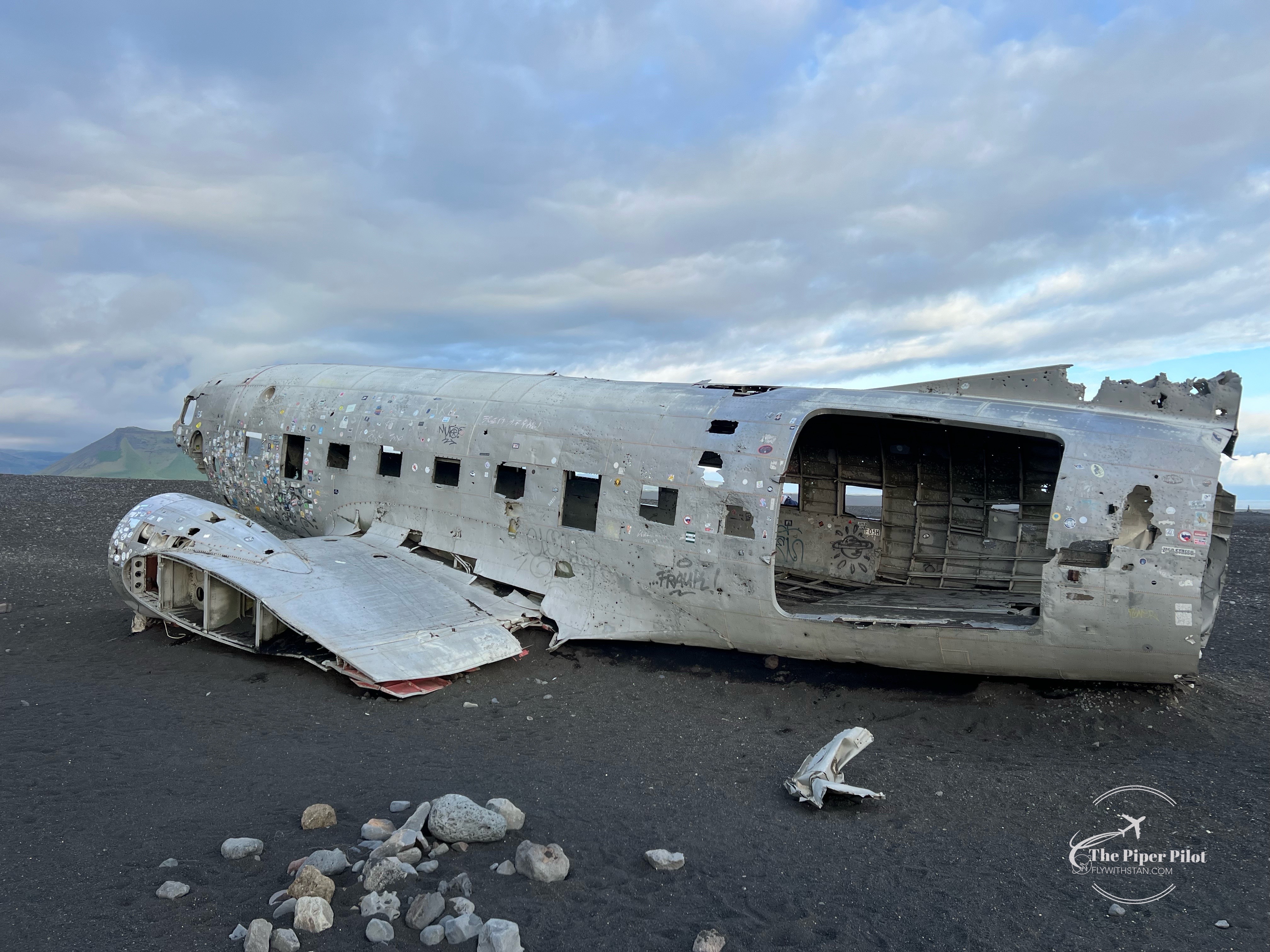
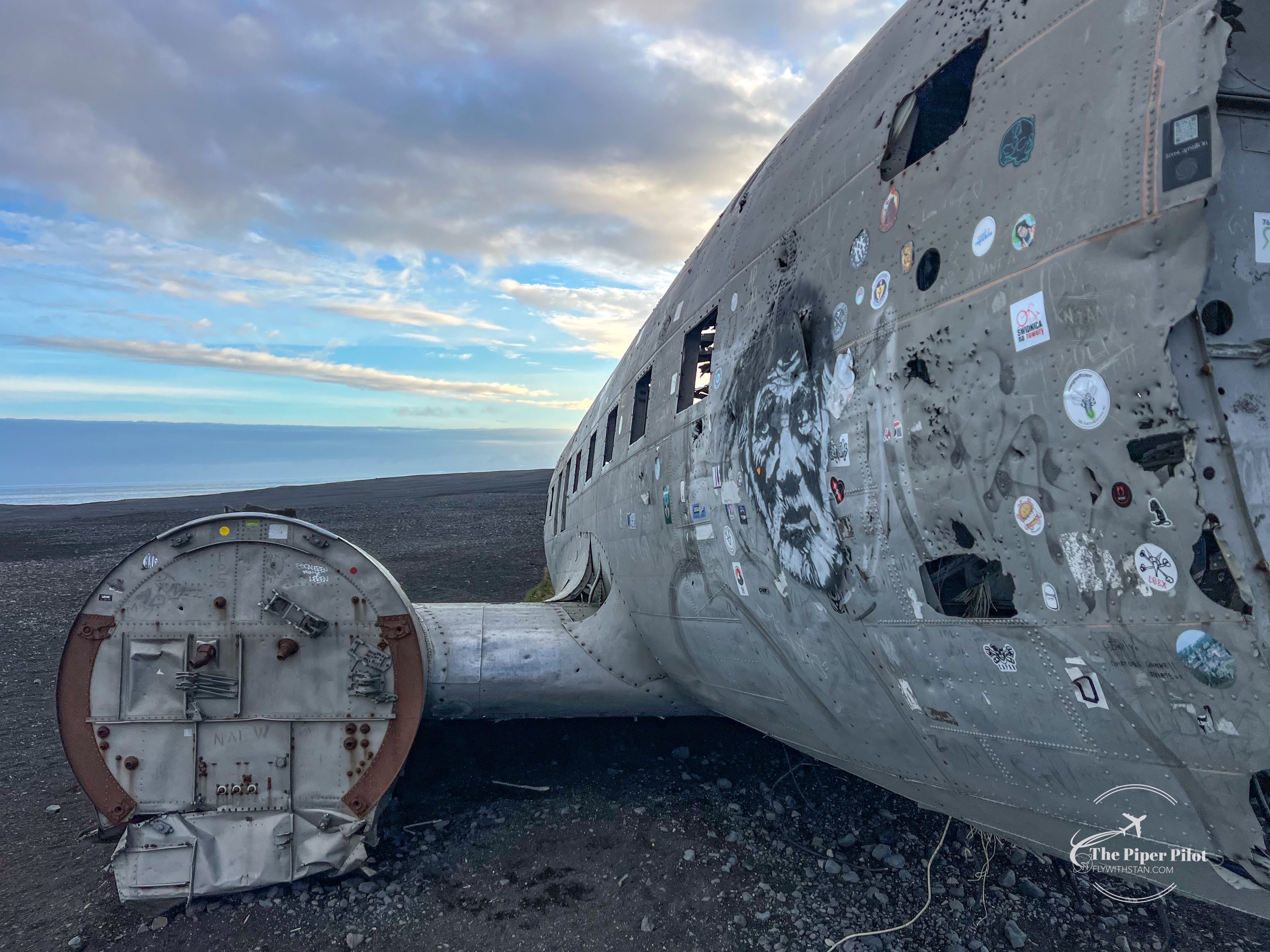
The visit of this place was something that has been on my bucket list for a long time; since I saw a photograph of the wreckage I got impressed by it so much that I’ve putted it on my bucket list.
Having waited patiently until the stars have aligned, the moment that I could make this journey happen has finally arrived.
DC3 Wreckage at Sólheimasandur, Island
So let’s tell the story…
Douglas R4D-8 (based on Super DC-3) was an US Navy transport plane delivering supplies.
Apparently en route the plane encountered severe icing and the crew were not able to maintain altitude. A forced landing was carried out on ice covered river on near coast of Iceland.
The ice broke but the plane did not sink. There were no fatalities. Source: Aviation Safety Network
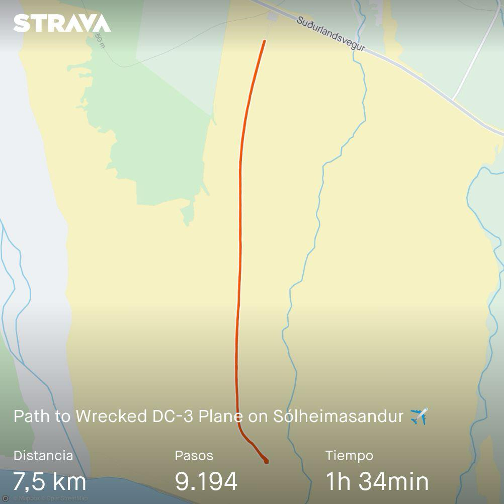
Getting to the wreckage is easy.
There is a parking spot right next to the main road (online parking fee applies).
Path to the DC3-Wreckage at Sólheimasandur via Strava
From there you can either walk approximately 4 kms to the site following the only path, or take a shuttle (please check the schedule). The walk to the plane takes approximately 1 hour depending on your rhythm (we made it in a bit less than 50 minutes) and needed the same time back.
Path to the DC3-Wreckage at Sólheimasandur
Obviously there are far more impressive images of the plane available on the internet than mine: night shots, with the northern lights, in the snow…
But I’ll just stick to those I’ve made now on this occasion being happy to have fulfilled one of my things from my bucket list.
Enjoy the images and safe landings 😊
DC3 Wreckage at Sólheimasandur, IslandDC3 Wreckage at Sólheimasandur, IslandDC3 Wreckage at Sólheimasandur, IslandDC3 Wreckage at Sólheimasandur, IslandDC3 Wreckage at Sólheimasandur, IslandDC3 Wreckage at Sólheimasandur, IslandDC3 Wreckage at Sólheimasandur, IslandDC3 Wreckage at Sólheimasandur, IslandDC3 Wreckage at Sólheimasandur, IslandDC3 Wreckage at Sólheimasandur, IslandDC3 Wreckage at Sólheimasandur, Island
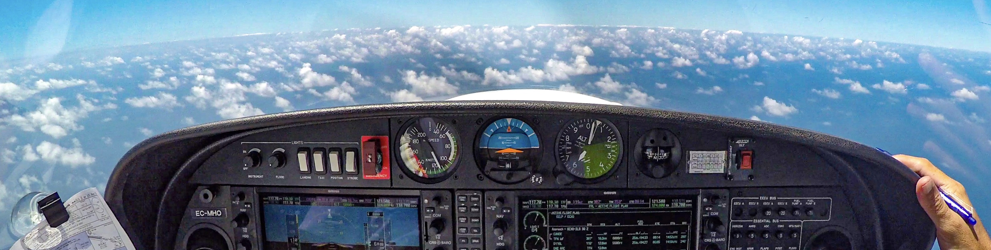
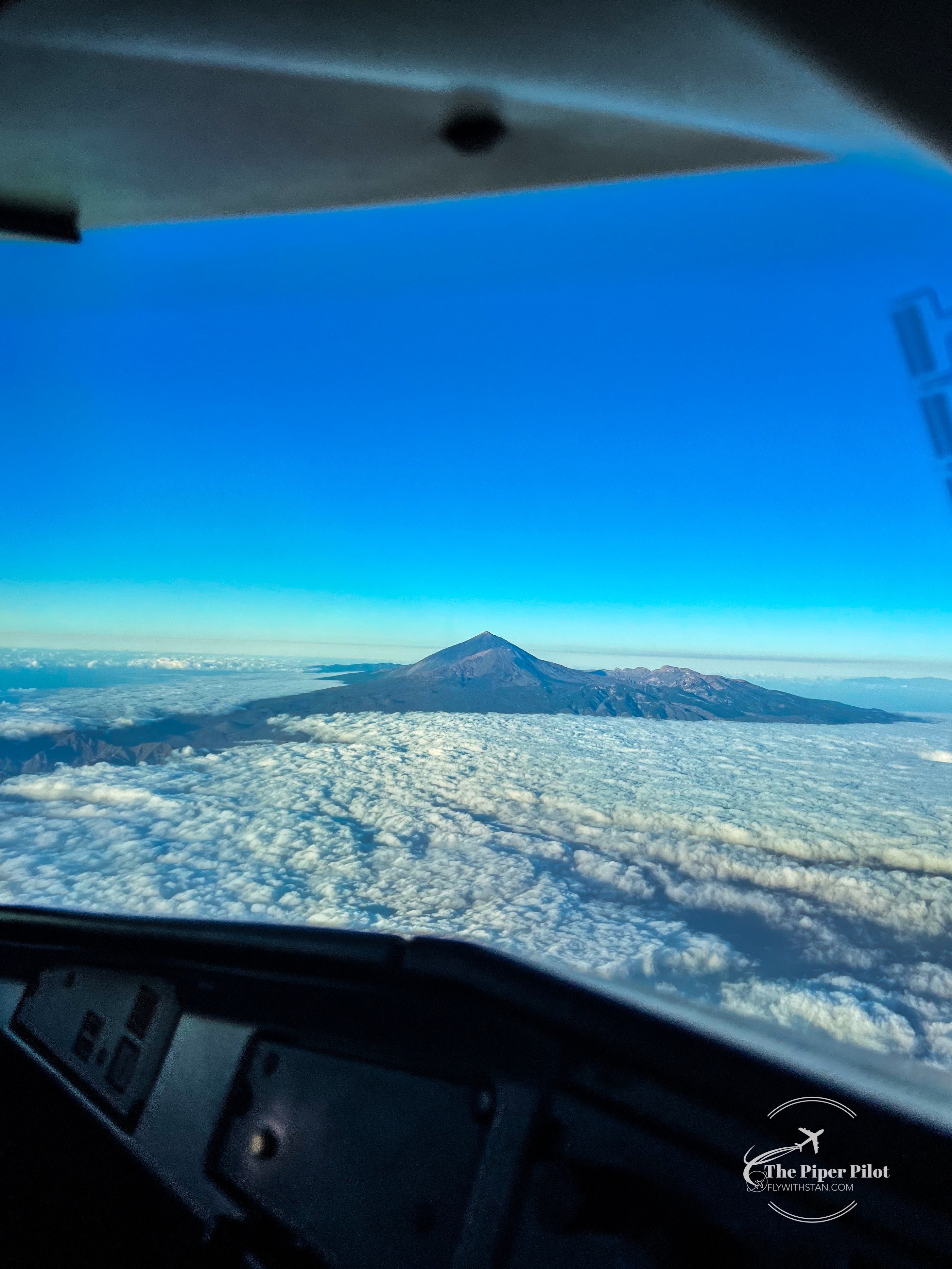
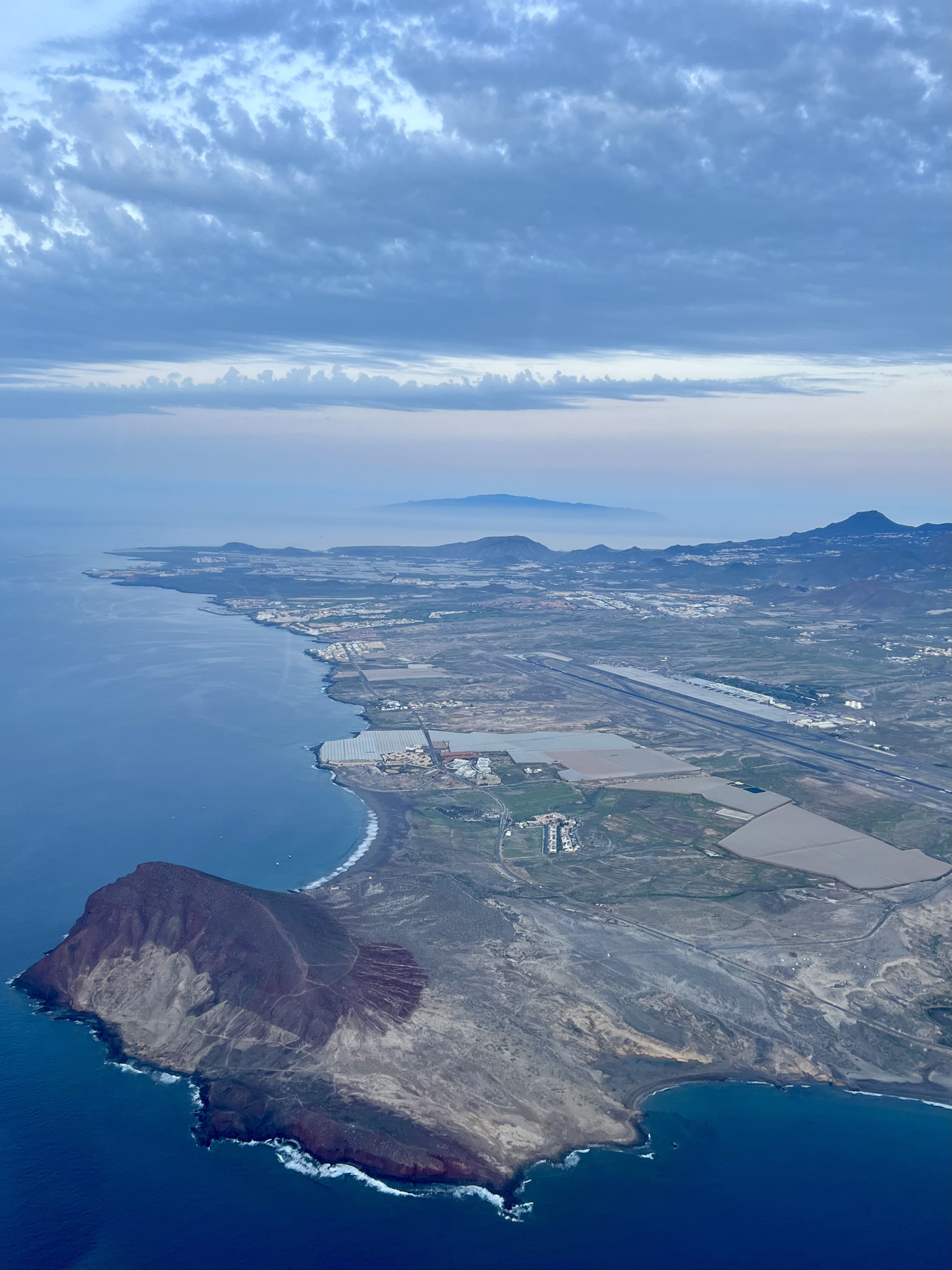
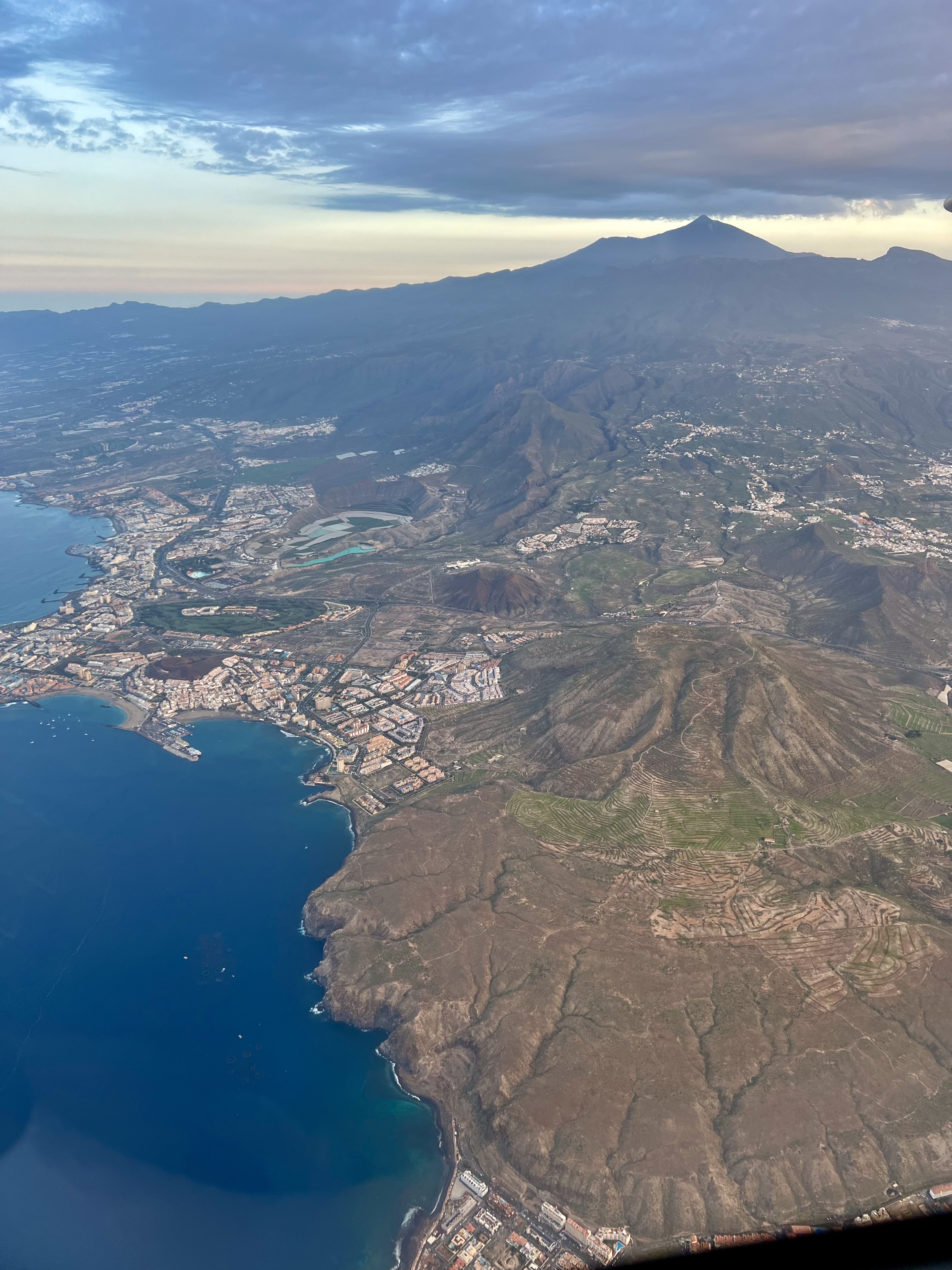
Pico del Teide, the highest peak in the Atlantic Ocean (above the sea level), with it’s 12.190 feet or 3.715m, surrounded by the sea of clouds, greets us on our arrival into Tenerife south airport 😁⛰️🛬
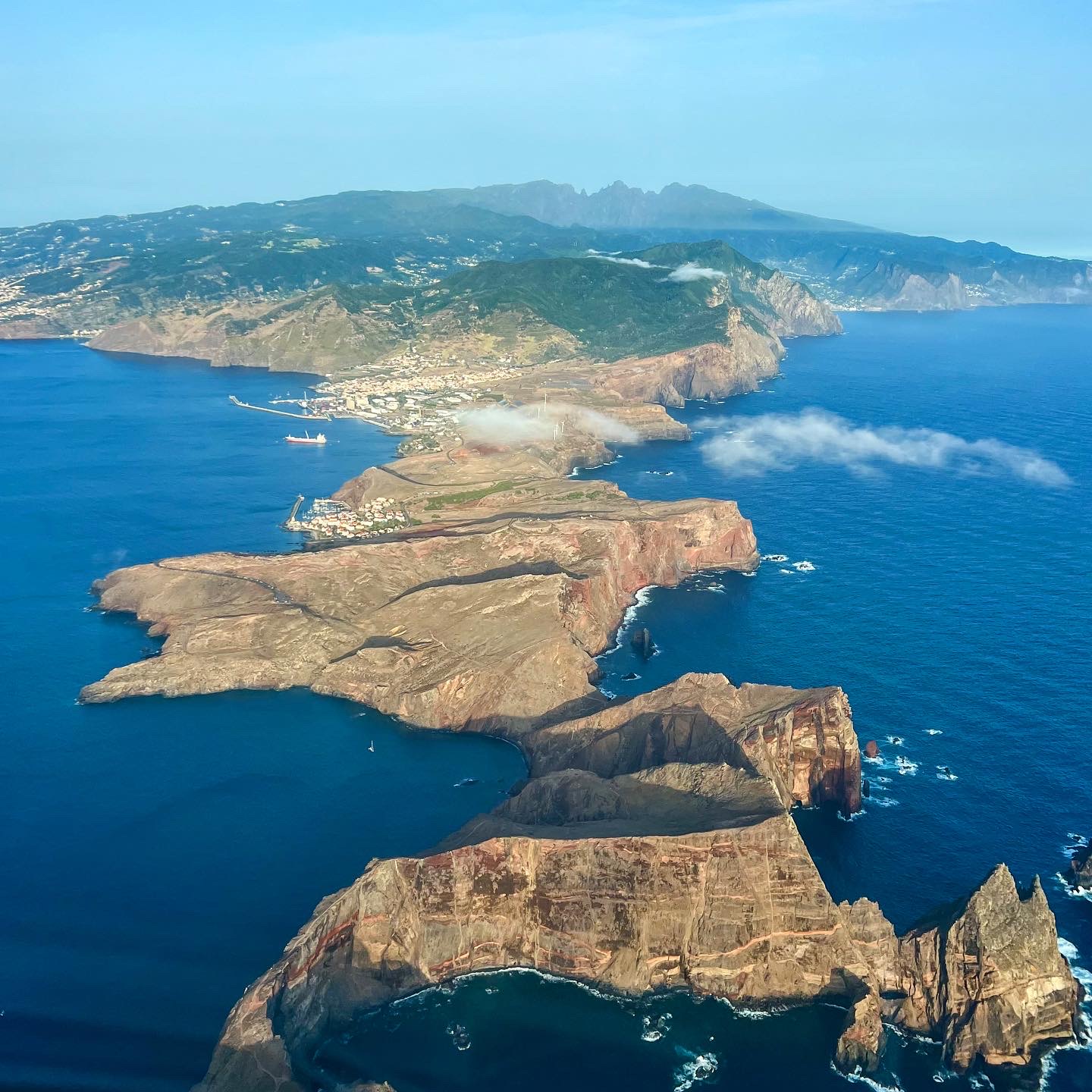
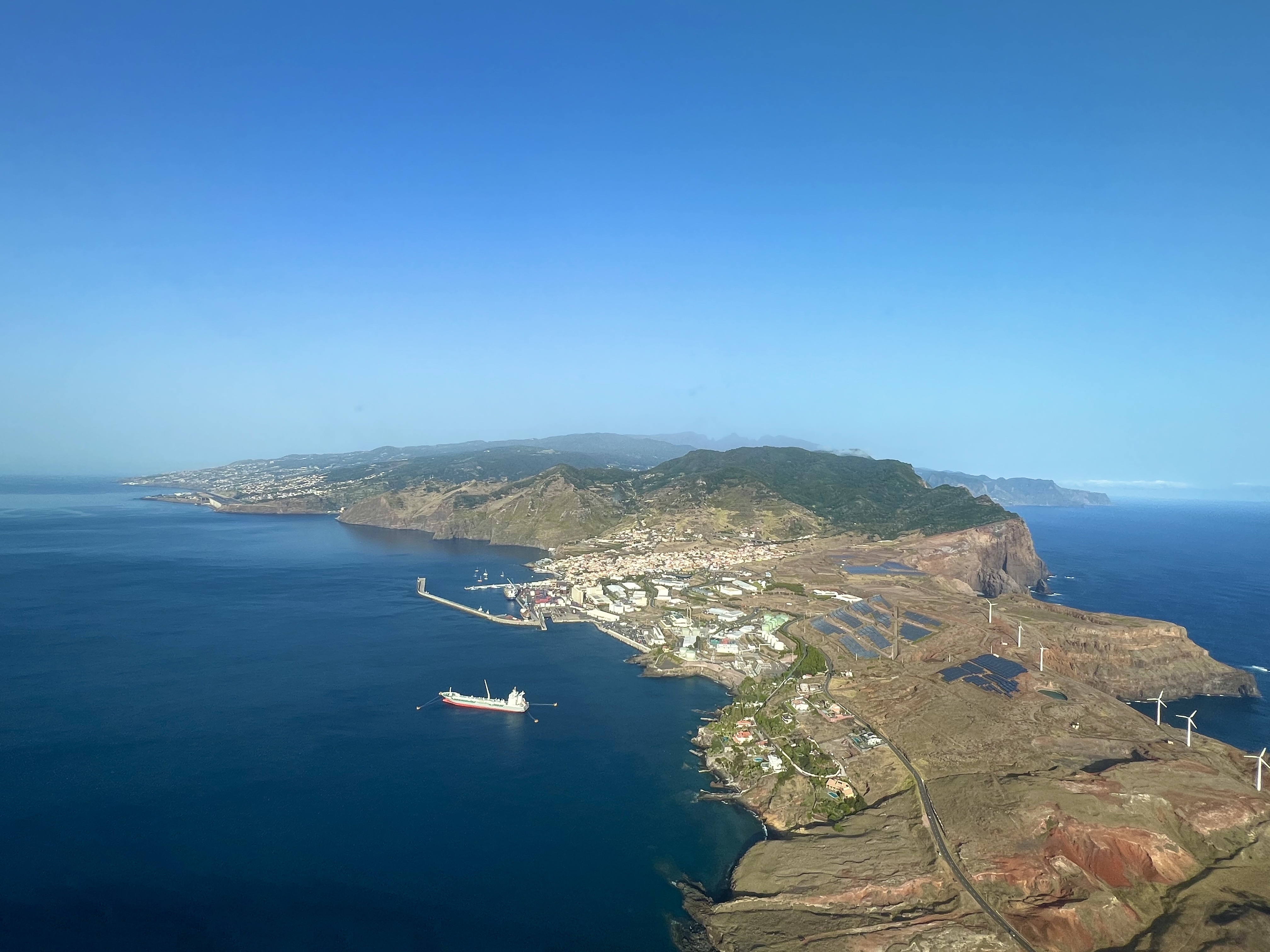
In the background to the right, Gran Canaria can be seen as well.
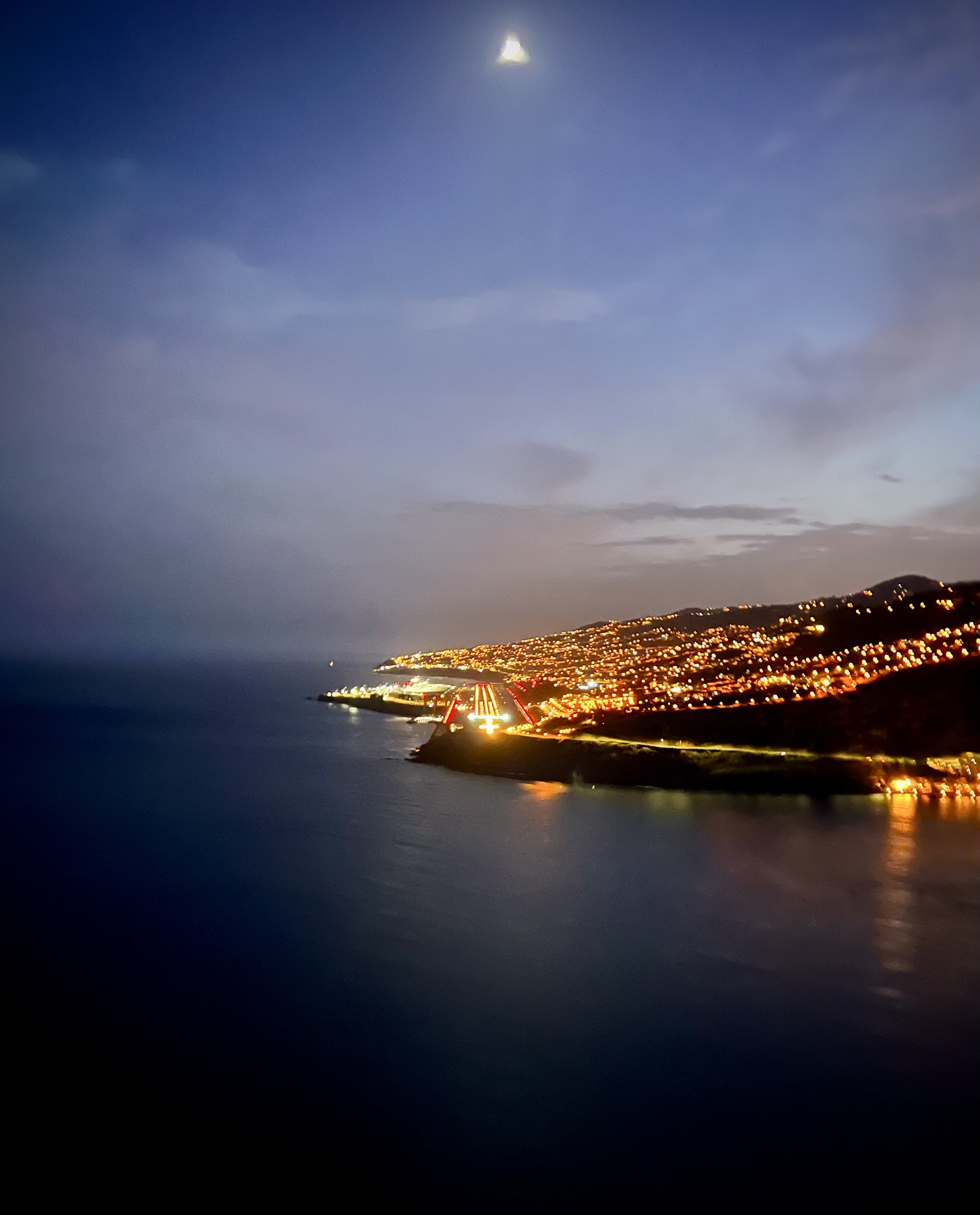
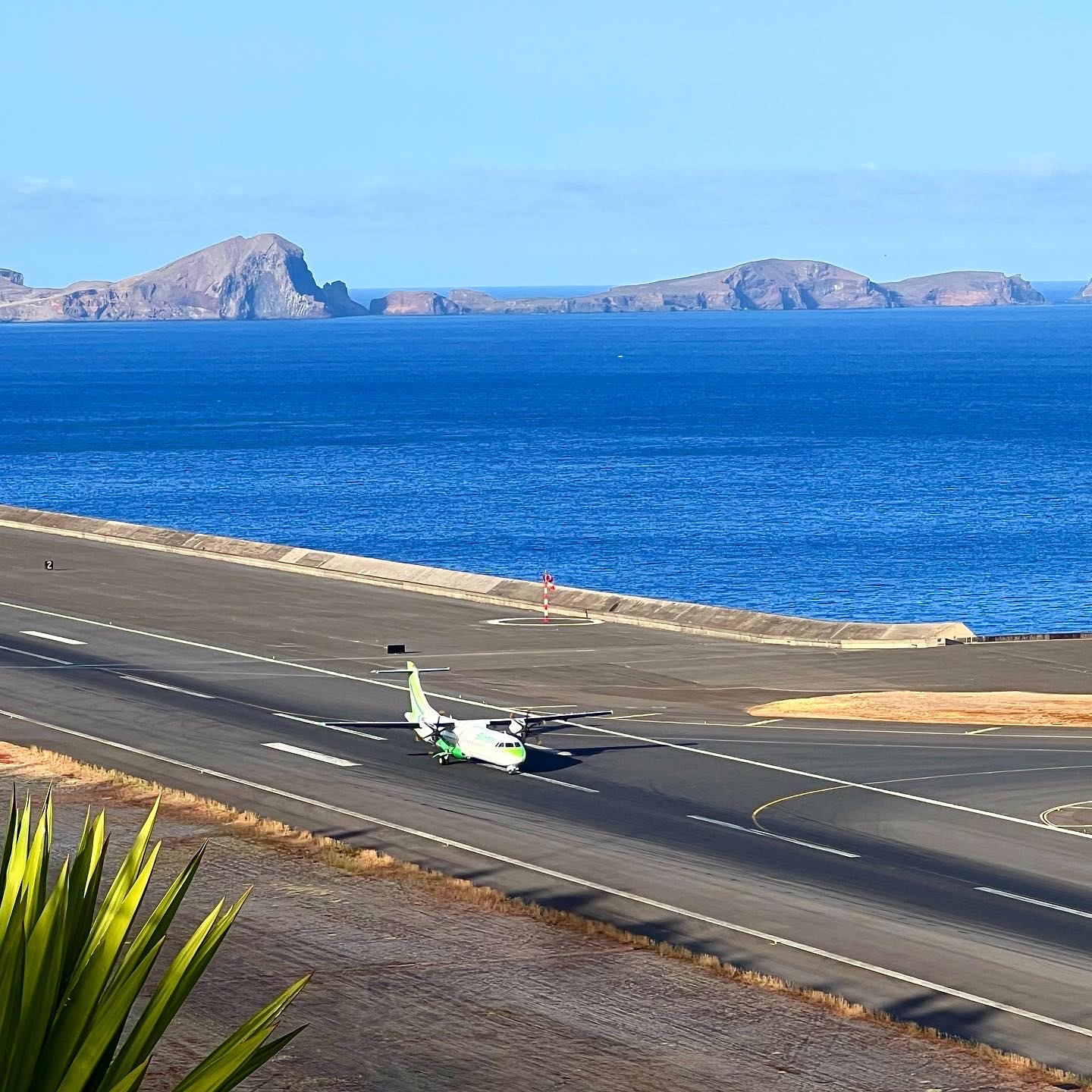
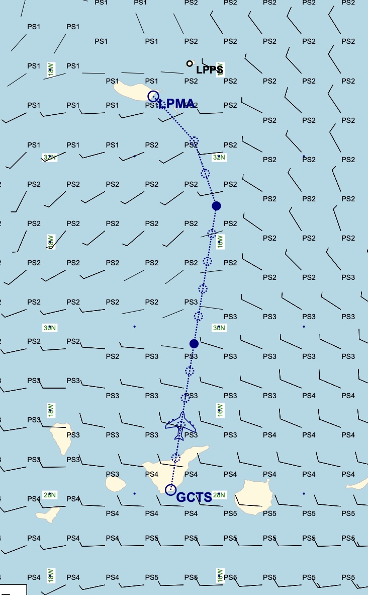
Finally got the chance to do a flight from Tenerife south to Madeira airport. The distance is approximately 280NM and the flight time on the ATR72 is around 1:30-1:45 minutes depending on the winds and traffic at Madeira (and also Tenerife south airport).
Madeira airport is very famous for its complicated approach; specially on a windy a stormy days. Captain landing only, and several other requirements by the local aviation authorities.
On this flight the winds were calm, which helped to make the flight more enjoyable and comfortable specially fot the passengers.
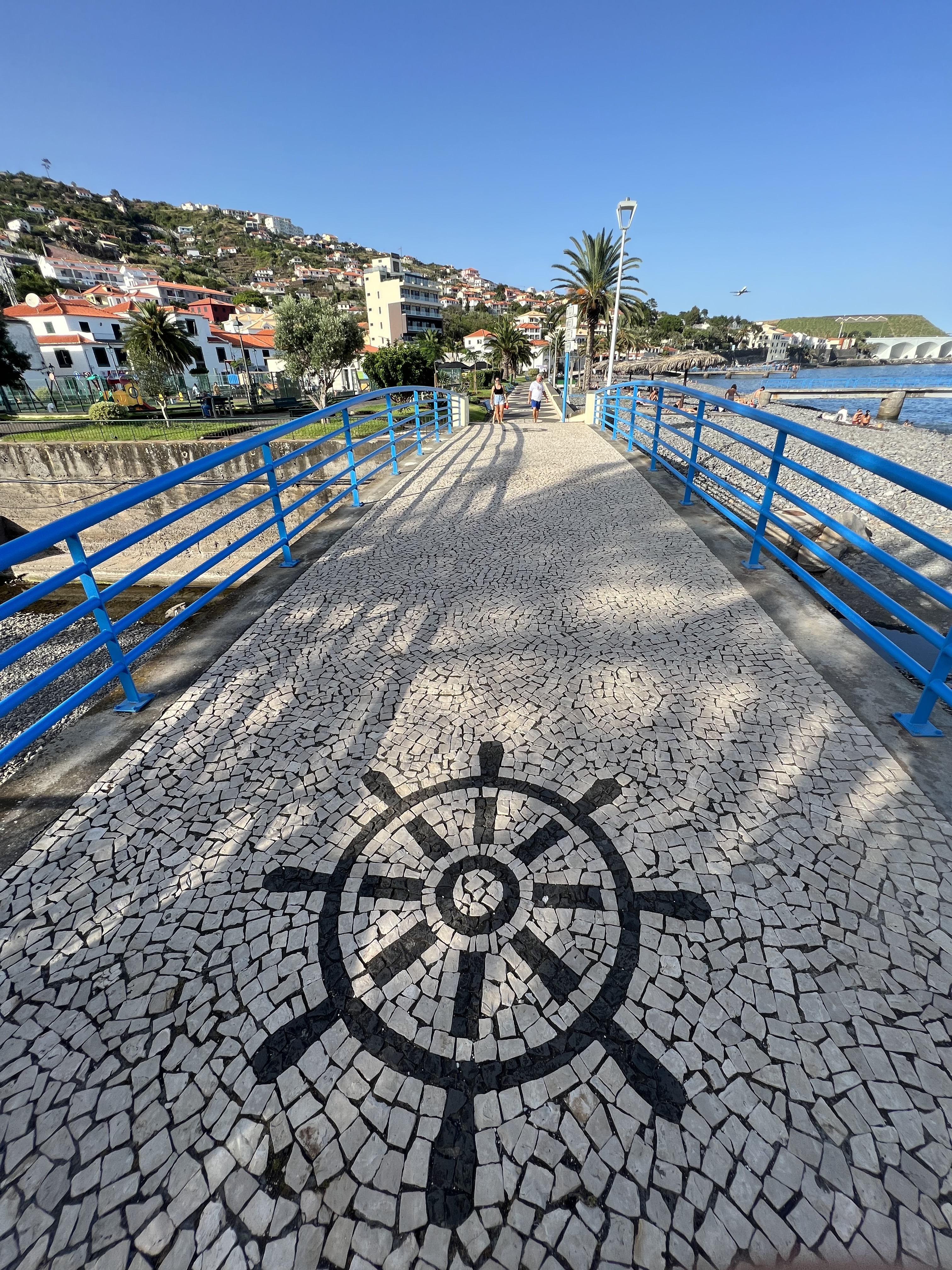
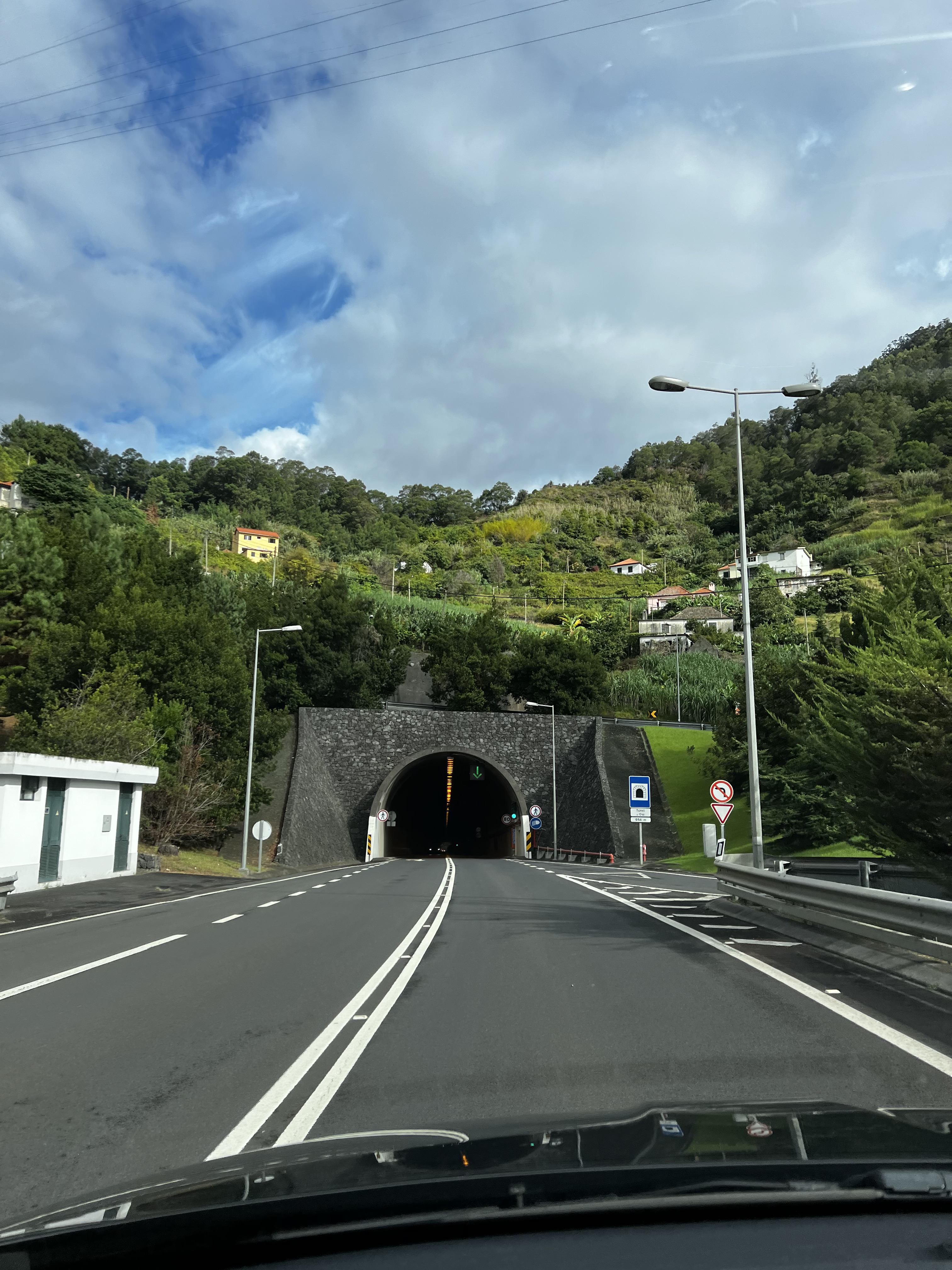
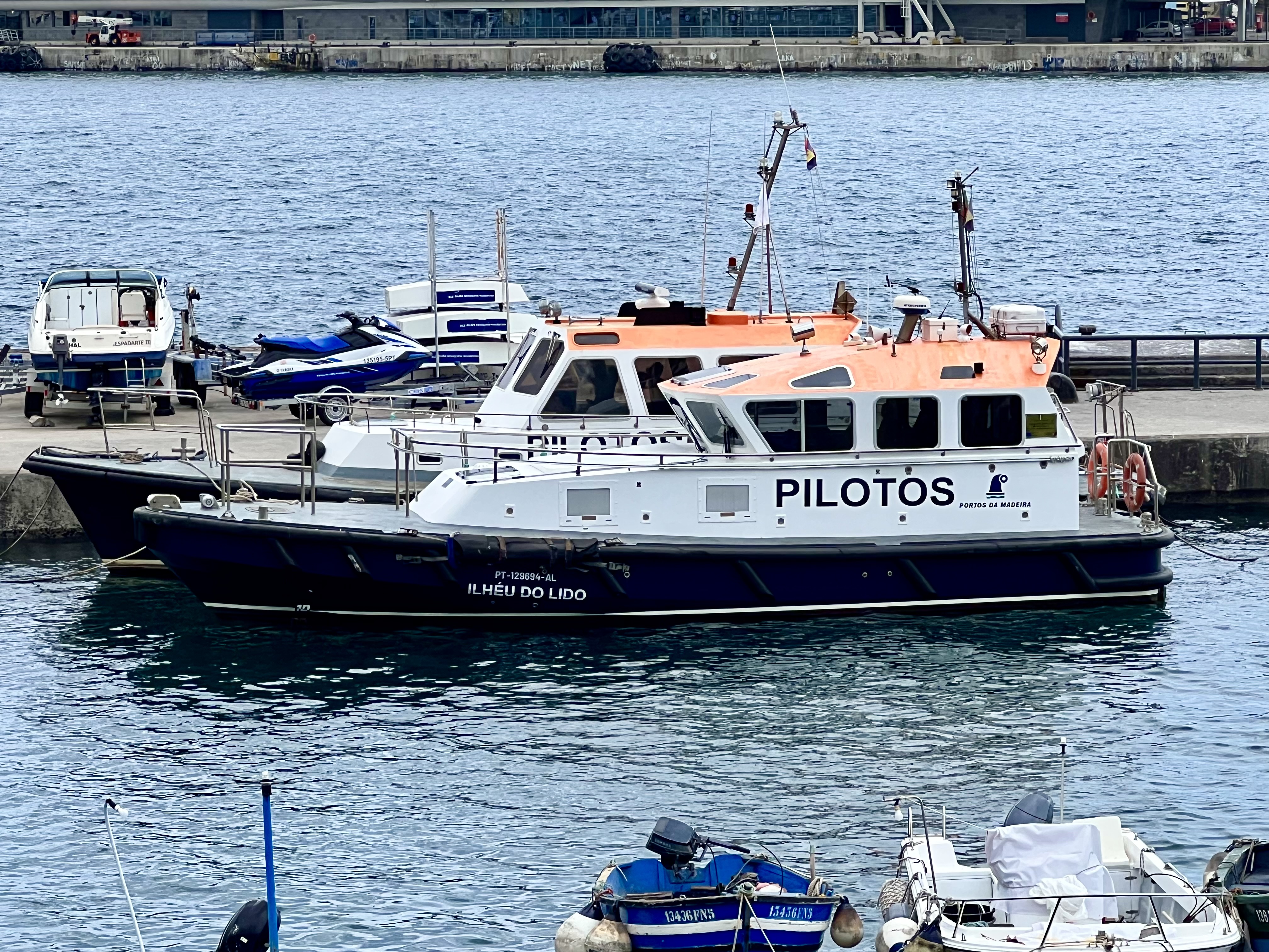
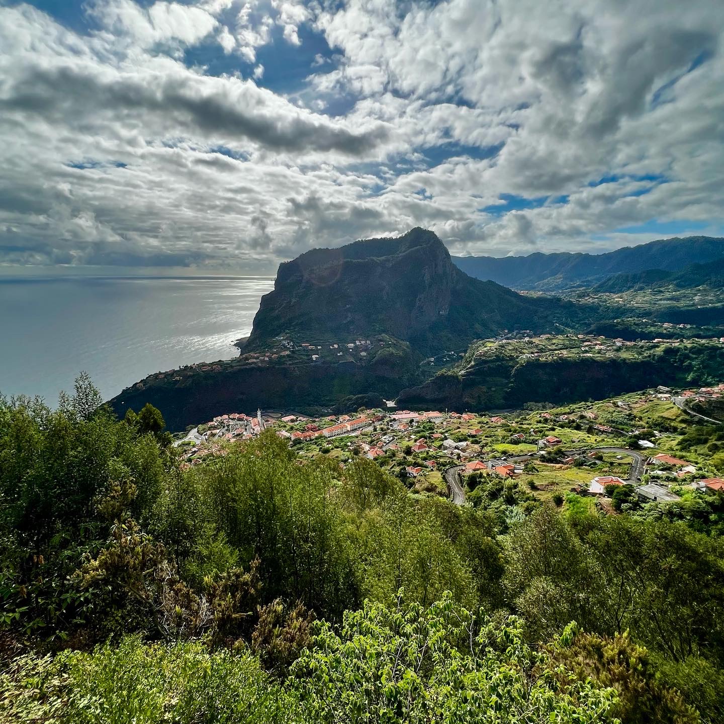
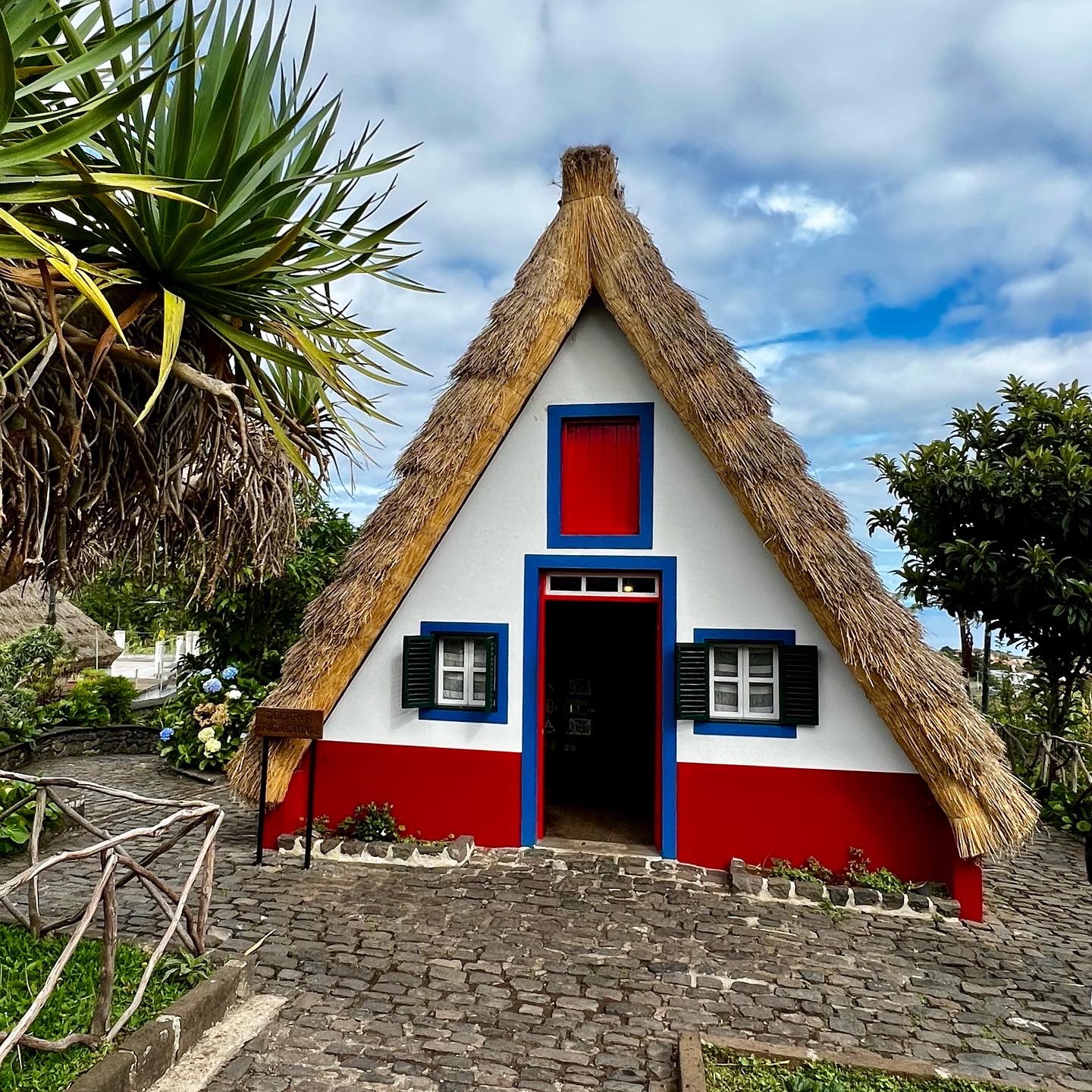
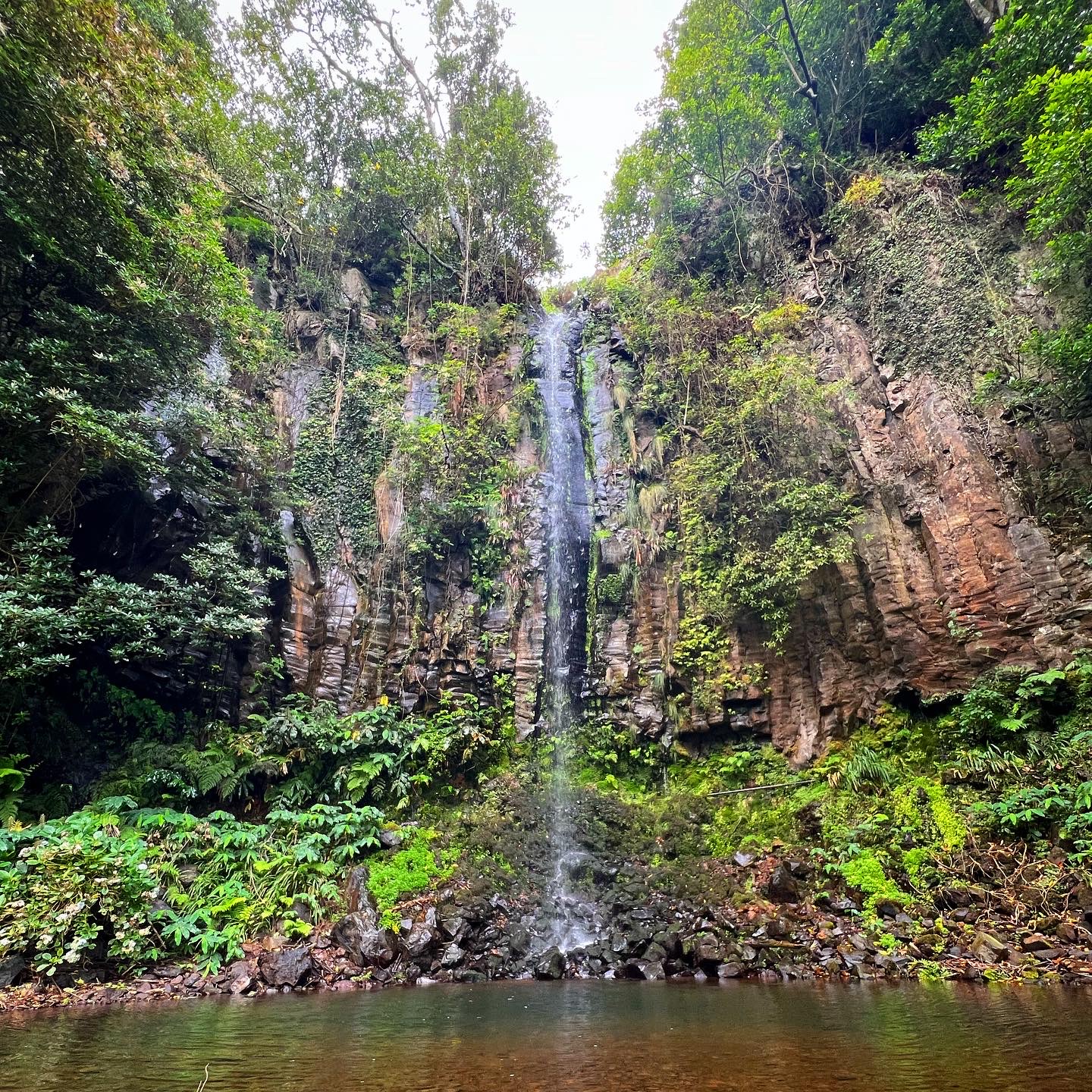
As I have spent some days on the island, I had the chance to rent a car a to drive a little bit around.
The nature is beautiful, green, lots of waterfalls, water running everywhere. Friendly people, good food. I’ll be definitely back (soon)!
Here are some (not only aerial) mages from Madeira.
Safe flights!
Madeira airportNight approach to Runway 23 at Madeira airportMadeira Airport (LPMA/FNC)A bit of Madeira spottingSupporting pillars under the airport runway extensionRoute Tenerife South-Madeira Arriving at MadeiraKeep “FUN” to the leftPonta de São LourençoCaniçal Room with a view: Threshold Runway 05Santa CruzFull moon in MadeiraThe island has a huge amount of tunnels Driving up to Santana via the old roads…When the pilots rent a boat… lol Countryside around SantanaFaial/Penha d’ÁguiaSantana Traditional Houses Waterfall Água d’AltoSkywalk Cabo GIrâoIlhas Selvagens
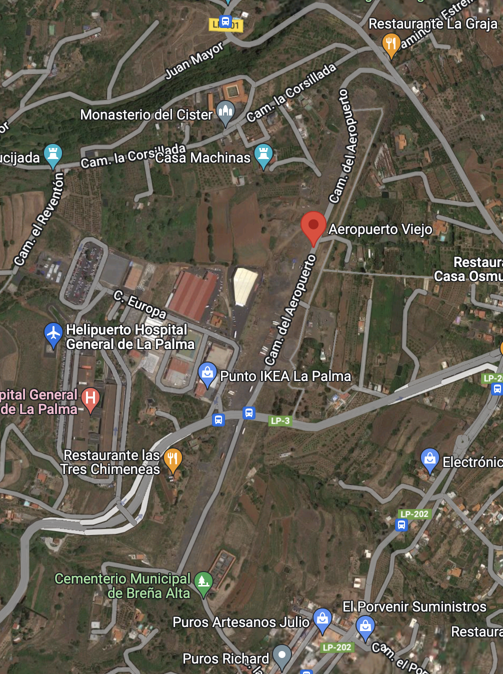
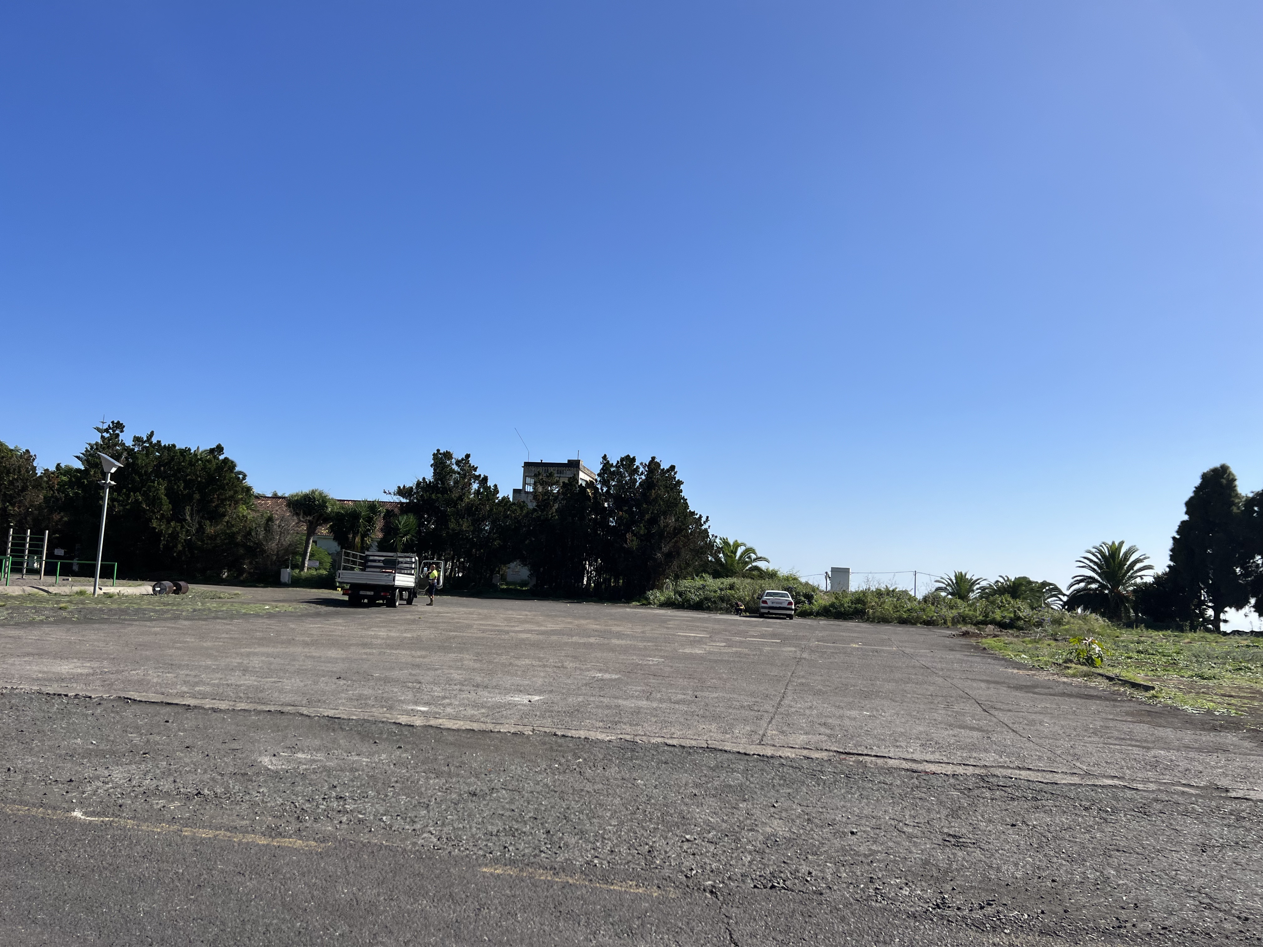
After visiting the closed aerodrome “El Revolcadero” at La Gomera, I did mention that my next stop will be at Breña Alta, to explore the former La Palma’s aerodrome.
So here it comes. Unfortunately there is not much to see around. A road is passing on the former runway and the terminal building and the tower are not accesible.
Aeropuerto Viejo “Breña Alta”, La Palma
The elevation of the aerodrome is 1.3700 feet and is surrounded by mountainous terrain, which I think was the cause why the aerodrome was closed. When clouds start to form, visual approach into this airport could become pretty complicated or maybe impossible.
The aerodrome was opened in 1955 and served until 1970. Initaly I didn´t have any relative information about the runway length, nor designation; but thanks to Claudio Sánchez added on Twitter some value information and now we know that the runway designators were 03-21.
The former tower
The Tower building looks to be still in a pretty good shape, considering it was closed for more than 50 years. Unfortunately the access was blocked, so it’s not possible to climb up to enjoy the “old airport” views.
The old terminal building at Breña Alta
The terminal building doesn´t look that bad either. But again, it’s not accesible. All doors and windows have been blocked.
Threshold of the former runway 03 at Breña Alta airport
And how about the runway? Well, on Google Maps you can clearly see that once there was a runway, now a road is passing on it.
Tried to measure the length of the runway on my Foreflight App and i’m getting a bit less than 1km of runway. As I don’t know where it exactly started and finished, it’s difficult to say how long it exactly was.
The length of the runway as measured on the Foreflight appAeropuerto Viejo “Breña Alta”, La PalmaThere is a road now on the former runwayOn the former runway at Breña Alta
At least you can drive on the runway. Should have paid attention to the distance the car would have measured to know the exact length. And I think I did it, but forgot the note it somewhere…
Looks like the old apron with the former tower in the bushes
And this image looks like the apron just in front of the tower and terminal building.
Well, that’s it folks! A piece of history, pity they didn’t make anything special of it. But it seems there were a lot’s of problems with the ground and properties. But this would be something for a “non aeronautical post”, which is not the subject of my blog.
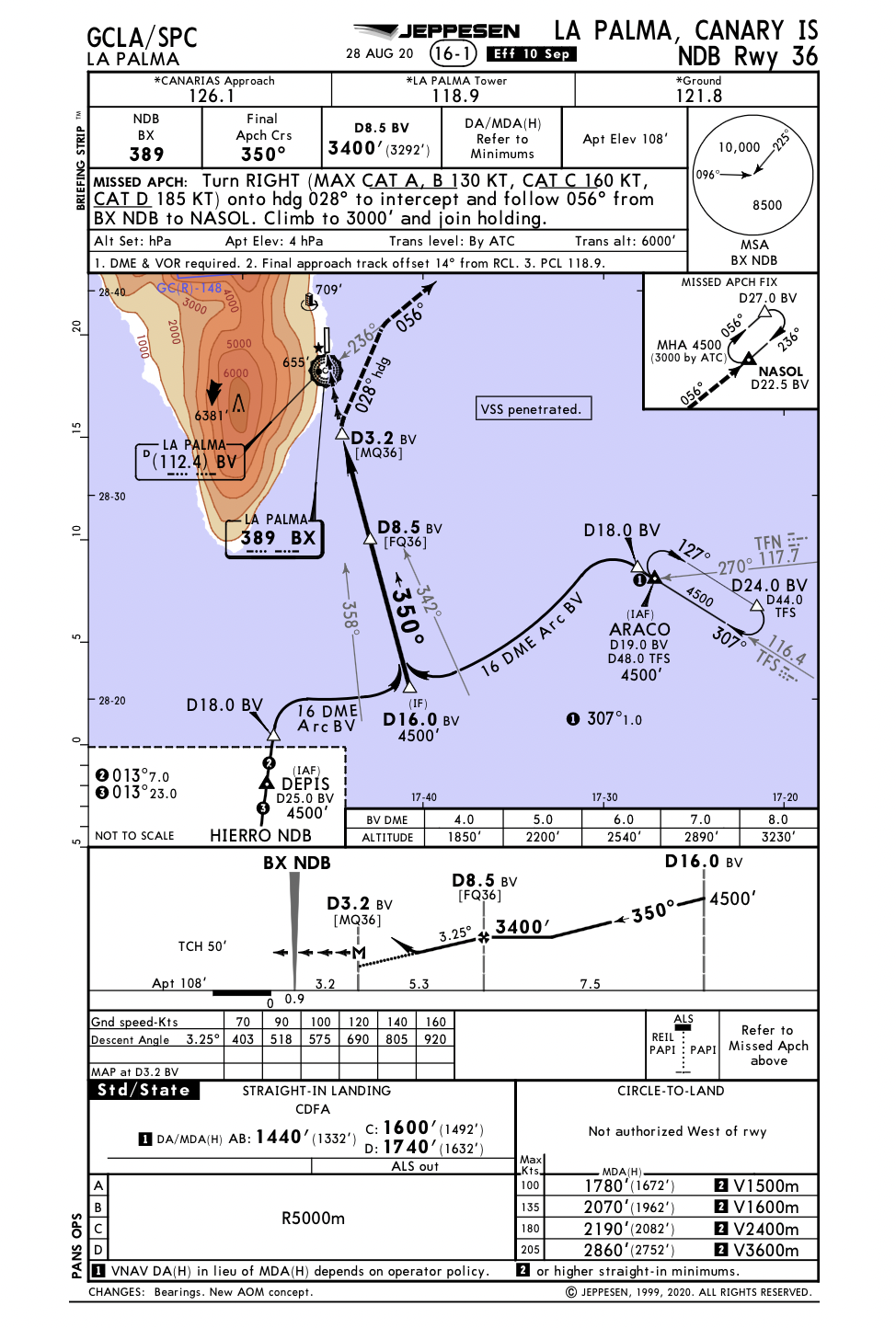
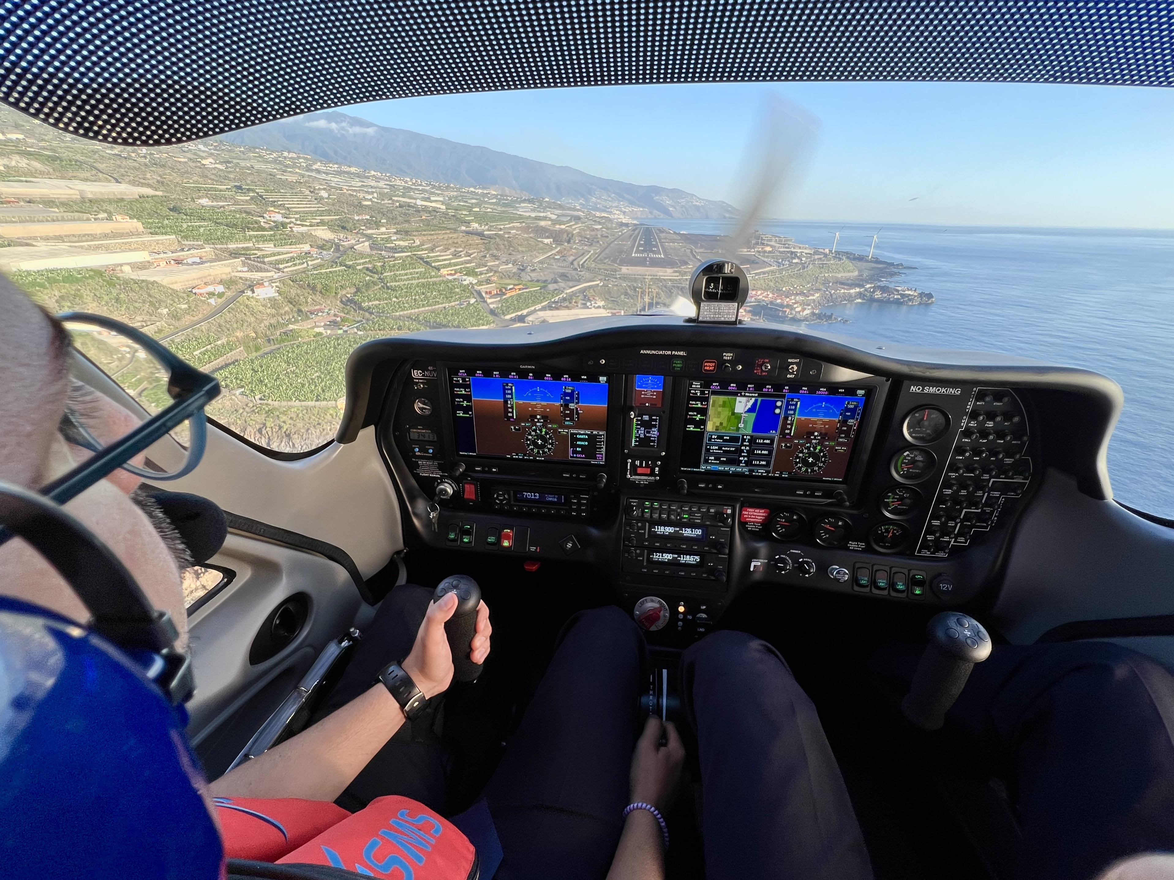
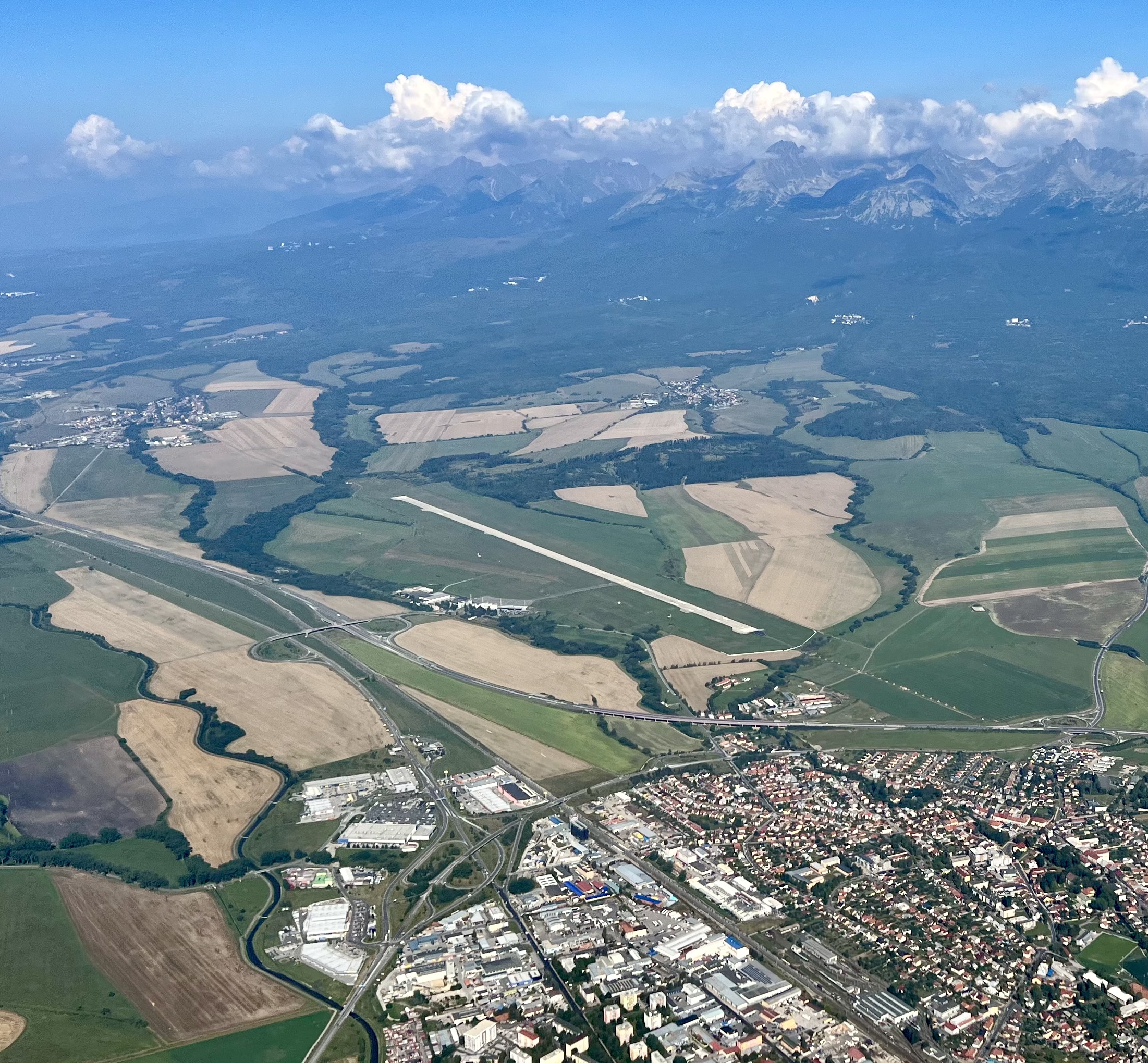
Yesterday the weather was fantastic and we took of early from Tenerife south airport on our training flight toward the island La Palma. As there was not much traffic, we decided to practice with the student the SID (standard instrumental departure) and the arrival into La Palma.
Even though that we operate under visual flight rules, we can request simulated instrument departure or arrival and simulate it under VMC. We briefed the procedures with my student and requested the simulation.
We did the Araco 4E departure followed by the NDB36 into La Palma airport as you can see on the image from Flightradar24. It was a very good practice. After we took off from La Palma again, we flew around the island and enjoyed some spectacular views of the landscape.
Enjoy some more images from the journey.
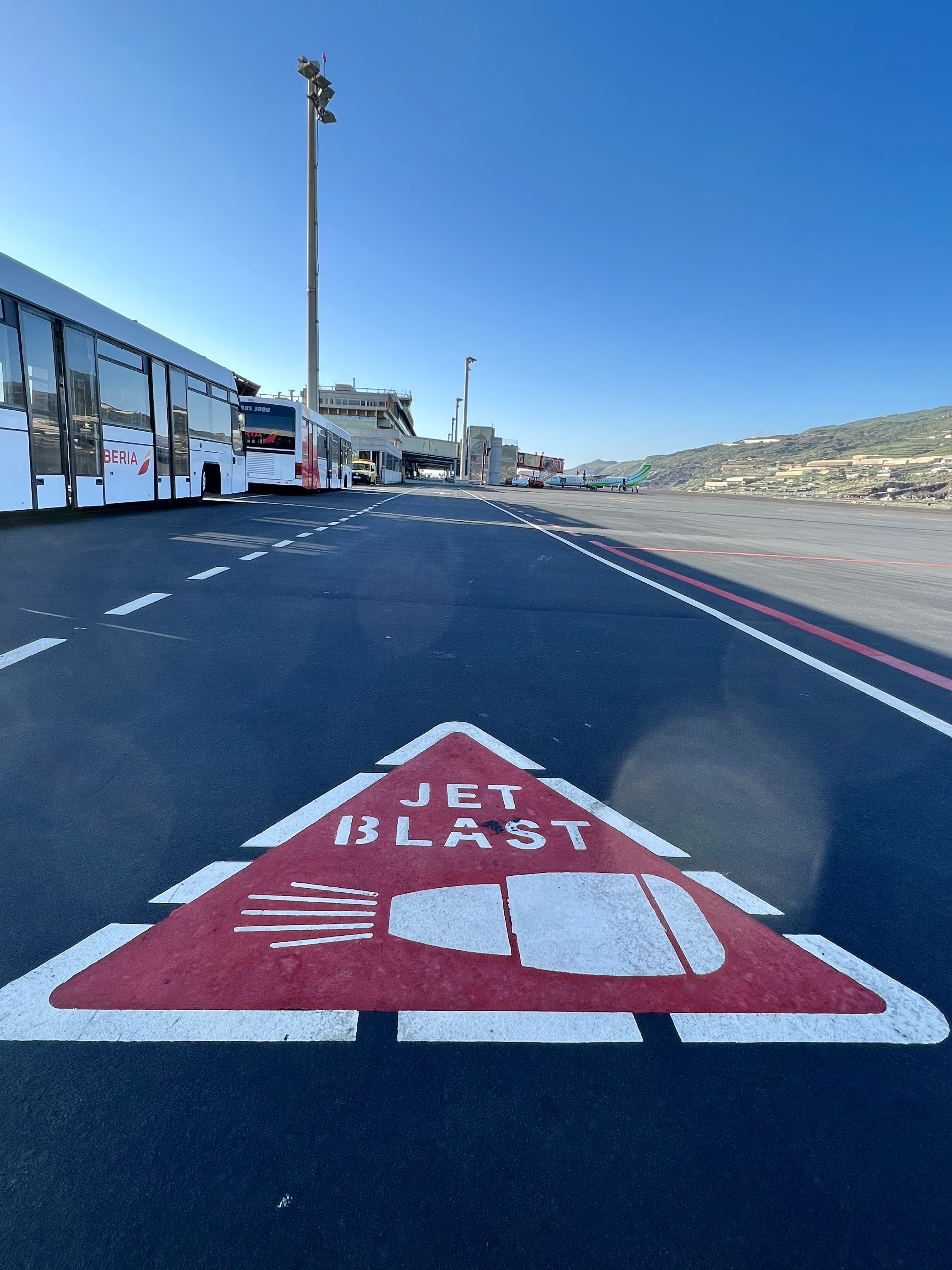
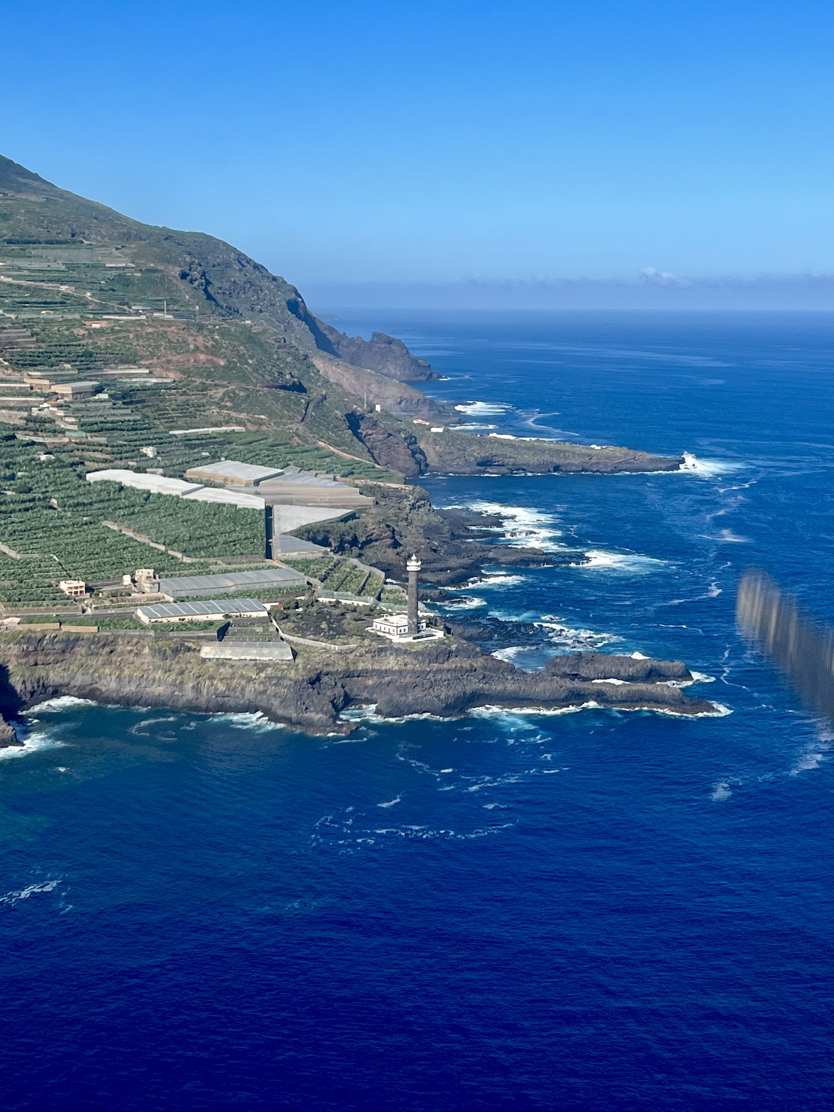
Tenerife during our early morning departure from Tenerife South airportTenerife during our early morning departureAraco 4E departureOur flown trackNDB Approach into La PalmaFlying simulated NDB approach into La PalmaFinal RWY 36 with almost calm windsJet blast warning signSanta Cruz de La PalmaLos Tilos, La PalmaFaro de Punta CumplidaImagine to live here… Volcán Tajogaite is still smoking… 🌋Aerial view of La Palma
Time flies so fast that I almost did not get the chance (or find a moment) to write a quick post about a flight with a friend of mine in Germany a couple of weeks ago.
We meet met at Bonn-Hangelar airport (EDKB), not far away from Bonn on a very warm August day.
Bonn-Hangelar airport
We flew the C172, it’s a great aircraft, and I always liked to fly it.
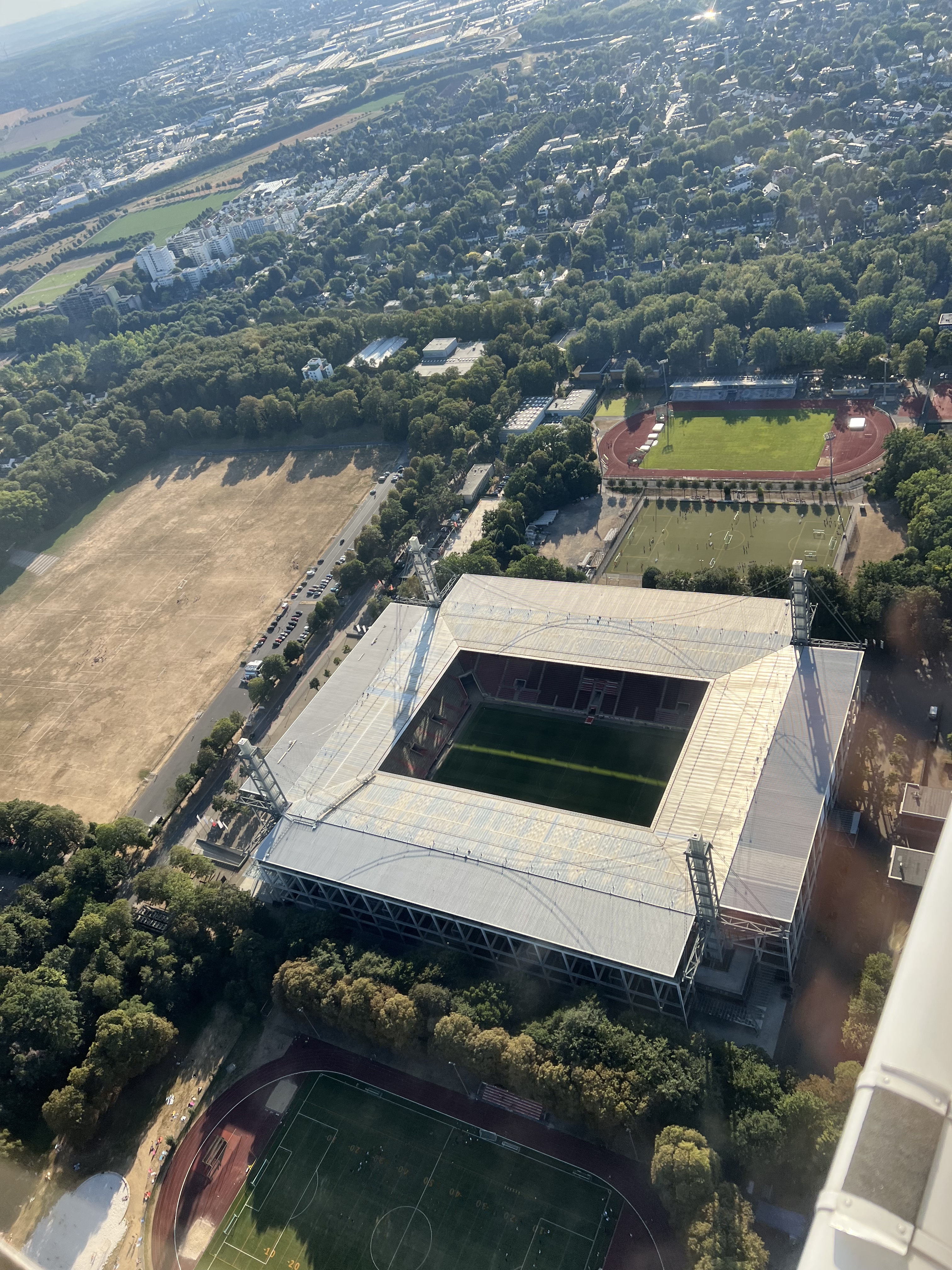
Definitely one of the highlights was the flight around Cologne and to see the Cathedral from above. 👇Exactly 2 years ago I’ve visited the city and stood just next to it. Now also the view from above…
Cologne Cathedralral
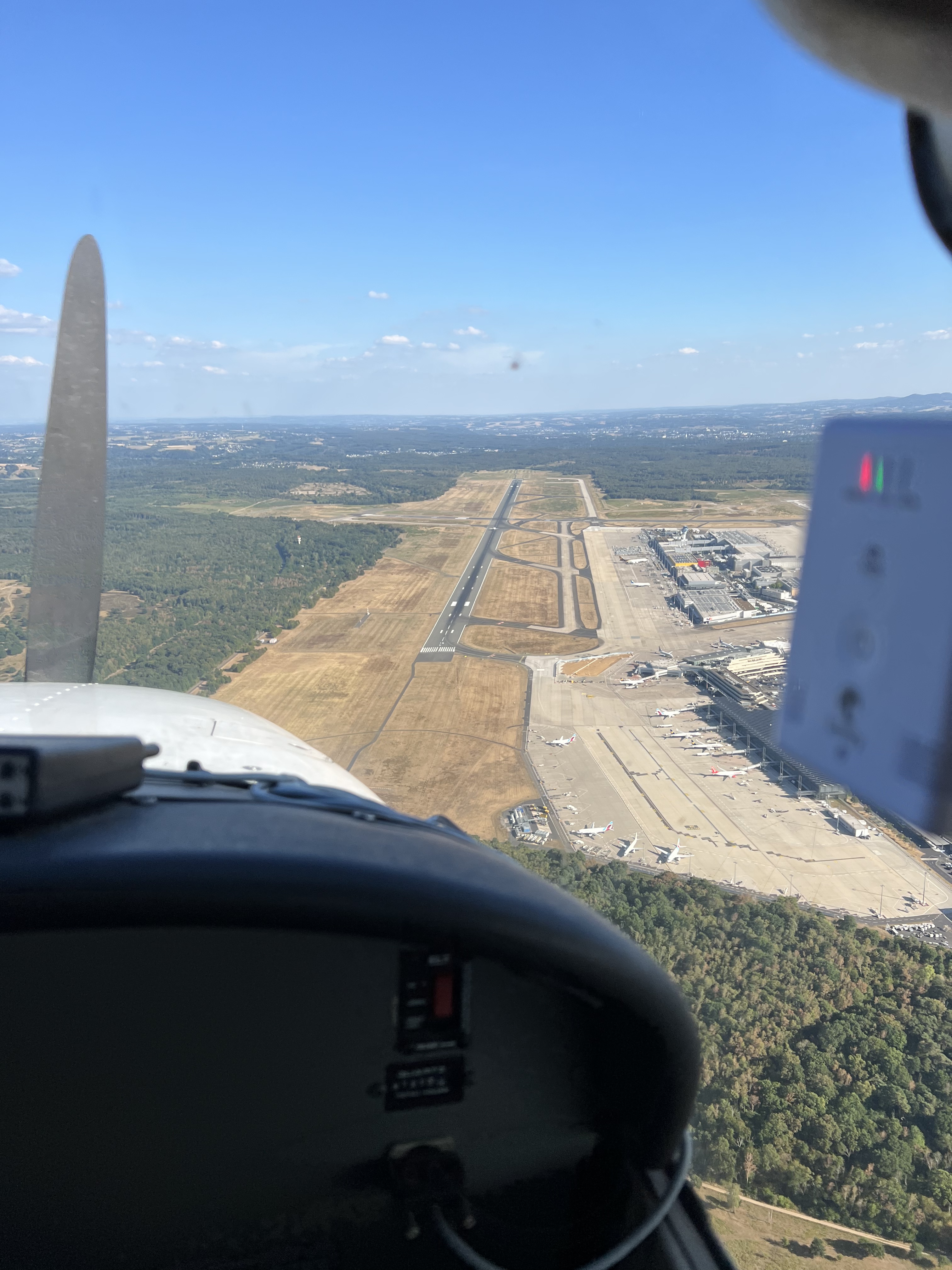
Another highlight was the low pass at Köln-Bonn airport (EDDK). After the initial request, we got vectors (even though that we were flying under VFR rules) to perform the low pass not bellow 1.000 feet on the RWY 14L.
Coming in foe the lowpass at EDDK RWY 14L
After the low pass we continued to Düsseldorf. Beautiful and green countryside, however it was a bit dry because of the heat.
Düsseldorf City
On our way back to Hangelar we saw also this nice castle (Schloss Drachenburg).
Schloss DrachenburgApproach into Bonn-Hangelar airportFinal RWY 11 into Bonn Hangelar
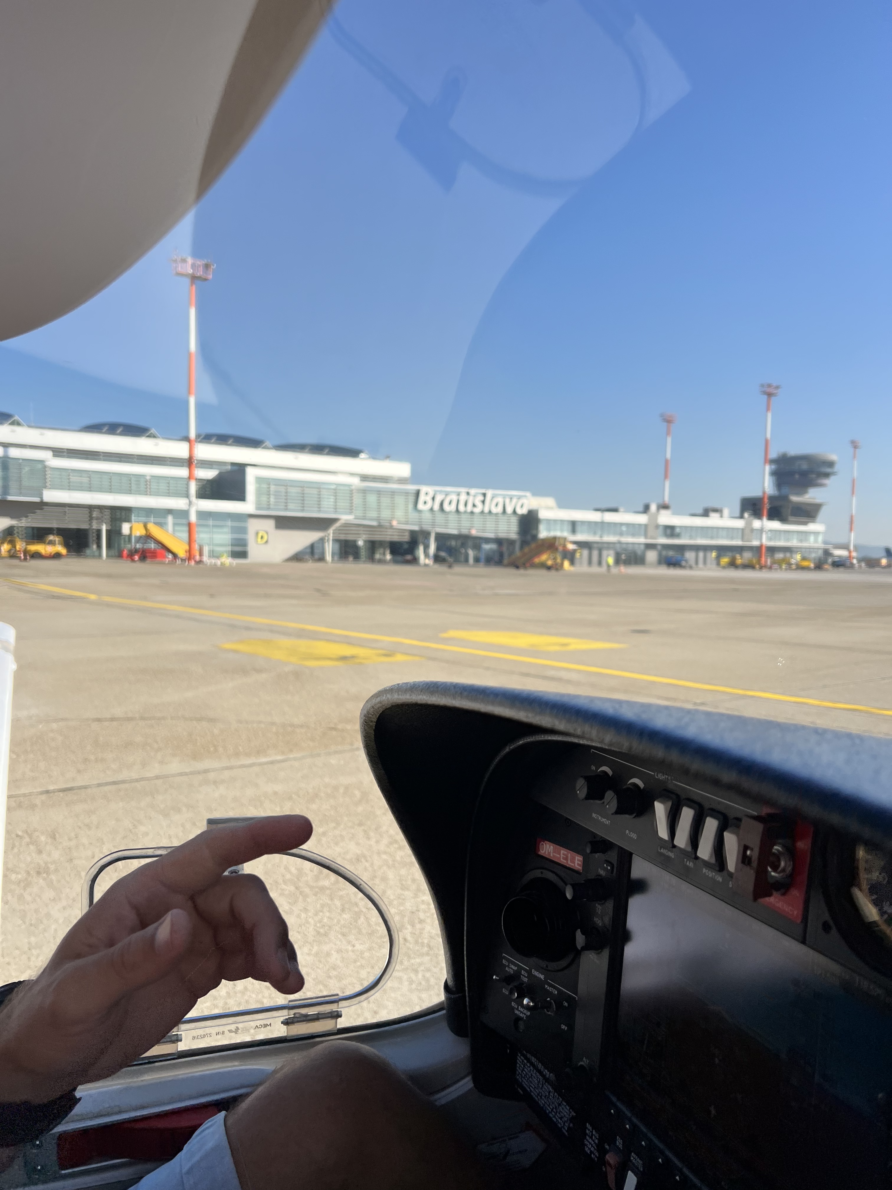
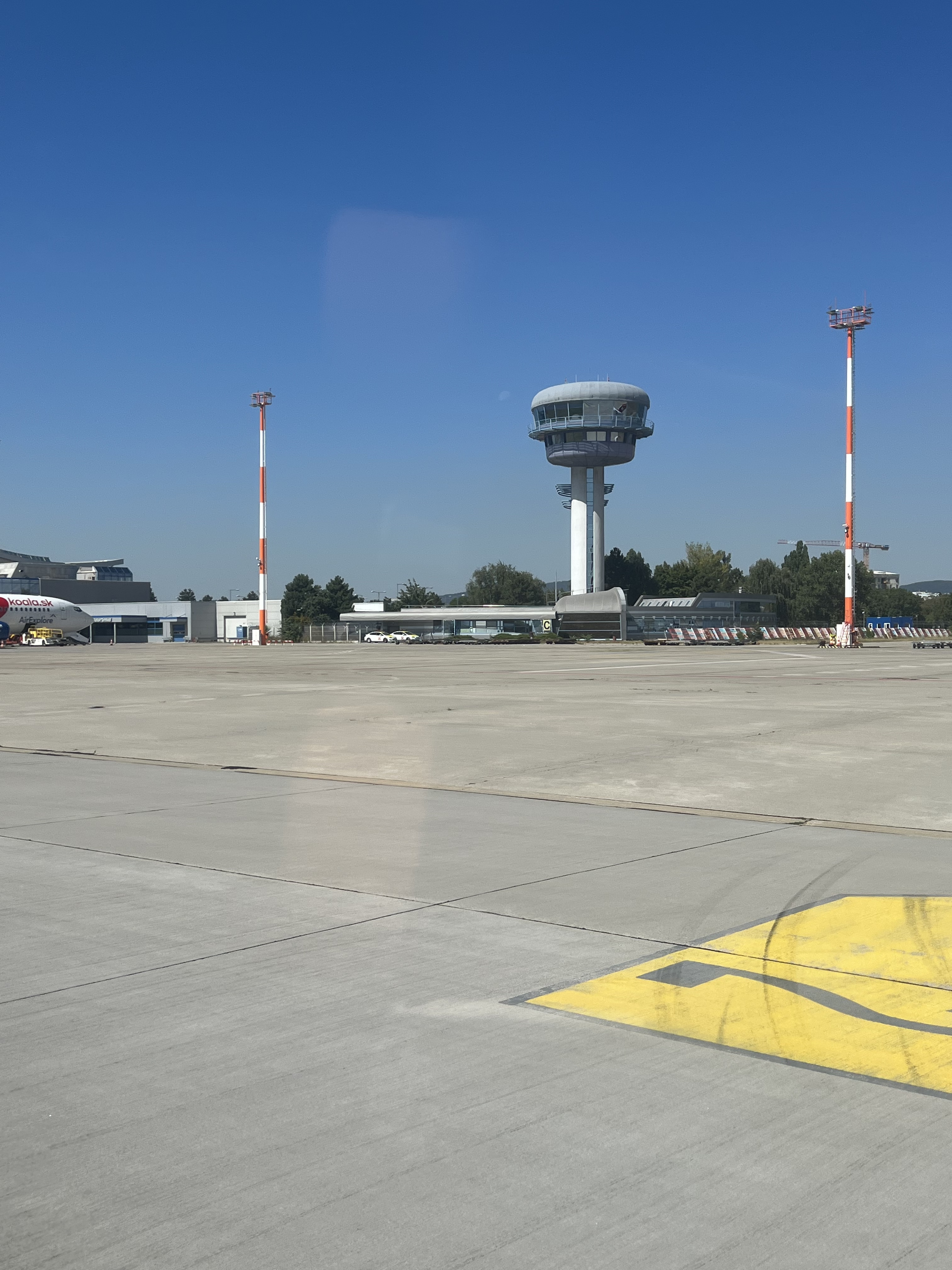
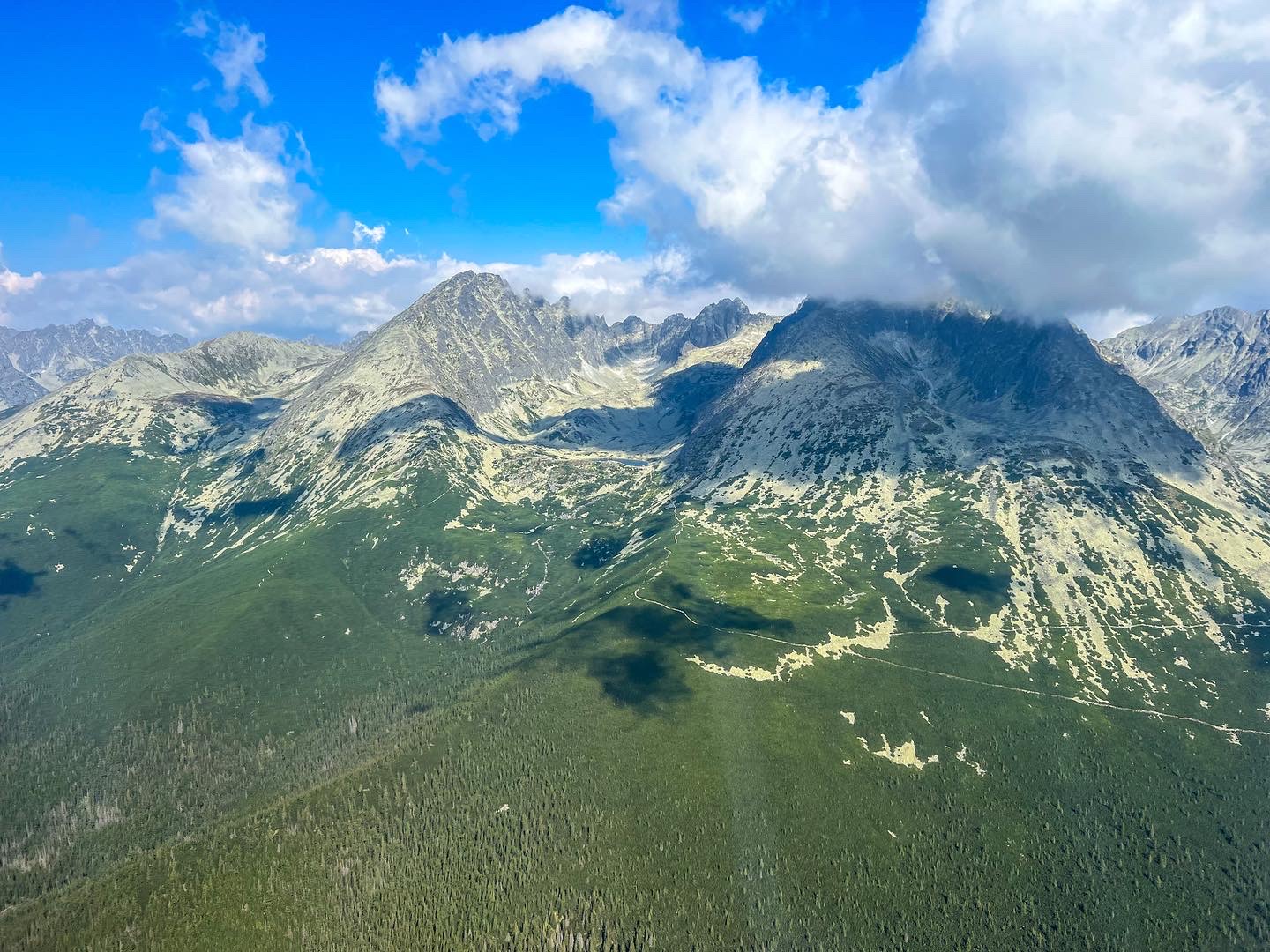
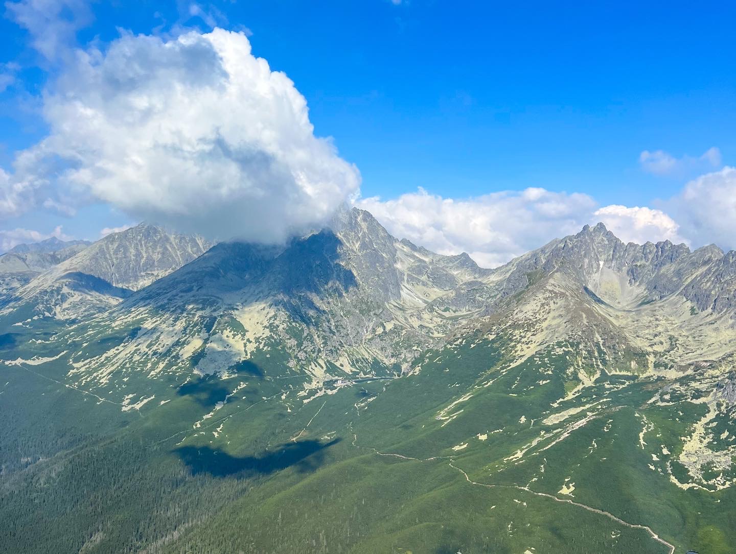
Got the opportunity to fly in Slovakia, country where I was born. Our trip took us from Bratislava to the High Taras and back on a shiny DA40 😀 on a warm and sunny summer morning.
Our route from Bratislava to High Tatras and back
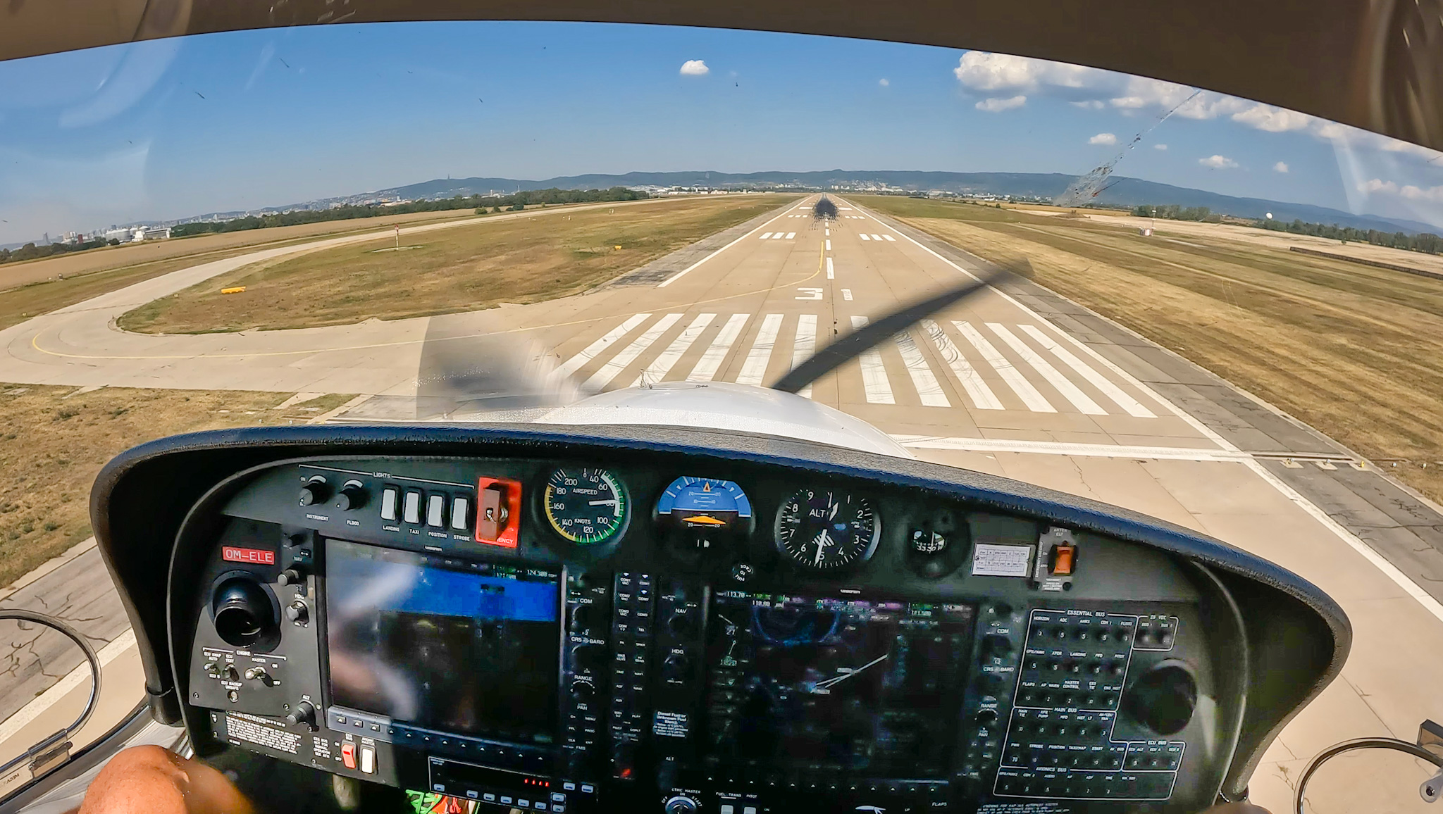
Flying out from Bratislava Stefanik airport was on my bucket list, so one thing less to do…
Bratislava airport BTS/LZIBTower at Bratislava Airport
And now just enjoy some nice views of the green countryside and the mountains.
Safe flying!
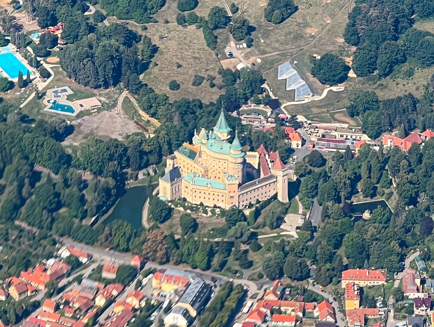
High TatrasHigh TatrasKrivanBojnice castleLake SenecLabyrinth in the corn fieldApproach into BTS airportPoprad/Tatry airportShiny DA40 in the Jetage hangar at BTSLiptovská Mara
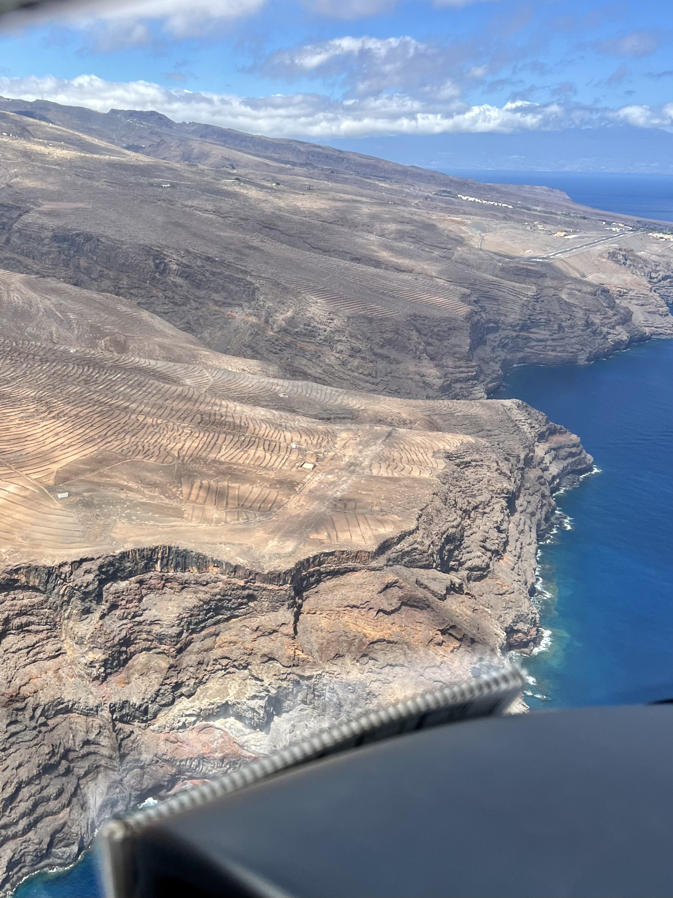
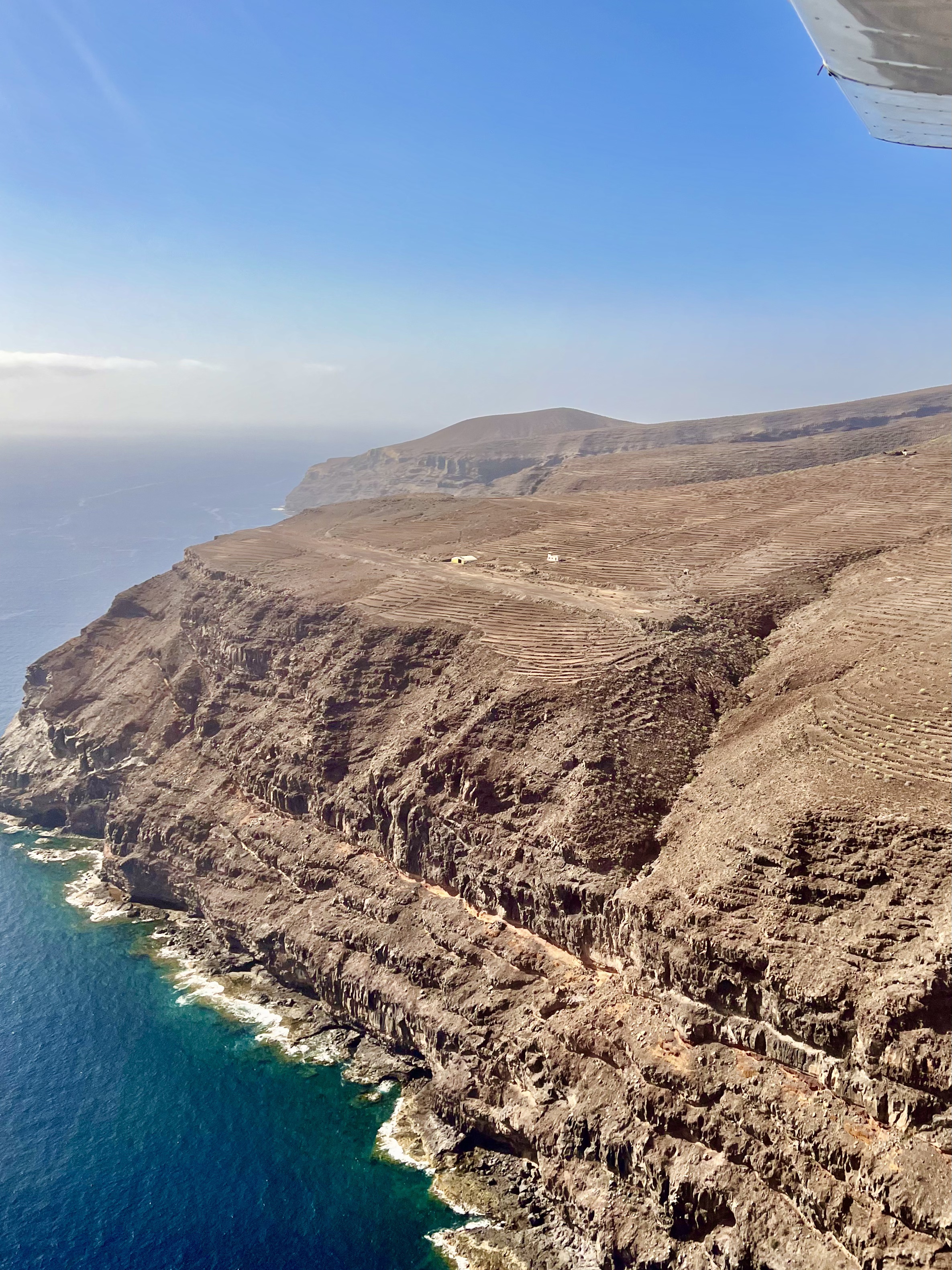
La Gomera’s former aerodrome El Revolcadero was closed so far for more than 25 years. The visit of this place has been on my bucket for more than 7 years, and now I finally decided to move on and make it happen. Just wanted to travel back in time and see how it looked liked there some 30 years ago.
The aerodrome was officially opened on the 24th of April 1959 and the first plane landed on the aerodrome was a Piper PA23-160 Apache (EC-ALQ), which landed at El Revolcadero on the 15th of July 1959.
El Revolcadero aerodrome, La Gomera
The runway was 500m long and at both ends it counts with up-sloping “stopways” helping the planes to slow down after the landing and most probably to help to gain speed during the initial take off run as well.
El Revolcadero aerodrome, La Gomera
The runway designation was 27/09, same as the new airport which can be seen on the next cliff behind the old aerodrome.
El Revolcadero aerodrome, La Gomera
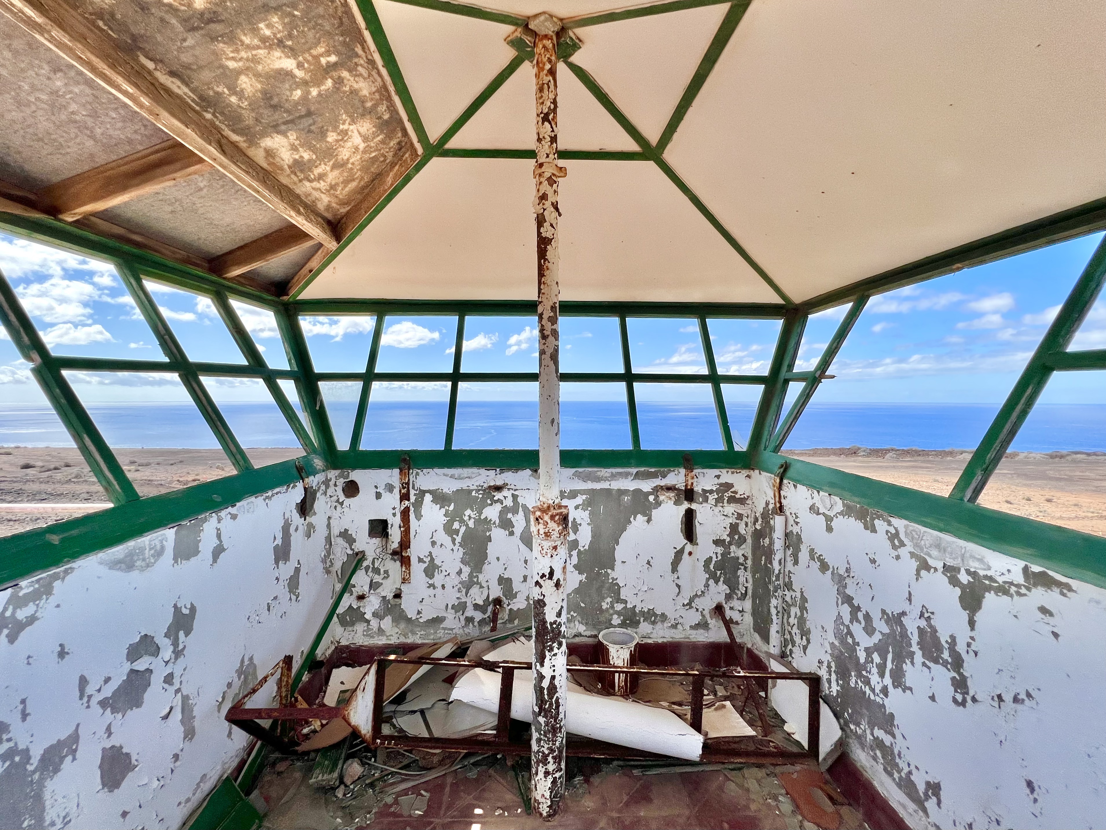
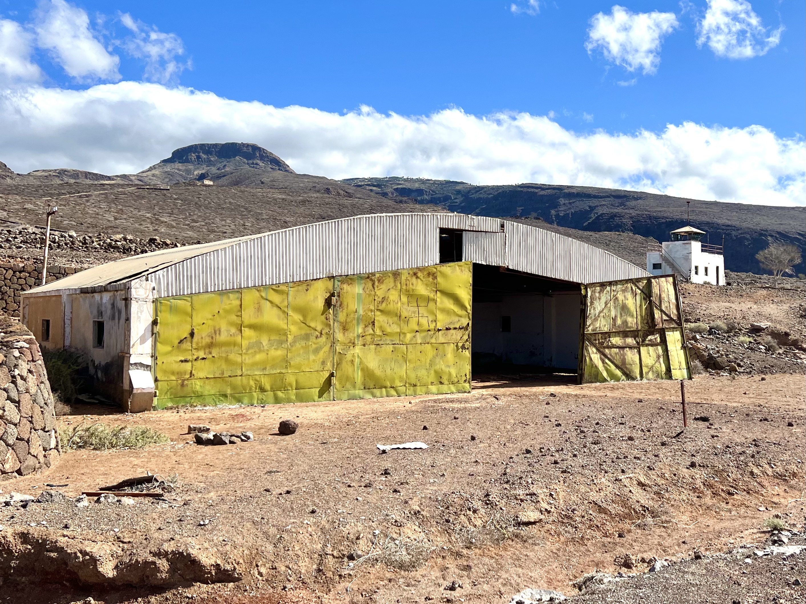
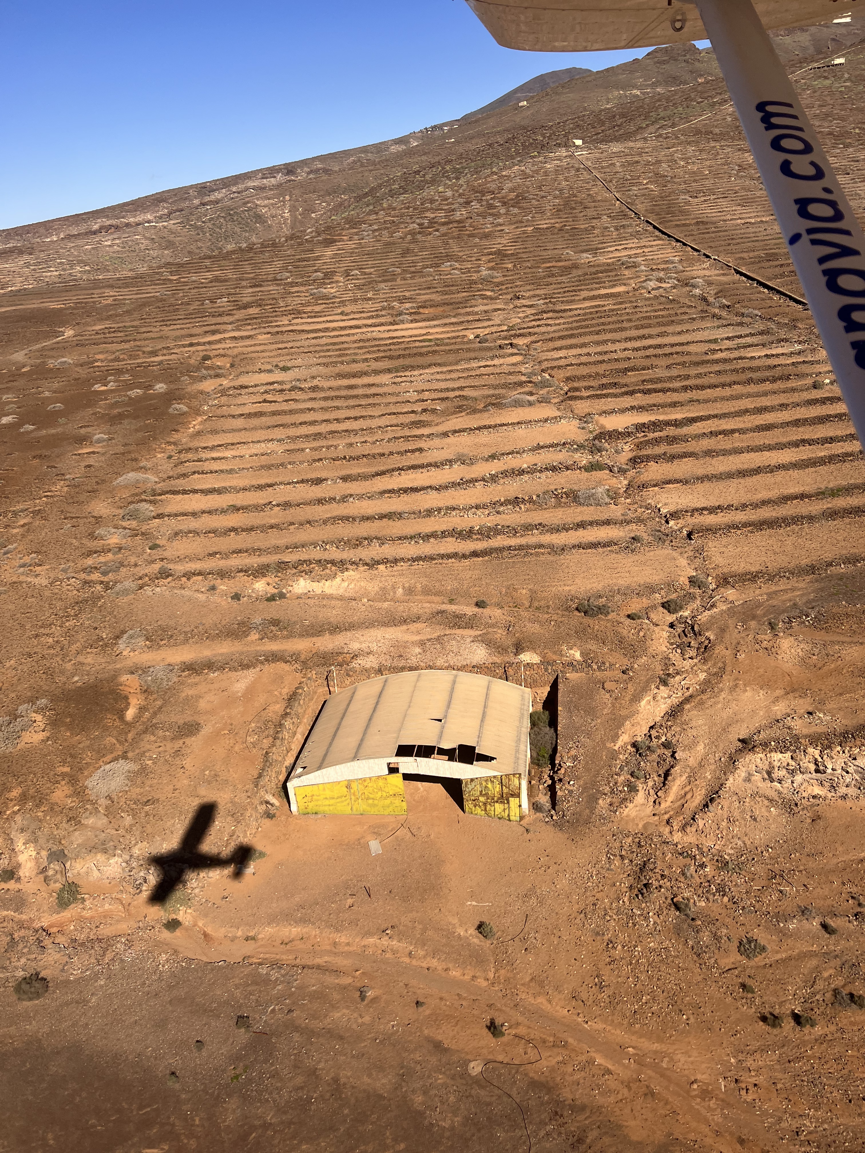
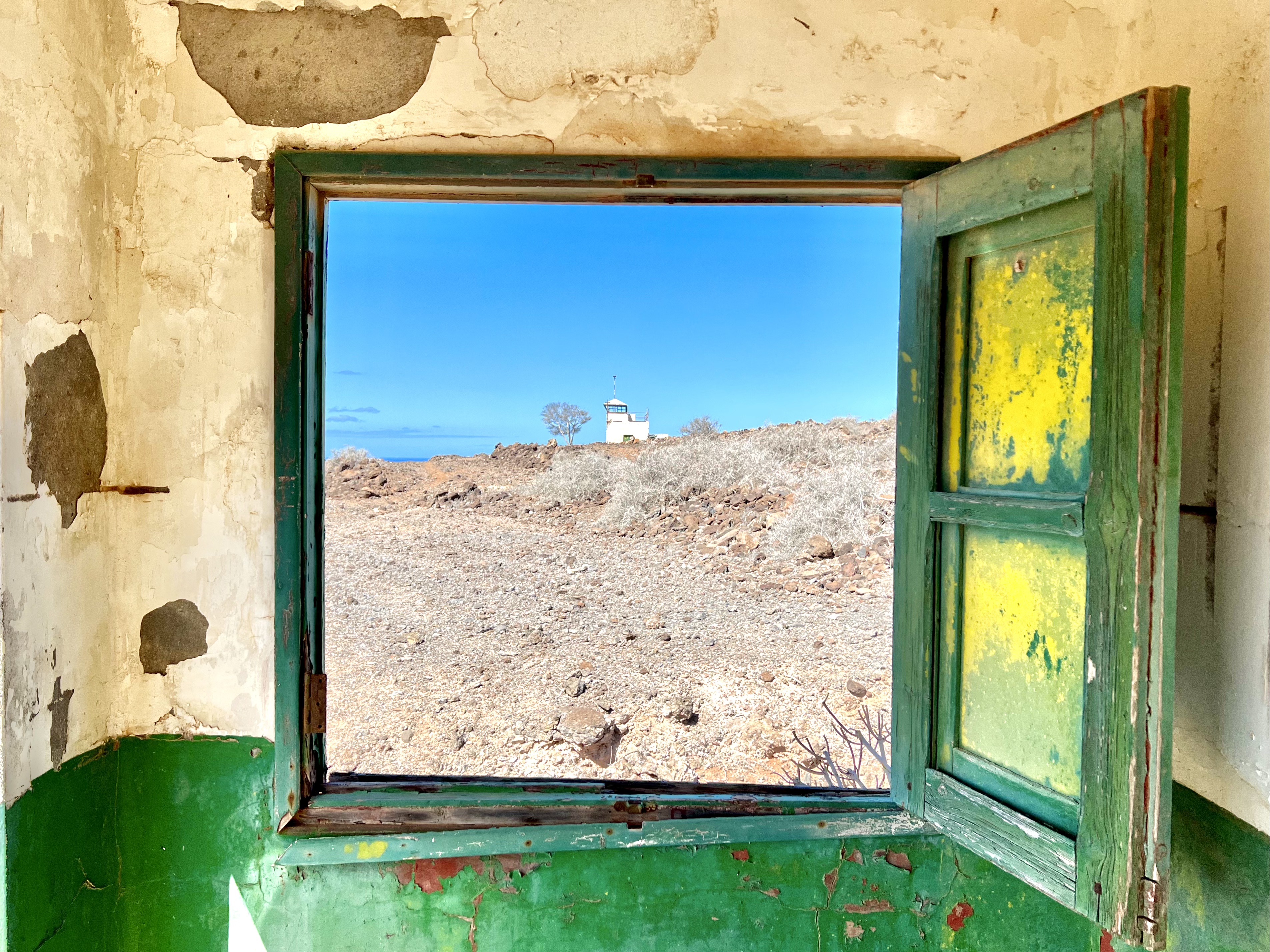
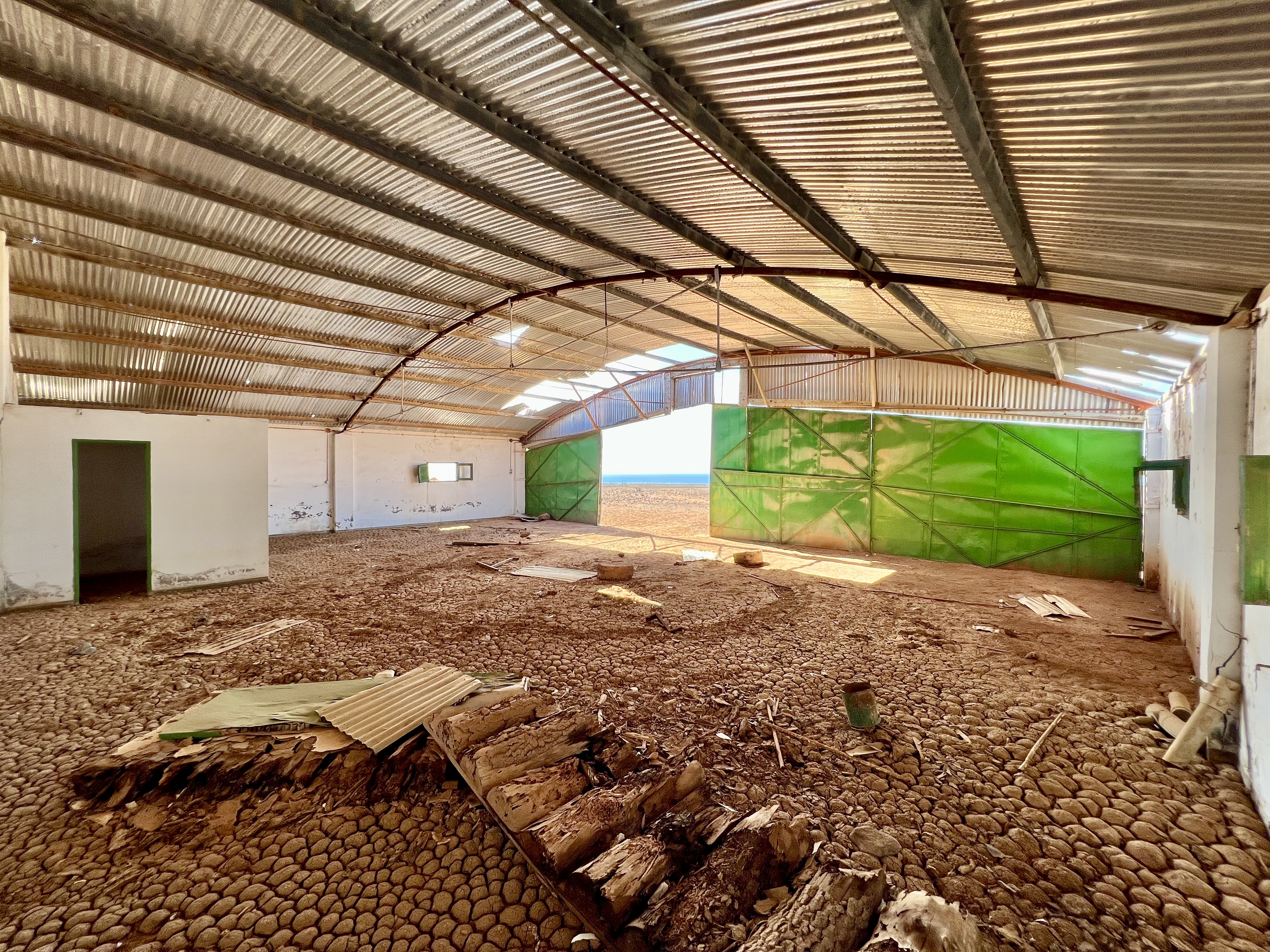
The aerodrome (still) counts with a small hangar, tower and a small power plant building.
The old tower at El Revolcadero aerodrome, La GomeraThe old tower at El Revolcadero aerodrome, La GomeraViews from the old tower at El Revolcadero aerodrome, La GomeraThreshold Runway 27 at El Revolcadero aerodrome
It’s just a fascinating piece of history, you just need to imagine that people were passing during years through the airport.
Hangar at El Revolcadero airfield, La GomeraInside the hangar at El Revolcadero airfield, La Gomera
During the last years I flew a lot of times by, and need to admit that I’d love to land at the aerodrome or to see again some signs of “life” there.
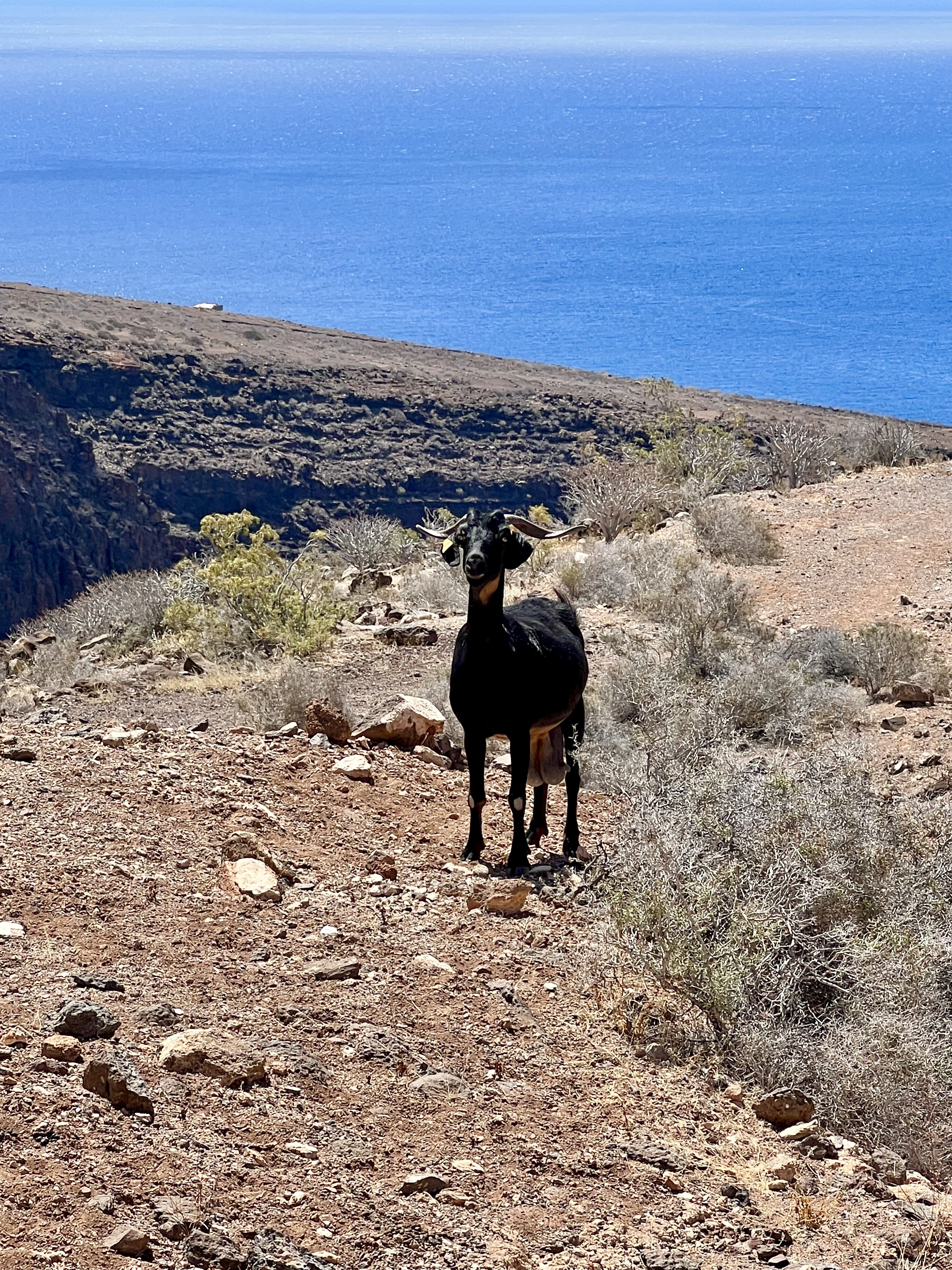
The place, where the time stands still… Quiet… Visited by some curious tourists now and then, and by the goats.
Goats seem to be the only passengers…
Unfortunately, there is not much information to be found about this aerodrome on internet, nor images of the planes at the aerodrome, nor the date when it was closed. But definitely at least some 25 years ago, as the new airport started their operations back in 1999.
So enjoy some more images and the video of this experience, and for those who’d like to know how to get to El Revolcadero, you can find it here.
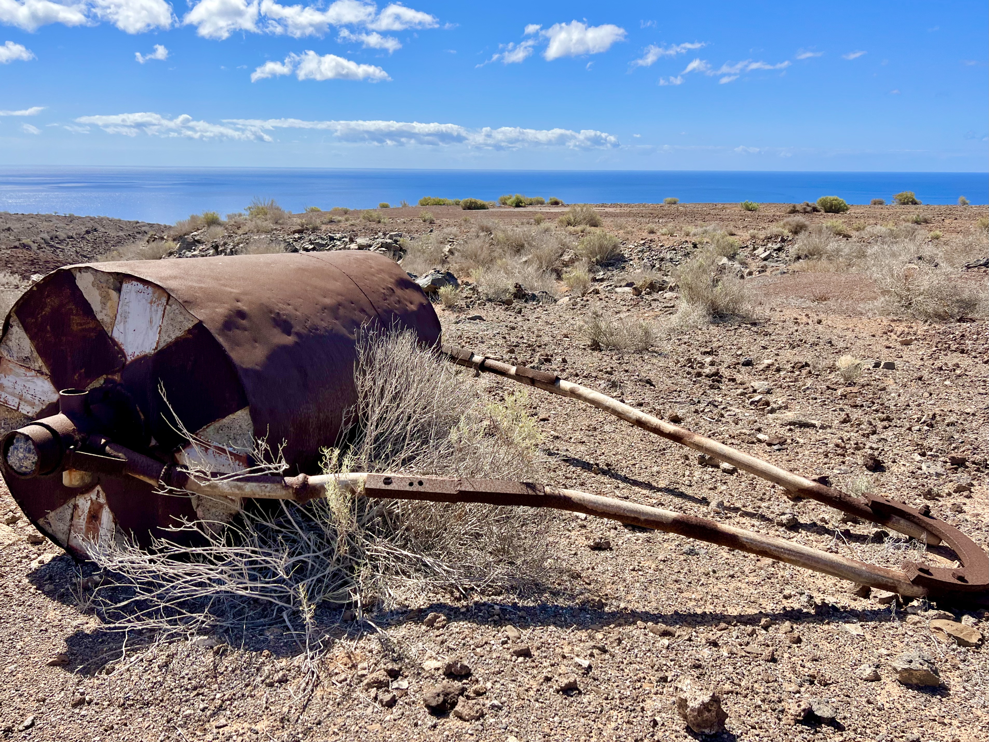
El Revolcadero aerodrome, La GomeraAerial view at the hangar at El RevolcaderoEl Revolcadero aerodrome, La GomeraEl Revolcadero aerodrome, La GomeraDebris on the runwayEl Revolcadero aerodrome, La GomeraEl Revolcadero aerodrome, La GomeraRunway at El Revolcadero aerodrome, La GomeraThreshold Runway 27 at El Revolcadero aerodromeLooking at the tower from the power stationThe old tower at El Revolcadero aerodrome, La GomeraThe old tower at El Revolcadero aerodrome, La GomeraThe old tower at El Revolcadero aerodrome, La GomeraThe old tower at El Revolcadero aerodrome, La GomeraHangar at El Revolcadero airfield, La GomeraInside the hangar at El Revolcadero airfield, La GomeraEl Revolcadero, La GomeraHangar at El Revolcadero airfield, La GomeraThreshold RWY 09 at El Revolcadero airfieldWalking down to El Revolcadero airfield at La GomeraEl Revolcadero aerodrome, La GomeraThis is what left from the access road to El Revolcadero aerodrome