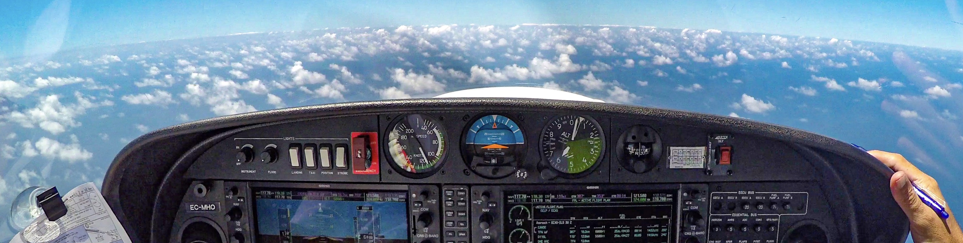
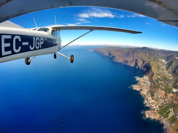
A short video o how Playa de las Américas looks like from the air.
Enjoy it!
Flying over Playa de las Américas from The Piper Pilot on Vimeo.
Home » Posts tagged 'Tenerife' (Page 2)
A short video o how Playa de las Américas looks like from the air.
Enjoy it!
Flying over Playa de las Américas from The Piper Pilot on Vimeo.
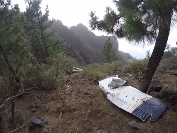
Sad end for the Piper, but a lucky end for the occupants.
This plane (Piper PA28, EC-DSD) crashed in January 2009 while attempting to cross the mountain “Montaña de la Crucita” (6.761ft high) during VFR flight into IMC conditions resulting in an impact in the mountain at 5.700 feet, just 1.000 feet bellow its top.

Plane’s route
The 3 occupants were injured and were rescued by the helicopter of the Guardia Civil. There were no fatalities.
Wreckage of the EC-DSD.

The slop of the mountain.
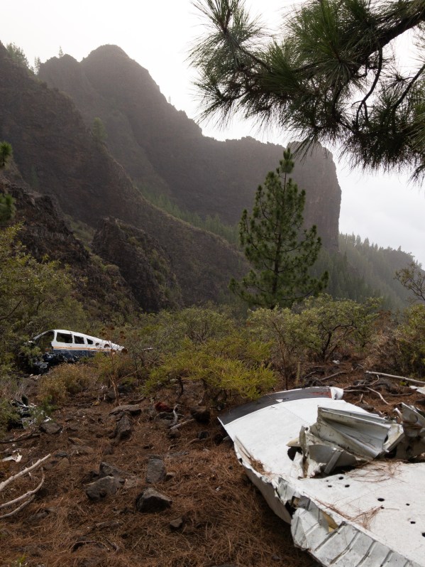

Wreckage of the EC-DSD.
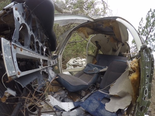
Wreckage of the EC-DSD.
The plane seems to be moved from its initial position and most of the parts are already missing.
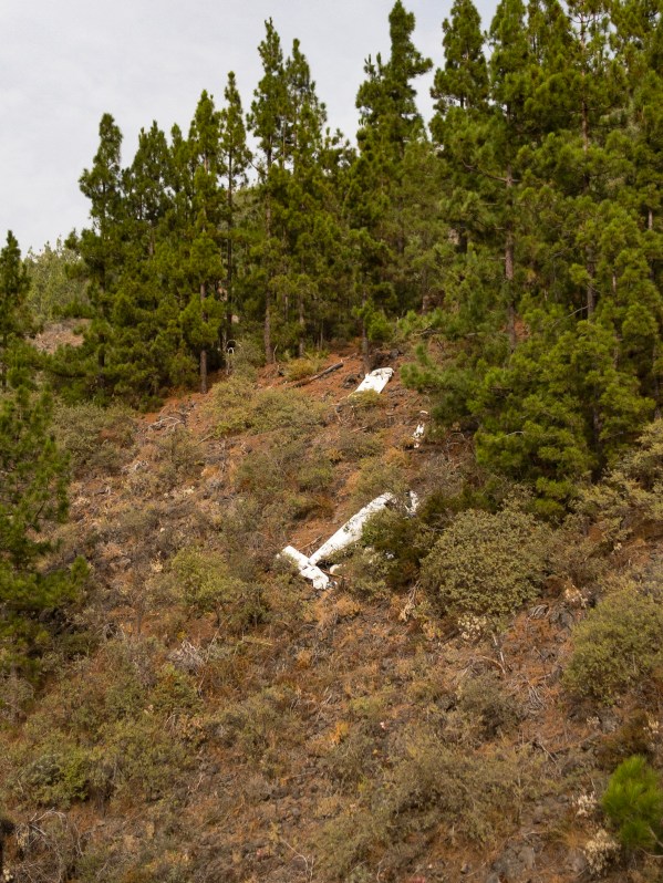
The plane seems to be moved from its initial position
The crash site is only 1 km from the road, but the access is difficult. On the images you can see the slope of the mountain and the surroundings; I´ve attached the plane´s route as well.
You can park your car at the Mirador de la Crucita and start walking from there:

Source: Ministerio de Fomento/Spanish Ministry of Development.
On the 22nd of march 2019 the plane was transported by a helicopter to a scrap yard, where it will be scrapped by a company Rimetal. This was her final flight after 10 years on the mountain.
Safe flying everyone!
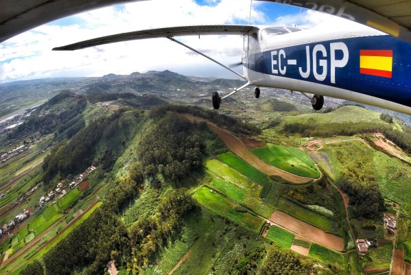
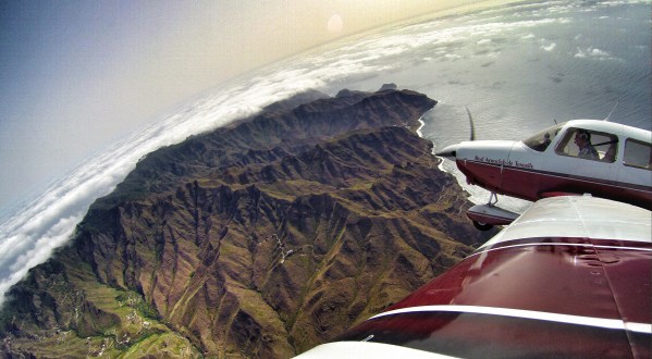
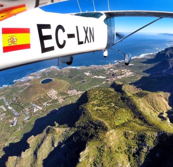
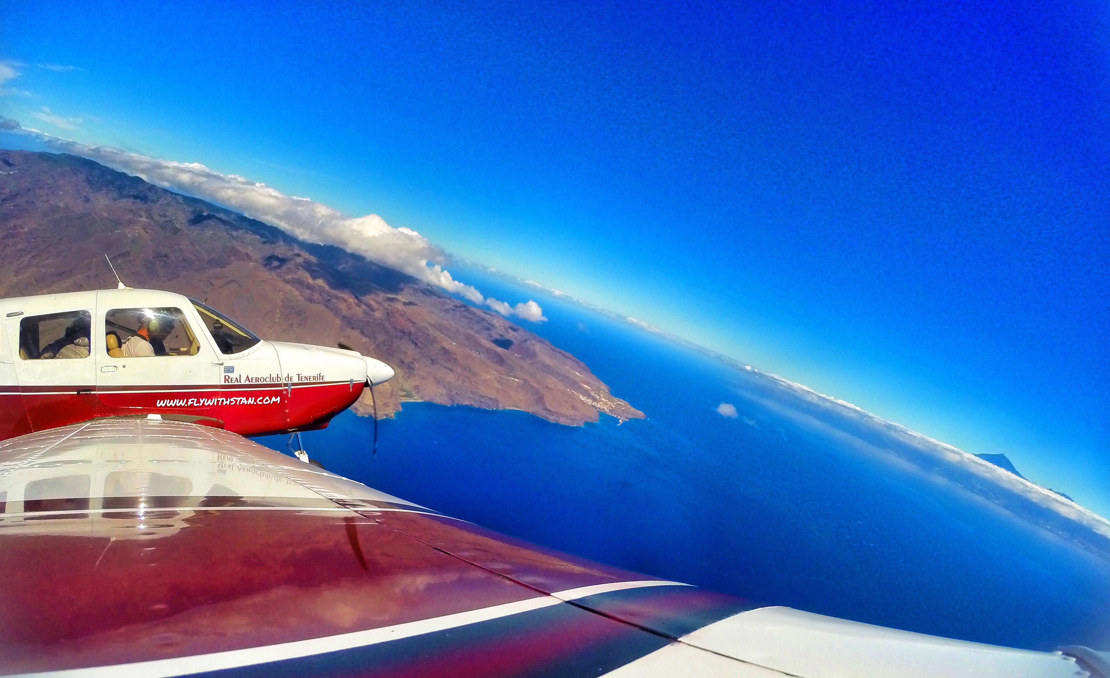
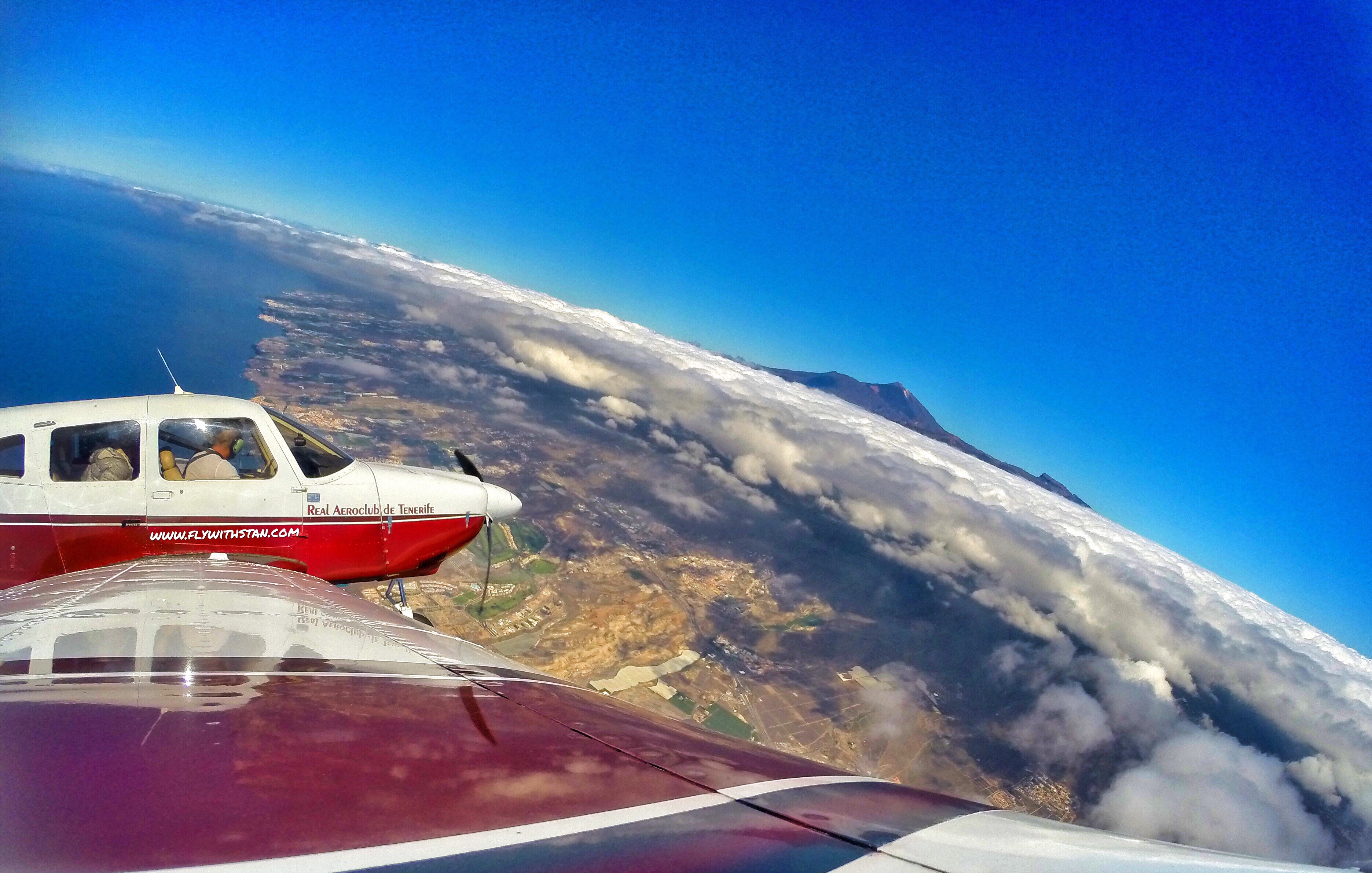
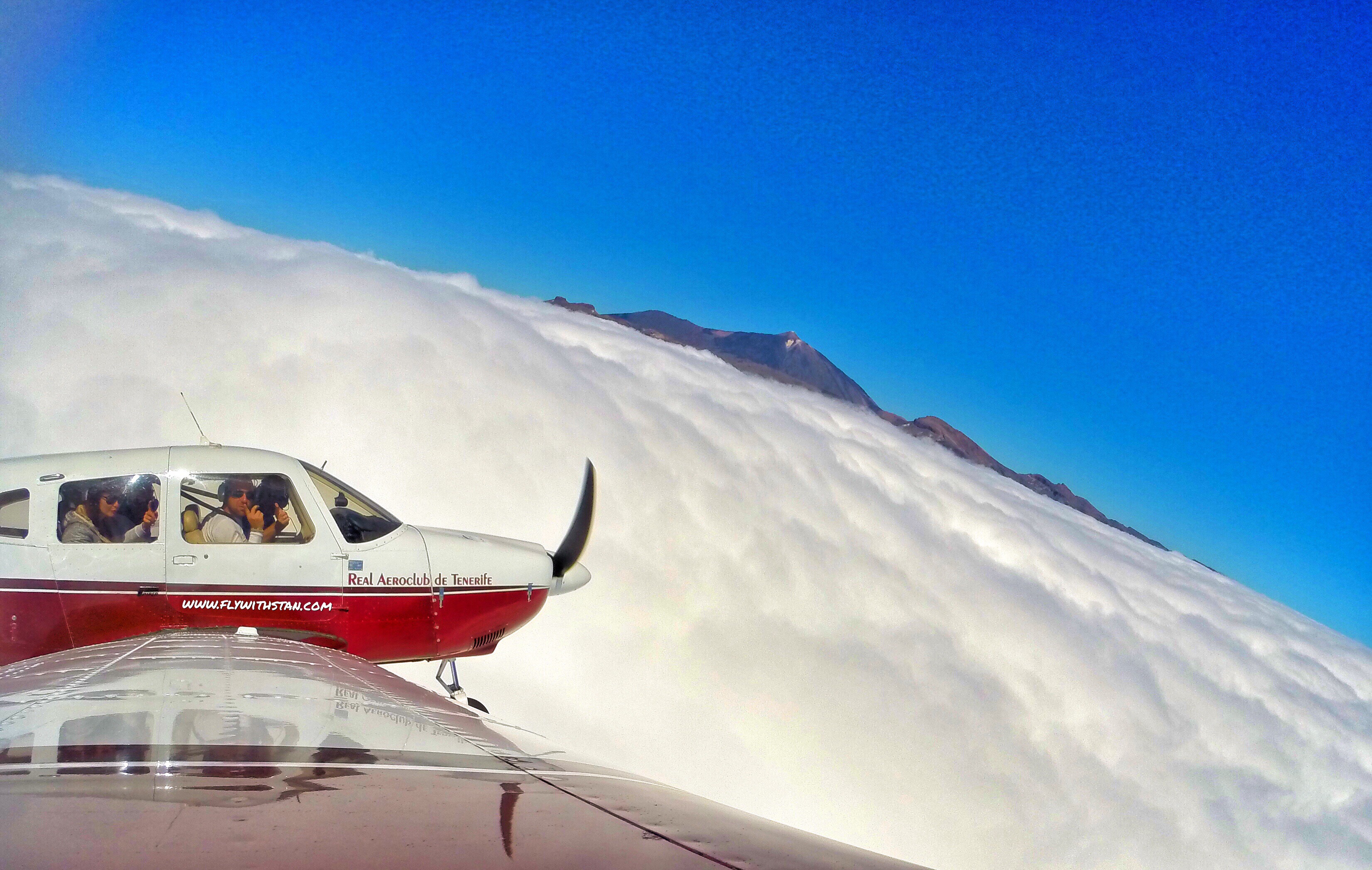
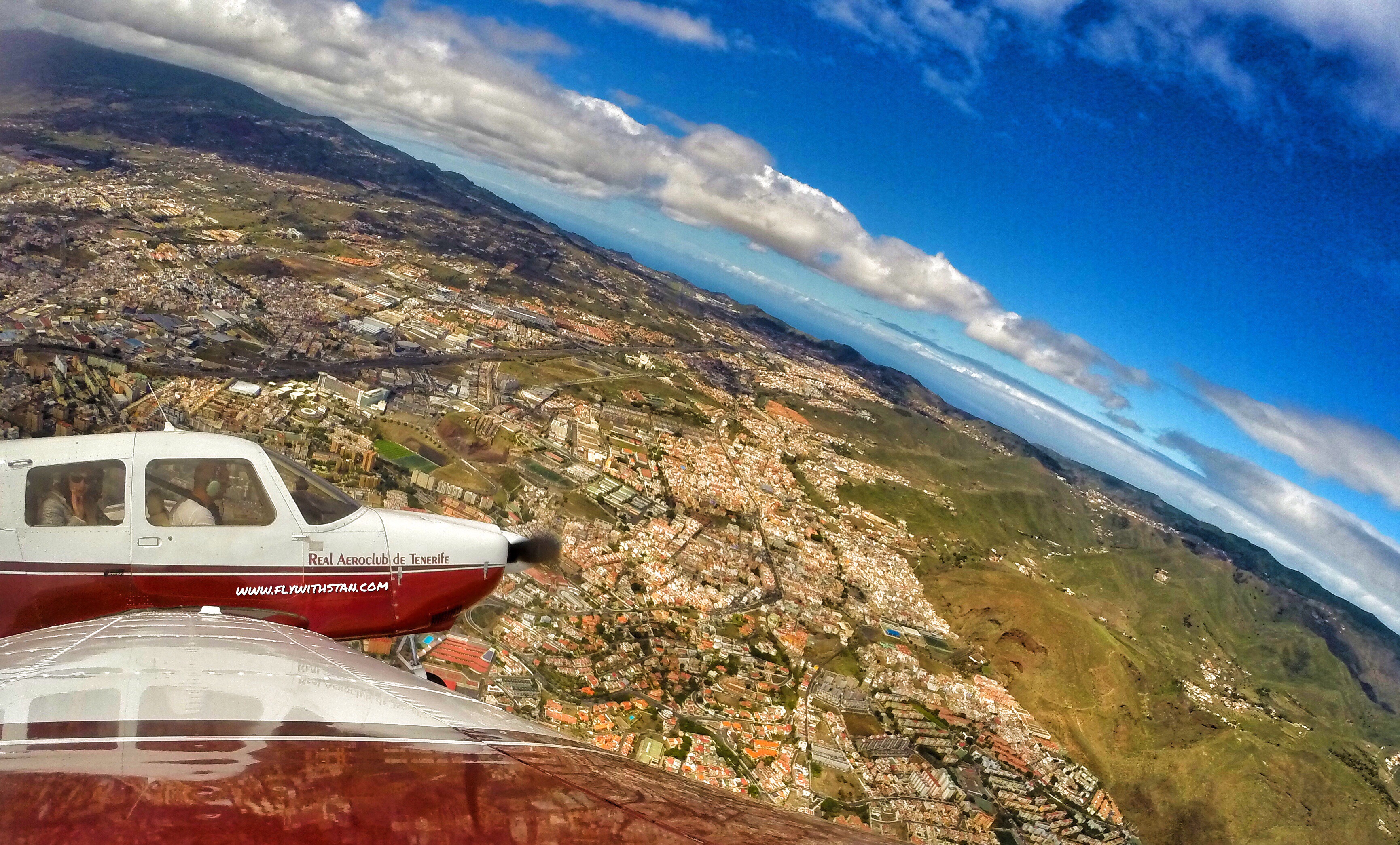
I have made lots of aerial images of Tenerife. Now I made a small selection of some of my favorites and share them with you. Which one is your favorite? 🙂

No caption needed

Playa de las Teresitas
El Médano

Playa de las vistas

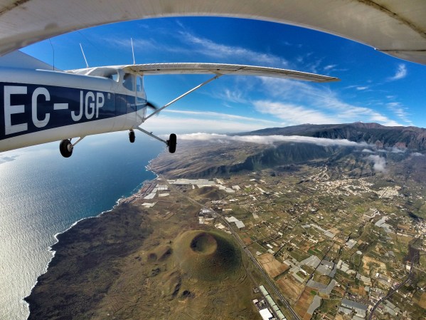
Roque Tierra, Anaga
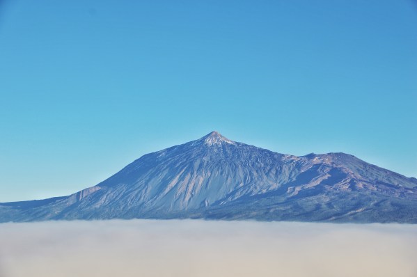
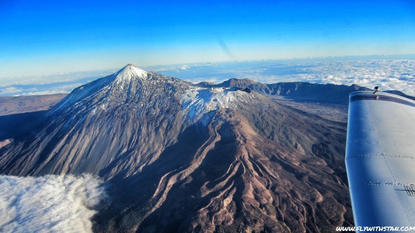
Pico del Teide & The sea of clouds
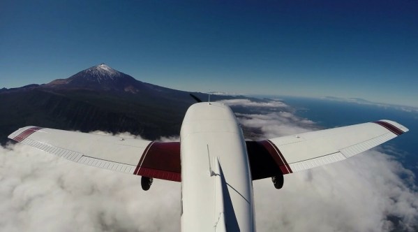
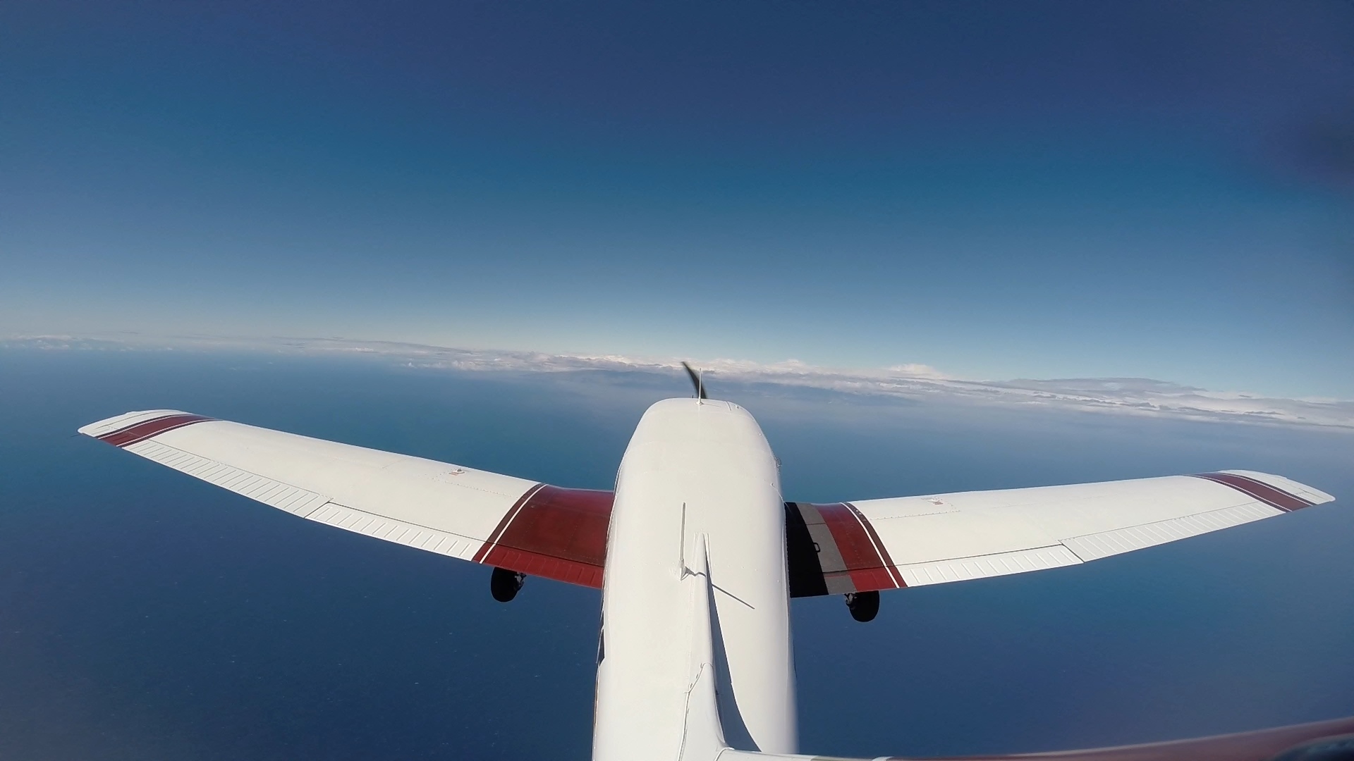
Gopro Mounted on the vertical stab

Snowed Mt. Teide
Somewhere over La Victoria, North Tenerife

Tenerife North (GCXO/TFN) airport from the air
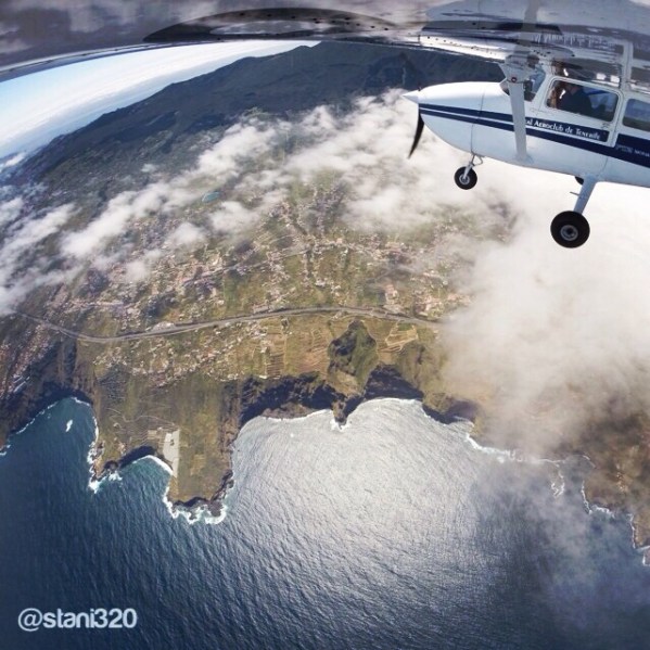
The Vulcano at Güimar valley

Costa los Gigantes from the air

Pico del Teide & Costa Los Gigantes

Anaga
Montaña El Pulpito

Above Anaga
Above Anaga

Above Anaga

Mt. Teide

Mt. Teide above the clouds

DCIM102GOPROG0238762.

Snowy MT. Teide
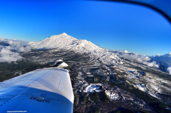
Snowy MT. Teide

What else can we ask than calm winds and a good visibility? Maybe a full fuel tank, file the flight plan and get airborne to enjoy these views…
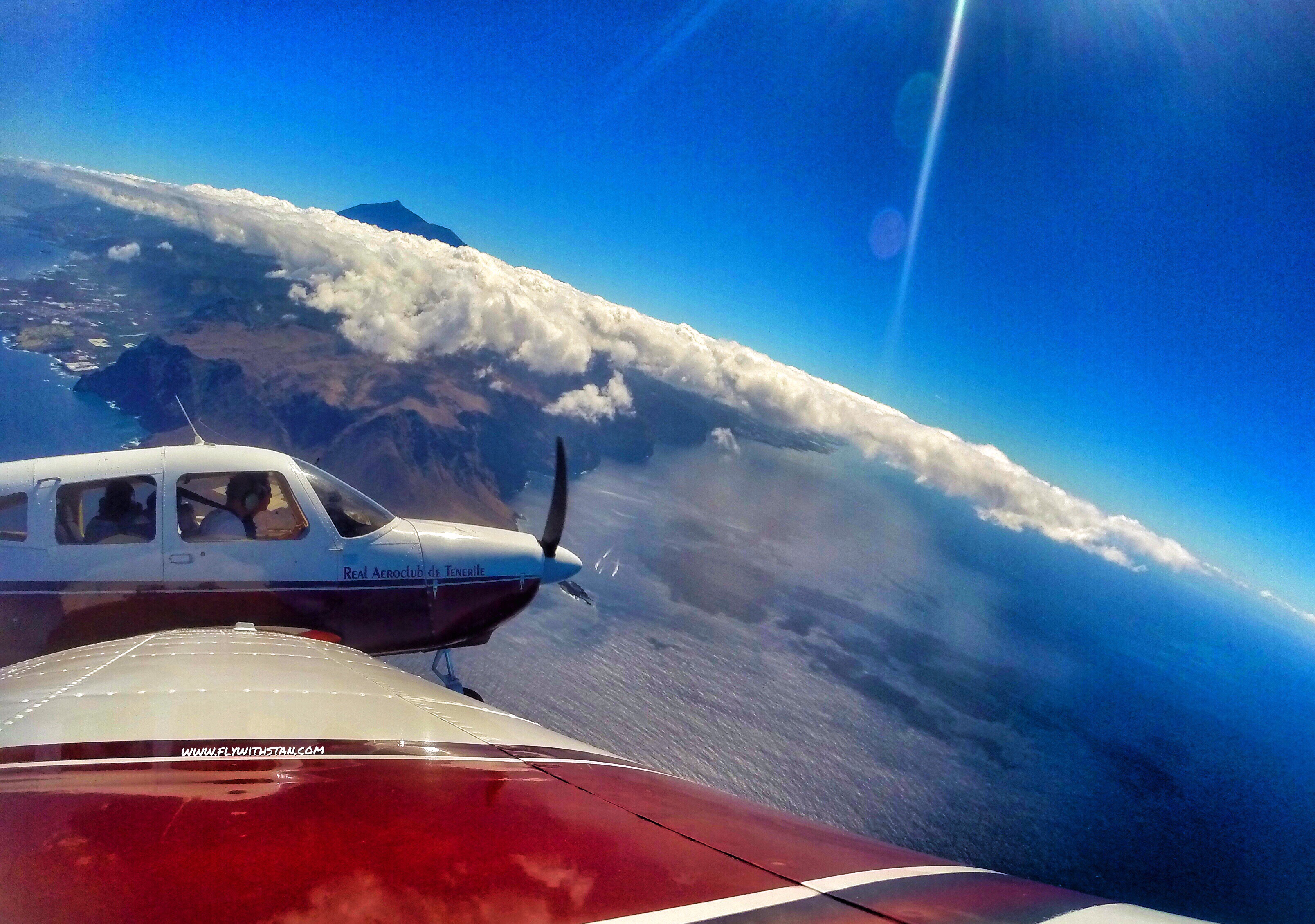
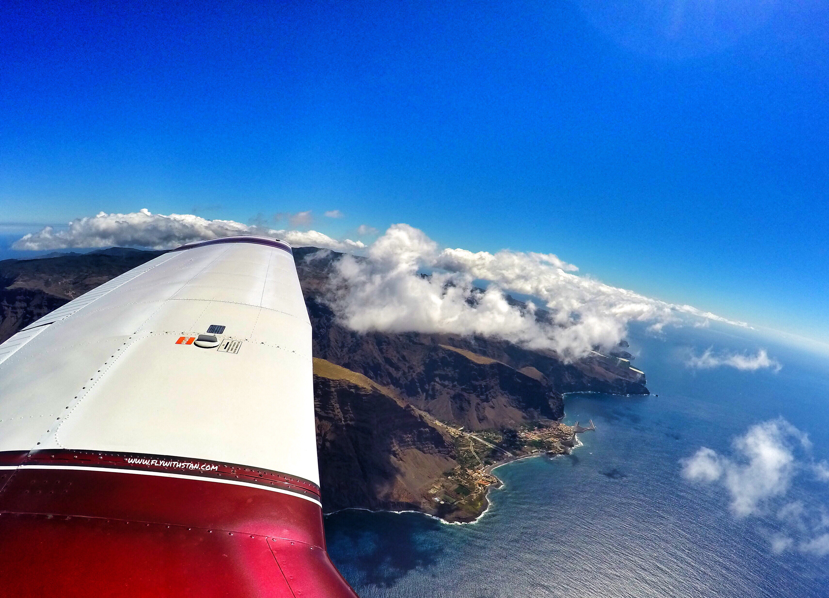
An image says more than 1000 words, so enjoy some of the views from my last 1 hour 40 minute long flight along Tenerife´s and La Gomera´s coast. 🙂
Safe landings!
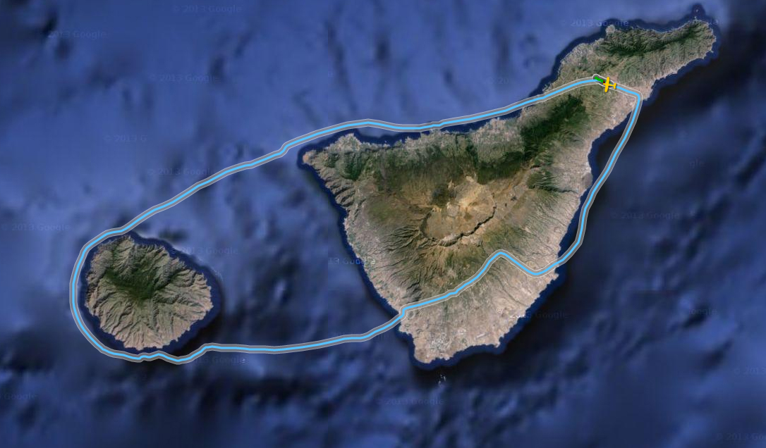
Our flight track

Tenerife North and its Mt. Teide

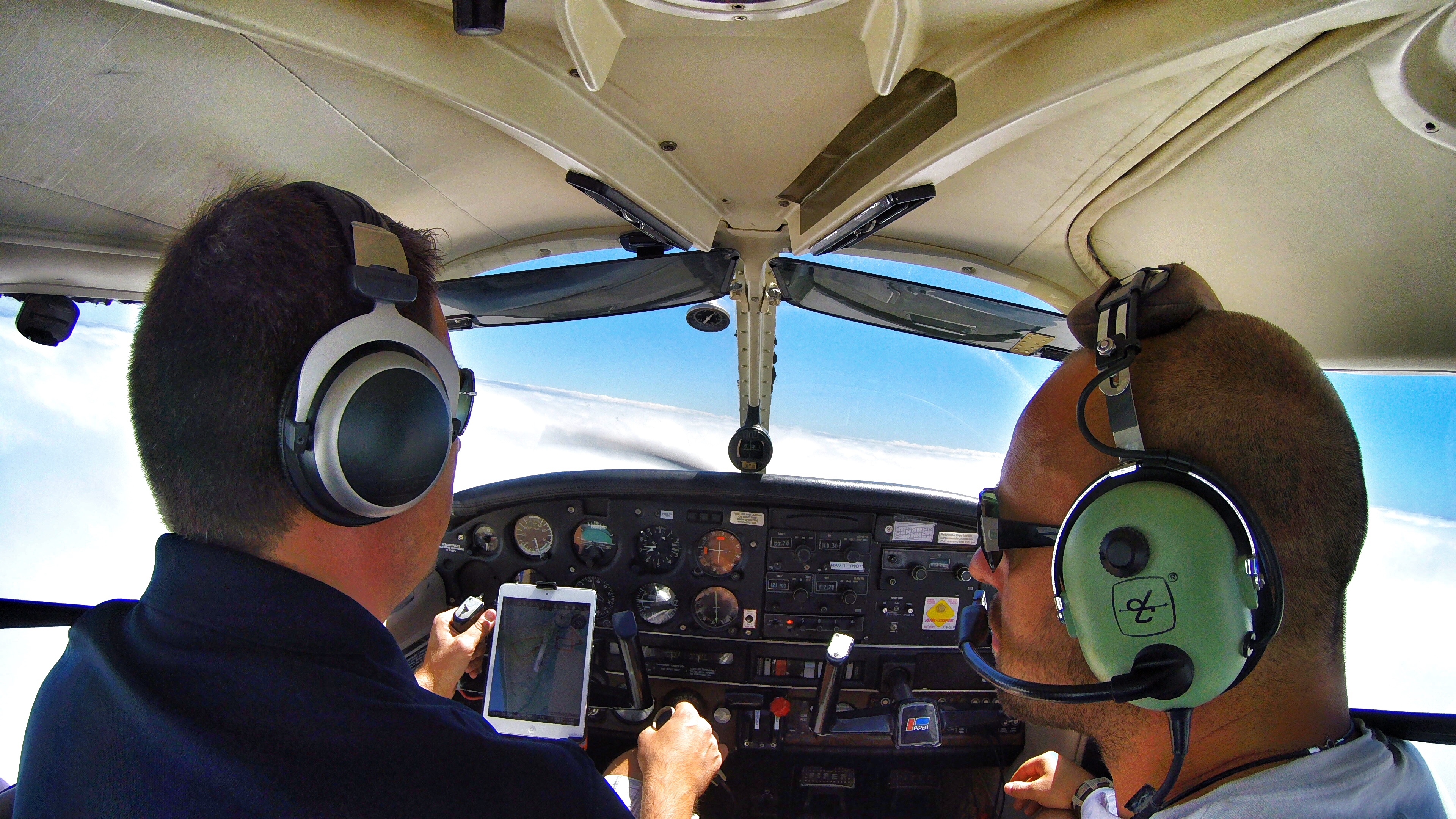
The crew 🙂

Copilot at the controls
Over Punta Teno
La Gomera
La Gomera and Tenerife’s Mt.Teide

2 islands on one image: Tenerife & La Gomera
Mt. Teide
Having small talk above the clouds
Mt. Teide above the clouds
Laguneando
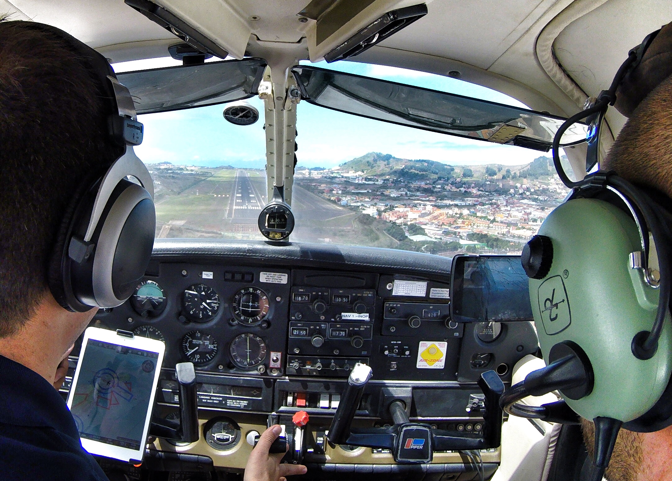
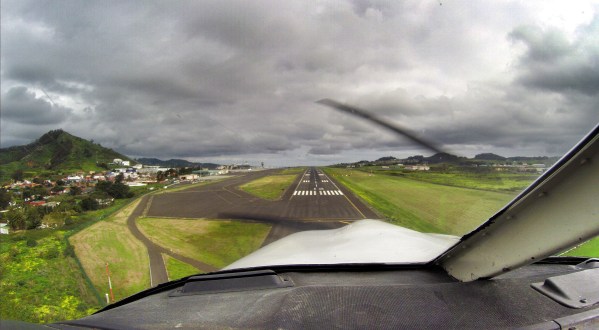
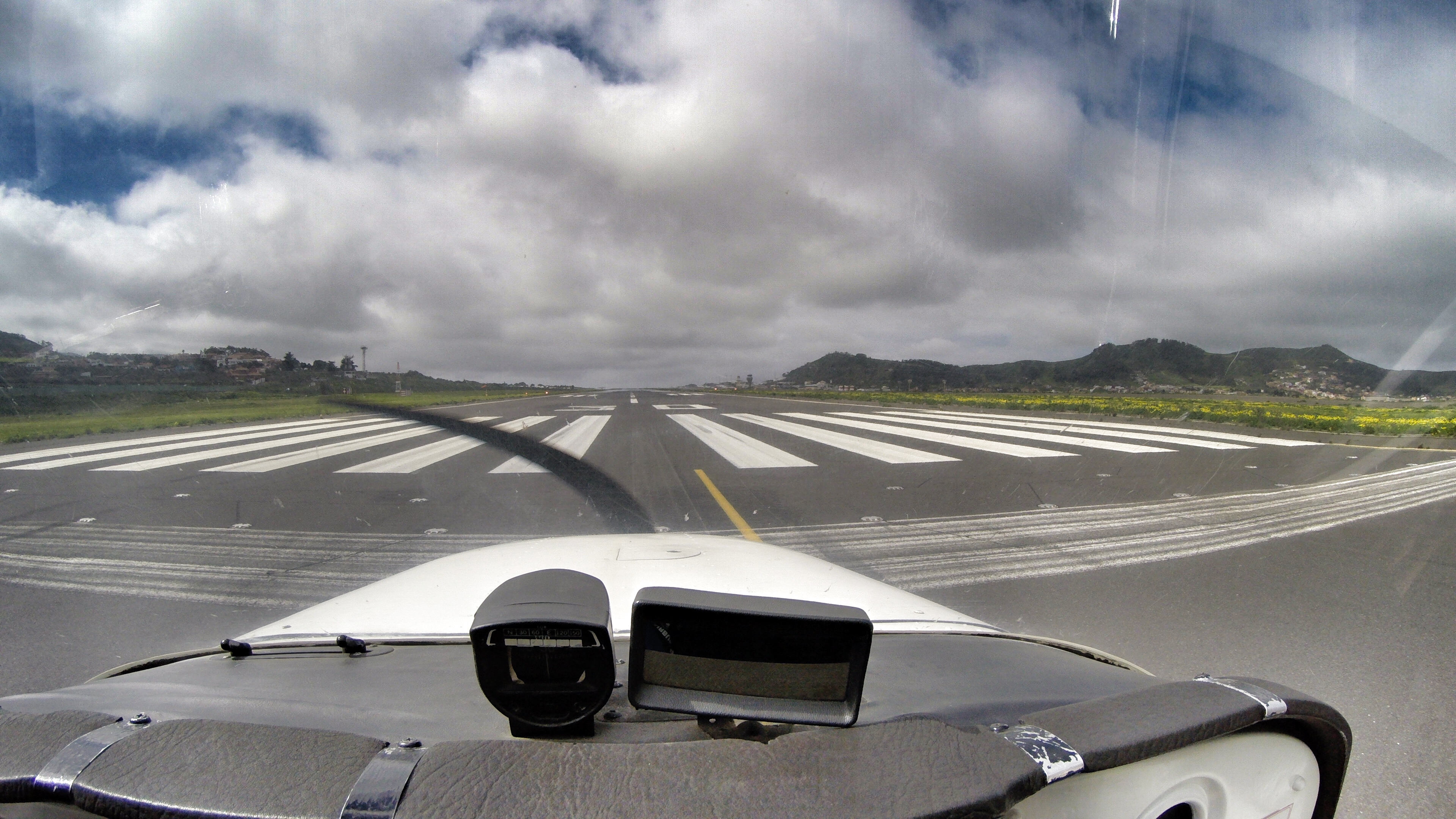
Landing at Tenerife North Airport
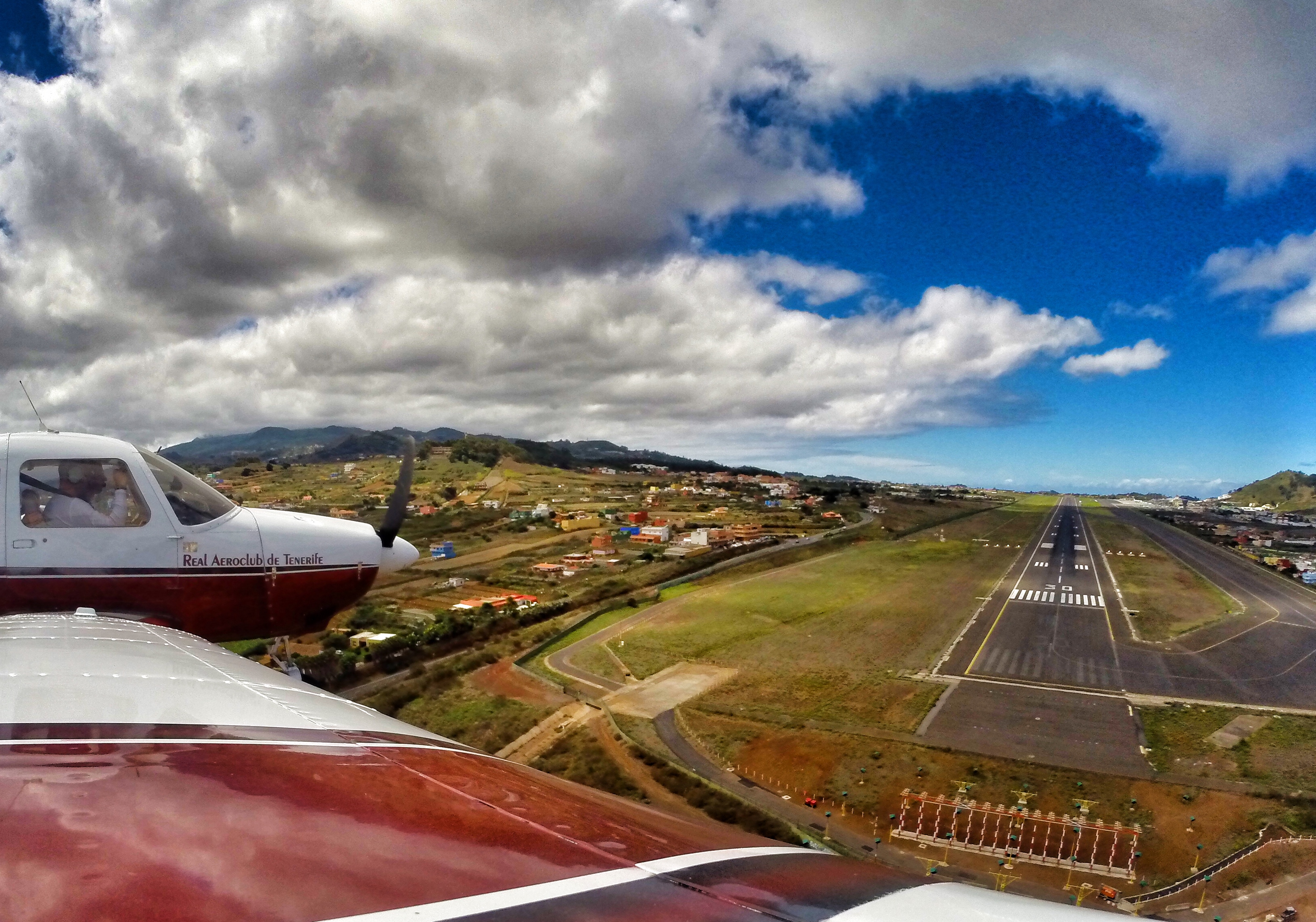
Landing at Tenerife North
Wanted to share with you a timelapse from one of my latest flights around Tenerife.
It is called Around “Tenerife in 2 minutes”, and actually exactly in 1 minute and 50 seconds we will overfly 170 kms of the coast Tenerife.
Hope you´ll enjoy it!
Safe flights!
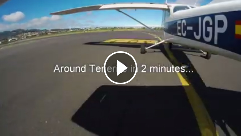
around tenerife in 2 minutes
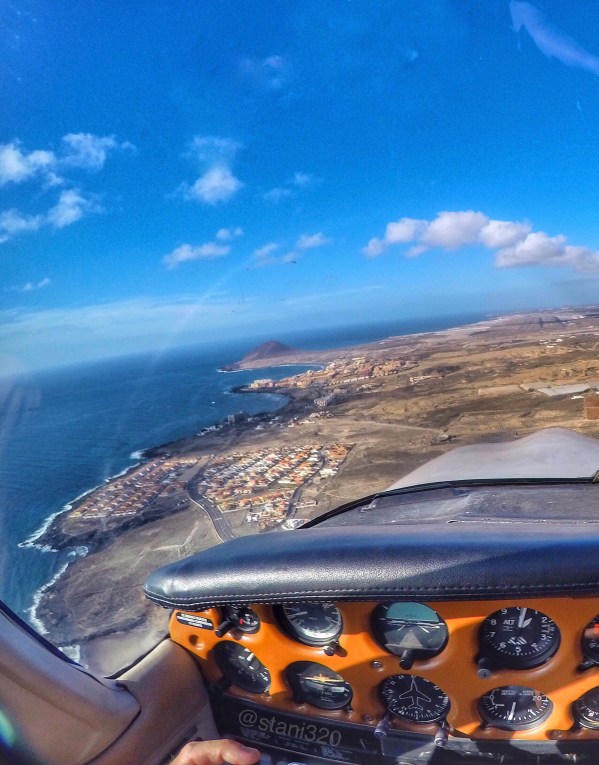
In the past I used to fly more Piper, but in the last time I am starting to like to fly more and more the Cessna 172. Why? It’s because I like to take pictures (actually my GoPro’s are doing this job for me), and I like how the images look like. I try to use the suction mount on different places of the fuselage to ensure that I am definitely the first one in taking an image of Tenerife from this angle from an airplane… And I like to edit them. Even in such a short one hour flight around the island it is always a different story, a new experience, new views… And the Cessna is pretty photogenic :-). What do you think? Let me share with you some of images from my last flight with Cessna… Safe landings!
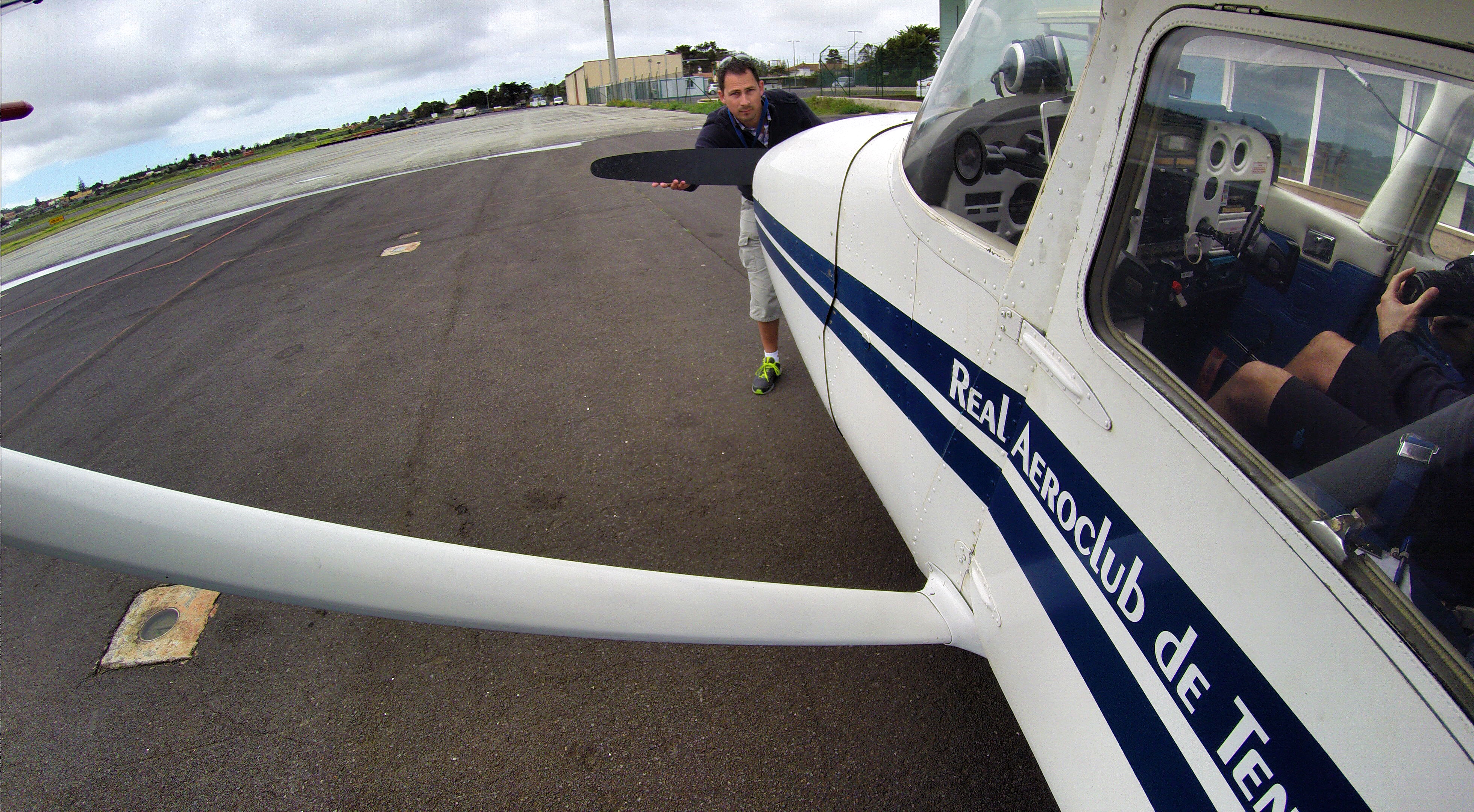
Peek a boo… During the outside check
Starting a new adventure: Ready for departure

Descending towards Puerto de la Cruz

Over Puerto de la Cruz

Over Puerto de la Cruz

Let us shoot some images

Pico del Teide & Costa Los Gigantes

Obligatory cloudsurfing. This is heaven!!!

Over Playa de las Américas

On final RYW 30 at Los Rodeos Airport

About to land…
And a short video is a must! 😉
Recently I’ve made a flight with 2 friends spotters on the Piper from Tenerife North to La Palma and back.
As this was the first time for them on a small plane like this one, they were really enjoying the views from the cockpit and also from the co-pilot seat.
The weather was actually pretty good, almost no wind, no turbulence. Only some cloud layers between 3.000 – 8.000 feet. We were able to climb to get about them and wnjoy the views of the sea of clouds. It feels like to fly a big airliner…
The basic instrument training I´ve done was a great help to maintain the plane on the desired track when descending through the cloud layer. The basic thing is to look inside the cockpit on the instruments and trust your instruments and don’t look outside.
We did one touch and go at La Palma Mazo Airport (GCLA) and returned back to Tenerife North (GCXO). It was a great trip with great views in a great company!
Here I share with you some of the views and of course a short video as well.
Safe landings!

Above the sea of clouds cockpit view

Above the sea of clouds

North of La Palma

Los Llanos
About to touch and go at La Palma airport (GCLA)

Over the sea of clouds at 8.500 feet
About to land at my home airport GCXO (Tenerife North)
I have decided to make a short selection of images I’ve made here in Tenerife, and not only during my flights…. Put them all together, edit and publish as a 2 minute long video. Hope you’ll enjoy it: “Beautiful Tenerife not only from the air”…
We were flying with my friend around the island, he is a commercial pilot and instructor as well; and it seems that the flight was a bit “boring” for him without making any manouvers, stall recoveries, etc.
So he just asked me during the flight: “Can you make at least some stall or something to make it a bit more entertaining”?
My response was pulling back the throttle maintaining the altitude with the yoke and centering the plane with the pedals until the Cessna stalled, followed by the recovery. It is pretty amazing, how difficult it is to stall a Cessna, it stays simply hanging in the air… If I compare it to the P28A which I use to fly more often, the Piper would be a piece of a brick falling from the sky 😀😀😀 comparing to the Cessna. Somehowe after this couple of flights I am starting to like the Cessna as well.
I have recorded the stall recovery with the Gopro mounted in the cockpit; unfortunately forgot to delete the files from the Gopro hanging outside on the wing, so I was only able to take 2-3 pictures (grrr) with it. It was hanging outside for nothing (creating more drag). I will have to create my personal “gopro checklist” haha before going out for flying to avoid bad surprises like this one. However, I like those 2 pictures i’ve taken… Quality before quantity (a good excuse), haha.
Somewhere over La Victoria, North Tenerife
It seemed that stalling Cessna was not enough so we have said: “engine failure”! Why not? First set the best gliding speed (around 70 kts) and searched for a field to land. Pretty difficult on a hilly volcanic island like Tenerife…

Searching for a field to land
The first and probably best option to avoid ditching in the sea was a golf course. We were gliding from 4’500 feet for a while and were trying to calculate the approach taking in consideration the weather conditions, etc. (we had a tailwind, so after the final turn we could be short of the field and…. do not think about the worse…).
When on the final of the golf field (almost with the golf players in sight), we have performed a go around and continued with the island tour. It was a very good excersise; sometimes it is necessary to go back to the basics and train the emergency procedures.
The funny thing is that a couple of days later a friend of mine who was playing on the course that day asked me: “Were you flying on saturday?” I answered, yes, it was me 😀😀😀. “I was thinking to hit you with the ball”, he said… I thought probably he recognized my flying technique ;-).
Enjoy the 20 sec short video…
Safe landings!
The most of us are flying to enjoy the 100$ hamburgers. In Spain we could speak about something similar, as for example “100$ paella”.
My last flight went to La Palma, together with my friend Daldo and his wife Virginia as passenger.

Today’s crew
I was flying the inbound leg and we were cruising at 8,500-9,000 feet. Pretty nice views over the Atlantic Ocean, the sea was very calm, but we were having some headwinds of 20 kts which made this flight a bit longer and of course a bit more expensive ;-), that is why I speak about 200€ paella ;-).

Some different views of Tenerife
Actually I enjoy flying high(er), as there is normaly less turbulence and you can enjoy better views. Also, in the case of an engine failure, the range of possibities of gliding or trying to restart it, are better, as you gain time. And also, you feel like you are flying a real arliner ;-). So there are only a advantages of flying at higher altitudes.

Cruising at 8,600 feet (Sorry for the bad quality)
The icing was forecasted for this day at 9,000 feetm the OAT was around 2 degrees, but no ice was forming on the wings. We were cheching it constantly, for just in case, however we were not flying in the clouds and the day was pretty sunny as well.

Passing La Gomera island
Cruising over the Atlantic ocean at 9,500″
Reaching La Palma island we have maintained 9,000 feet and made some cloudsurfing. The weather forecast for today was some rain and also a front was comming from NW. We have decided to do this flight anyway, as the visibility was ok, no clouds were in sight, and in the case the weather would starting to change, we would return back to our base airport.

Flying over the clouds, reaching La Palma island

Cloudsurfing over La Palma and the rainbow
After this short cloudsurfing, we have started our descent to the visual point Sierra, in the south of the island. Being so high took as a while to descent and make some nice manouvers between the clouds.

Descending through the clouds
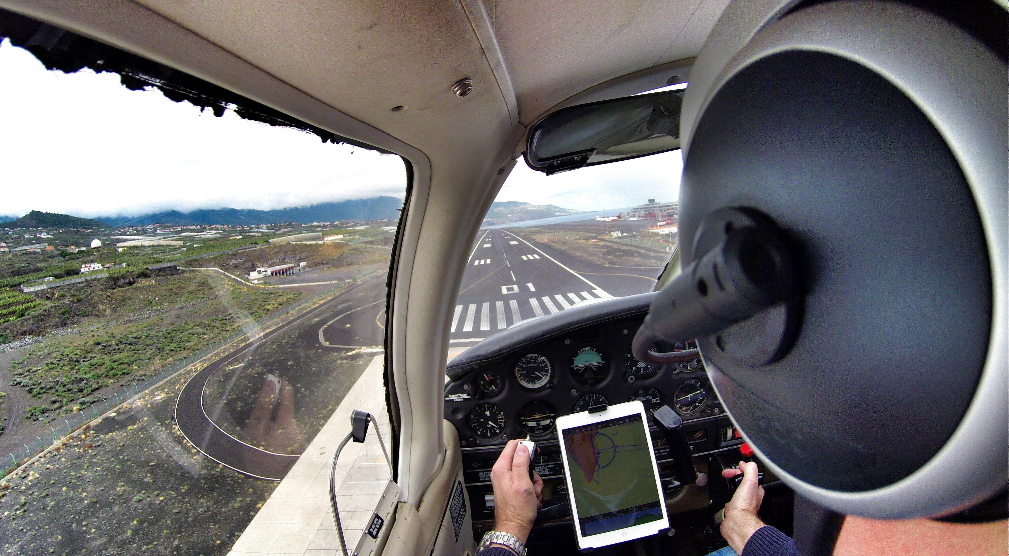
Finaly after 1,30 hour long flight we have landed at the La Palma’s “El Mazo Airport”. This airport is considered one of the world’s most complicated approaches, however with its 2,2 km long runway it is nothing special for our Piper ;-).

Seconds before landing at La Palma
Our Piper was parked as it should on a nice place, where even an Airbus 330/340 could be parked. A realy big honor for this plane ;-).

Just a quick selfie to prove that the Piper was parked on the A330 stand and that I was there as well 😉
We knew, that we had not much time, as the storm was comming sooner or later, so we have decided to go quickly to the restaurant Casa Goyo, situated under the extended centerline of the runway, just between the extended centerline´s lights. They have a lot of specialities, good quality-price relationship and also very good seafood. This restaurant is situated in a walking distance from the airport, some 10 minutes.

Restaurante Casa Goyo La Palma
It consists of small wooden houses, where you can sit, or small rooms, where you can enjoy some privacy as well. We had some paella, which was already ready and we didn’t had to wait, as we had to be pretty quick. So to come over to La Palma to eat this small plate of paella costs around 200€ ;-); not to shabby 😉

Inside the restuarant (bad qualiry foto, grrr)

This one is better 😉 Waiting for the paella.
After the lunch we took a taxi (6€) and we hurried up back to the airport to pay the taxes (18€), made our new flight plane and departed direction Tenerife. There were pretty much clouds than earlier this day, so Daldo had to climb up to 10,000 feet and fly around the clouds to avoid them. The views were even more spectacular.

Cruising at 9,700″ Pretty awesome, isn’t it?

Flying between the clouds

Flying over clouds at 9,700″

The north coast of Tenerife can be seen through the clouds

Anaga

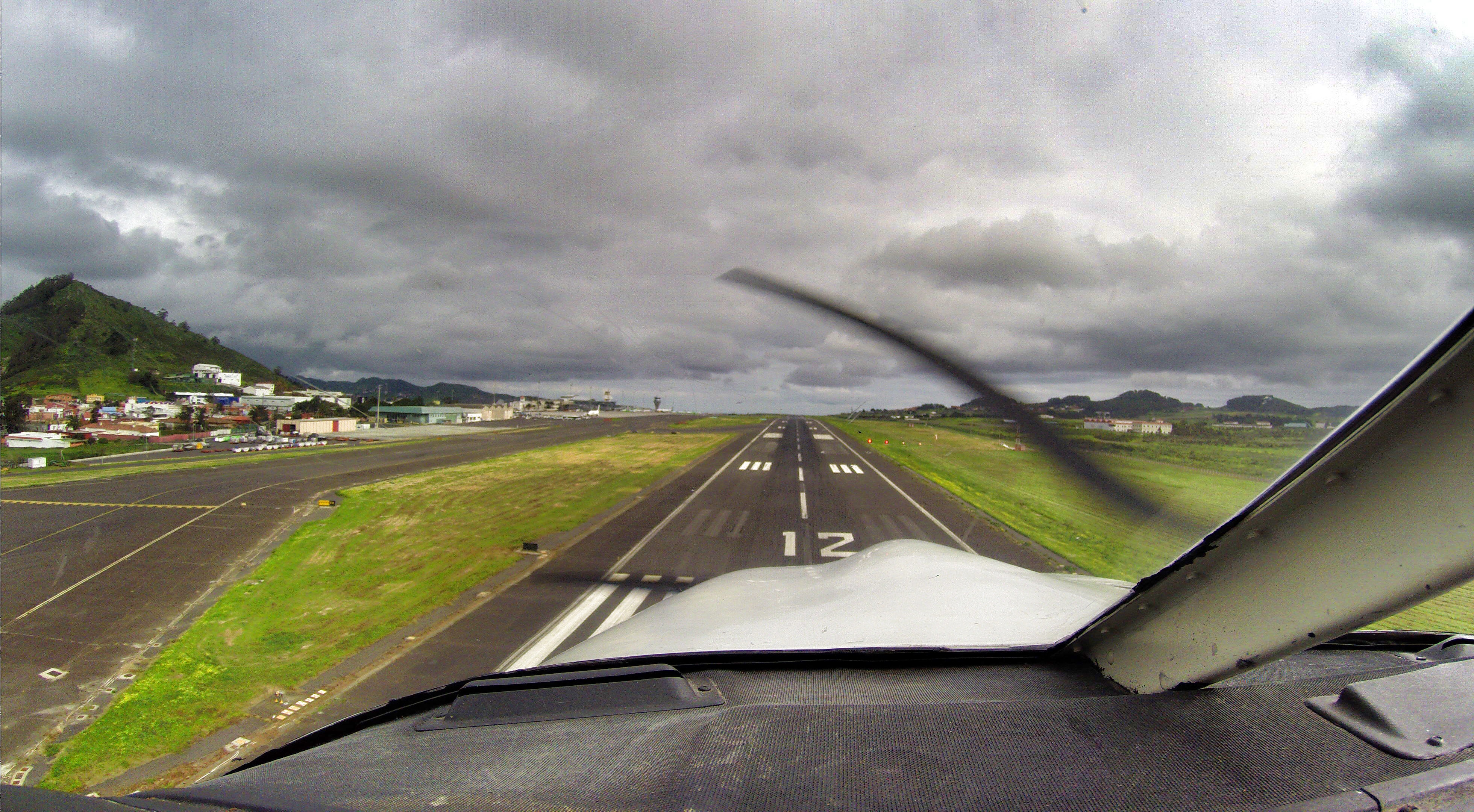
On final RWY 30 at Tenerife North Airport
Only a couple of minutes later after our landing, when the plane was parked outside the hangar, it started to rain and the visibility dropped down significantly. This was a perfect planning, in the other case we would have had diverted to the alternative Tenerife south airport.

The Piper is parked outside the hangar and the rain is comming
A short video of the descent, cloudsurfing, approach and landing at the La Palma Airport. The Gopro has been mounted on tail of the plane.
We have returned a washed and clean airplane 😉
Safe landings!
